2012 IRIS Workshop
A 3-D Shear Velocity Model of the Crust and Uppermost Mantle Beneath the Western US from Bayesian Monte Carlo Inversion of Surface Wave Dispersion and Receiver Functions
Weisen Shen: Center for Imaging the Earth’s Interior, Department of Physics, University of Colorado at Boulder, Michael H. Ritzwoller: Center for Imaging the Earth’s Interior, Department of Physic
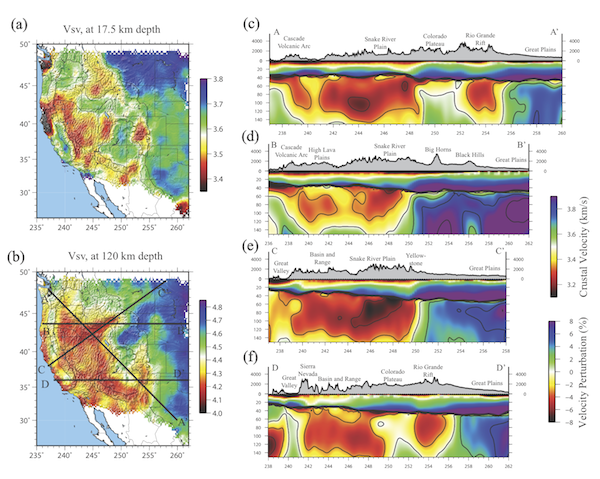
(a) Map view of the Vsv model in the middle crust (17.5km depth). (b) Vsv model at 120 km depth. (c) Vertical slice of the model along transect AA’ in (b). Geological features are identified. Absolute velocity is shown in the crust, while Vsv perturbation referenced to 4.4 km/sec is in the mantle. Contours are 3% perturbations. (d) Same as (c), but for transect BB’ with mantle referenced to 4.32 km/sec. (e-f): Same as (c), but for transects CC’ and DD’, respectively.
Full-resolution graphics file in original format: 0101.ai