2012 IRIS Workshop
Create a Real-Time Geoscience Display for Your Department's Lobby
Patrick McQuillan: IRIS Consortium, Russ Welti: IRIS Consortium, Shelley Olds: UNAVCO
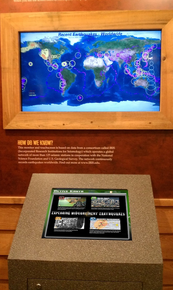
The IRIS Active Earth Monitor and the large-screen Earthquake Channel can be used to create low-cost interactive geophysics displays with real time data, regional geology and general seismology content.
Full-resolution graphics file in original format: 0106.jpg
The IRIS Active Earth Monitor and Earthquake Channel are low cost, high quality solutions for public displays in a University science department. The Active Earth Monitor provides a convenient platform for disseminating recent earth science research results to the general public in order to meet broader impacts goals. The ease of content page creation allows research results to be presented soon after release. The interactive format of the display provides the public with a means to better understand complex research topics and their relevance. All Active Earth Monitor content can be interactive using a touch screen, mouse or trackball. Current pre-packaged content sets include Cascadia, Basin and Range, New Madrid, and General Seismicity. The General Seismicity content can also be displayed as rotating non-interactive content using a standard monitor. The Earthquake Channel is a live non-interactive, large-screen display of regional and worldwide seismology data. A world map as well as a variety of regional maps can be displayed.
Acknoweldgements: Content funded by NSF.
Keywords: education, public_outreach, exhibit, display, active_earth_monitor, kiosk, real_time_data, earthquake_channel, seismic_monitor