


5min 55s Novice Spanish
Who were the major supporters of plate-tectonic theory?
This animation gives an overview of the most-recognized proponents (and opponents) of Plate Tectonics Theory up into the 1960's, with the discoveries that helped form the theories.
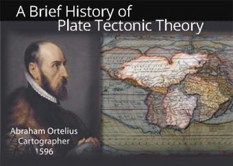
In the year 1596 cartographer Abraham Ortelius noted that the coastlines of Africa and South America appeared to fit together, compelling him to propose that the continents had once been joined but were pulled apart by "earthquakes and floods."
And yet, the theory of plate tectonics represents a fairly young science. The "Father of Plate Tectonics", Alfred Wegener proposed "Continental Drift" in 1912, but was ridiculed by fellow scientists. It would take another 50 years for the concept to be accepted.
CLOSED CAPTIONING: A .srt file is included with the downloiad. Use appropriate media player to utilize captioning.
Important contributions to Plate Tectonics theory:
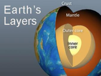
The Earth has 3 main layers based on chemical composition: crust, mantle, and core. Other layers are defined by physical characteristics due to pressure and temperature changes. This animation tells how the layers were discovered, what the layers are, and a bit about how the crust differs from the tectonic (lithospheric) plates, a distinction confused by many.
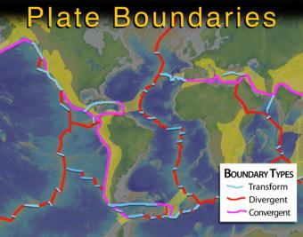
This intermediate-level animation describes what the tectonic (lithospheric) plates are and how they interact. It differentiates between continental and oceanic plates, and between the three major types of boundaries.
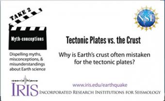
People often use the terms crust and tectonic plates interchangeably. It can be confusing because they are paired, and yet they are distinct from each other.
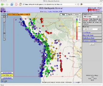
The IRIS Earthquake Browser (IEB) is an interactive tool for exploring millions of seismic event epicenters (normally earthquakes) on a map of the world. Selections of up to 5000 events can also be viewed in 3D and freely rotated with the 3D Viewer companion tool.
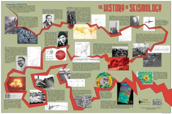
Depicting original sketches, photographs and colorful new imagery, this poster captures the major milestones of the development in the field of seismology.


