


What were the underlying causes?
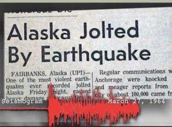
The 1964 Great Alaska Earthquake occurred on Good Friday, March 27th. It rocked the state with strong ground shaking for 4.5 minutes. Liquefaction in and around Anchorage tore the land apart. At magnitude 9.2, it was the second largest quake ever recorded by seismometers. Only 9 people died from the earthquake, but 130 died from the subsequent tsunami; 10 as far away as Crescent City, CA. This animation shows the underlying causes of that subduction-zone mega-thrust earthquake, and tells how research done on the ground deformation shortly after the earthquake by George Pflaker, US Geological Survey, and colleagues contributed to confirmation of early theories of plate tectonics.
CLOSED CAPTIONING: A .srt file is included with the download. Use an appropriate media player to utilize captioning.
The Great Alaska Earthquake is:
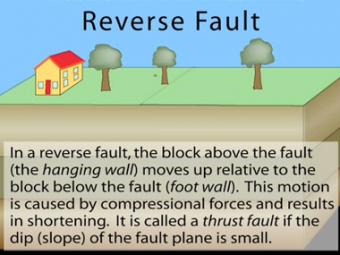
In a reverse fault, the block above the fault moves up relative to the block below the fault. This fault motion is caused by compressional forces and results in shortening. A reverse fault is called a thrust fault if the dip of the fault plane is small. Other names: thrust fault, reverse-slip fault or compressional fault]. Examples: Rocky Mountains, Himalayas.
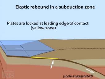
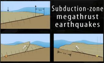
Oblique view of a highly generalized animation of a subduction zone where an oceanic plate is subducting beneath a continental plate. (See sketch below for parts.) This scenario can happen repeatedly on a 100-500 year cycle. The process which produces a mega-thrust earthquake would generate a tsunami, not depicted here.
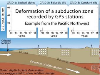
Subduction zones show that there are 3 distinct areas of movement in the overlying plate:
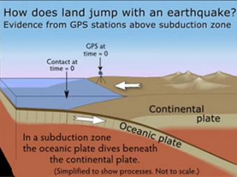
GPS can record the movement of the leading edge of the overlying continental plate in a subduction zone. The plates are locked and the overlying plate is forced back. When friction is overcome and strain is released, the GPS receiver will snap back toward its original position.
Subduction-zone megathrust earthquakes, the most powerful earthquakes in the world, can produce tsunamis through a variety of structures that are missed by simple models including: fault boundary rupture, deformation of overlying plate, splay faults and landslides. From a hazards viewpoint, it is critical to remember that tsunamis are multiple waves that often arrive on shore for many hours after the initial wave.
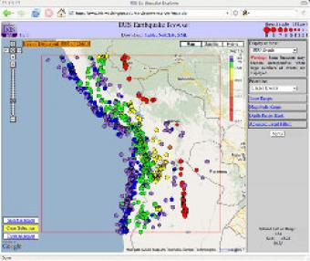
The IRIS Earthquake Browser (IEB) is an interactive tool for exploring millions of seismic event epicenters (normally earthquakes) on a map of the world. Selections of up to 5000 events can also be viewed in 3D and freely rotated with the 3D Viewer companion tool.


