


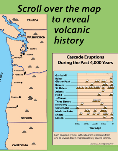
Learn about the volcanoes of the Pacific Northwest Cascade Range mountains by scrolling over individual volcanoes on this interactive map. Gives height, latest eruption, and other notes. Also shows the 4,000-year eruptive history on a US Geological Survey chart of volcanoes.
VIEW the interactive in a separate tab, by clicking on "Open Resource". (Note some browsers lack the plugins for rollovers.)
OR click Download All. AFTER downloading, you can Open either:
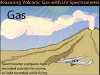
Magmatic gas is the driving force of volcanic eruptions. A primary objective in gas monitoring is to determine changes in the release of certain gases from a volcano, chiefly carbon dioxide and sulfur dioxide. Such changes can be used with other monitoring information to provide eruption warnings and to improve our understanding of how volcanoes work.
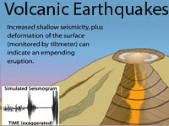
Earthquake activity beneath a volcano almost always increases before an eruption because magma and volcanic gas must first force their way up through shallow underground fractures and passageways. The continuous release of seismic energy is induced by the movement of magma.
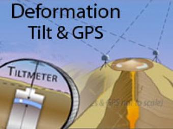
Volcano deformation can provide clues about what is happening deep below the surface. Two techniques used to monitor deformation include Tiltmeters and GPS.
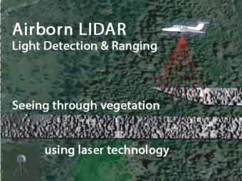
Airborne LIDAR is an optical remote sensing tool that uses laser pulses to measure the precise distance to the ground. The airplane-mounted laser range-finding system, transmits and receives data, which are precisely located using a highly sensitive GPS receiver. Computer-generated images reveal hidden faults not seen through the vegetation.
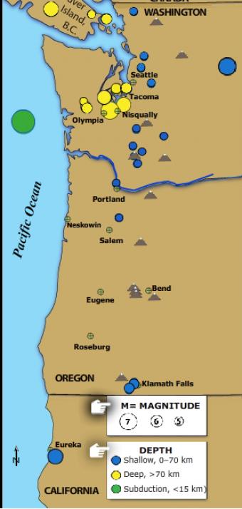
The Pacific Northwest is host to three kinds of earthquakes revealed in this Flash rollover. Subduction zone great earthquakes, shallow crustal quakes, and earthquakes within the subducting plate.
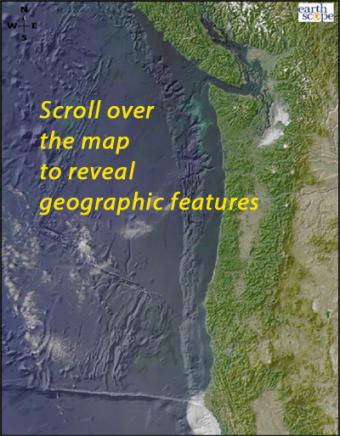
Scroll over the bathymetric relief map to learn about the geographic provinces of the Pacific Northwest.


