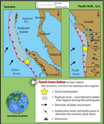
How is the 2004 Sumatran earthquake like the 1700 earthquake of the Pacific Northwest?
This rollover compares the an earthquake of 1700 in the Pacific Northwest with the 2004 Sumatra earthquake and tsunami. The tectonic settings are similar.
VIEW the interactive in a separate tab, by clicking on "Open Resource" then scroll over named features. (Note some browsers lack the plugins for rollovers.)
IRIS may be discontinuing these interactive animations in 2020. This file is an HTML5 file that uses a browser to view.
What do these subduction zones have in common?
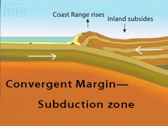
The subduction zone iswhere two tectonic (lithospheric) plates come together, one subducting (diving) beneath the other. The plates are locked together and periodically overcome the friction causing the leading edge of the overlying plate to surge back, lifting a wall of water producting a tsunami.
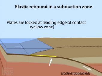
Oblique view of a highly generalized animation of a subduction zone where an oceanic plate is subducting beneath a continental plate. (See sketch below for parts.) This scenario can happen repeatedly on a 100-500 year cycle. The process which produces a mega-thrust earthquake would generate a tsunami, not depicted here.
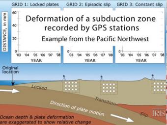
Subduction zones show that there are 3 distinct areas of movement in the overlying plate:
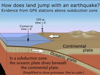
GPS can record the movement of the leading edge of the overlying continental plate in a subduction zone. The plates are locked and the overlying plate is forced back. When friction is overcome and strain is released, the GPS receiver will snap back toward its original position.
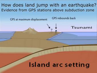
GPS records the movement of the leading edge of the overlying continental plate in a subduction zone. The plates are locked and the overlying plate is forced back. When friction is overcome and strain is released, the GPS receiver will snap back toward its original position.
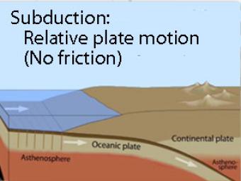
Oblique view of a highly generalized animation of a subduction zone where an oceanic plate is sliding beneath a continental plate with no friction just to show the relative motion between the plates..
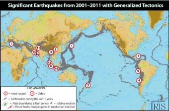
Causes and casualties of the 14 most-significant earthquakes of that decade. This Flash rollover reveals facts about each of the earthquakes.
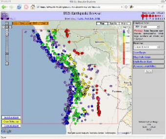
The IRIS Earthquake Browser (IEB) is an interactive tool for exploring millions of seismic event epicenters (normally earthquakes) on a map of the world. Selections of up to 5000 events can also be viewed in 3D and freely rotated with the 3D Viewer companion tool.