


Advanced Spanish
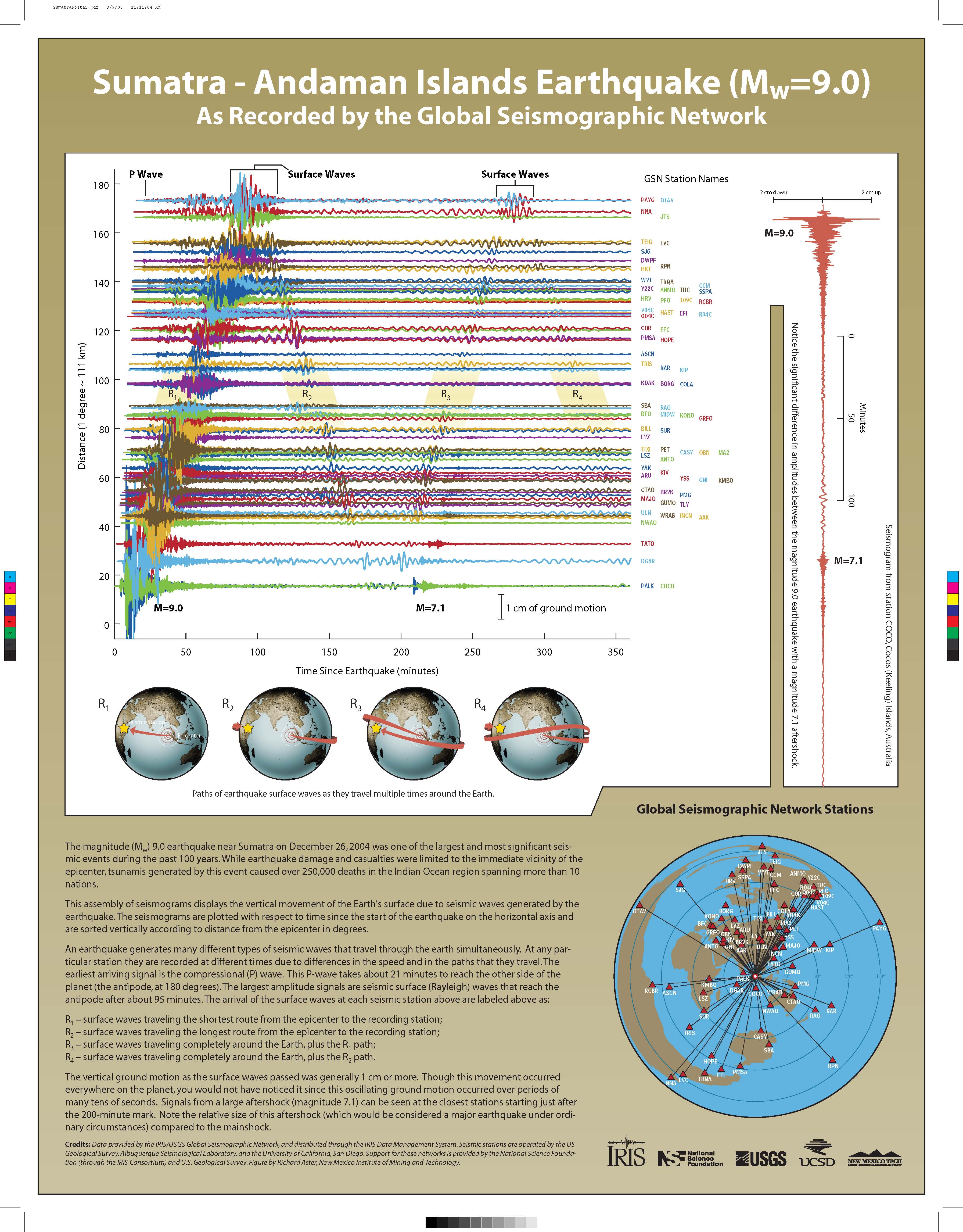
This assembly of seismograms displays the vertical movement of the Earth's surface due to seismic waves generated by the earthquake. The seismograms are plotted with respect to time since the start of the earthquake on the horizontal axis and are sorted vertically according to distance from the epicenter in degrees.
Explain, using the seismic record section presented, that great earthquakes release enough energy to cause large ground displacements even on the opposite side of the Earth, but that humans, at this distance, would not sense the movement as it occurs over hundreds of seconds.
Requesting Posters:
To request hardcopies of E&O materials, please send an email to EandOproduct@iris.edu with the following information:
PLEASE NOTE: Time-sensitive requests must be sent at least three weeks beforethe date they are needed. When e-mailing a time-sensitive request, please write "Time-Sensitive Request" in the subject line.
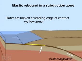
Oblique view of a highly generalized animation of a subduction zone where an oceanic plate is subducting beneath a continental plate. (See sketch below for parts.) This scenario can happen repeatedly on a 100-500 year cycle. The process which produces a mega-thrust earthquake would generate a tsunami, not depicted here.
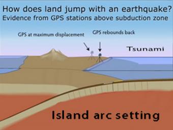
GPS records the movement of the leading edge of the overlying continental plate in a subduction zone. The plates are locked and the overlying plate is forced back. When friction is overcome and strain is released, the GPS receiver will snap back toward its original position.
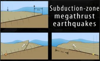
Subduction-zone megathrust earthquakes, the most powerful earthquakes in the world, can produce tsunamis through a variety of structures that are missed by simple models including: fault boundary rupture, deformation of overlying plate, splay faults and landslides. From a hazards viewpoint, it is critical to remember that tsunamis are multiple waves that often arrive on shore for many hours after the initial wave.
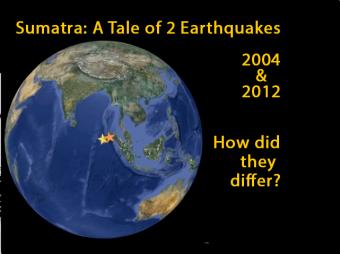
In 2004 a Magnitude 9.1 interplate subduction earthquake triggered a tsunami that killed over 230,000 people. Yet a nearby magnitude 8.7 intraplate earthquake in 2012, caused little damage and generated minimal ocean waves. This animation describes the different tectonic settings of the two plates, and how the Indo-Australian plate seems destined to become two distinct tectonic plates: the Indian and the Australian plates.
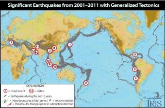
Causes and casualties of the 14 most-significant earthquakes of that decade. This Flash rollover reveals facts about each of the earthquakes.
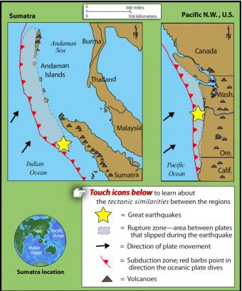
This rollover compares the an earthquake of 1700 in the Pacific Northwest with the 2004 Sumatra earthquake and tsunami. The tectonic settings are similar.
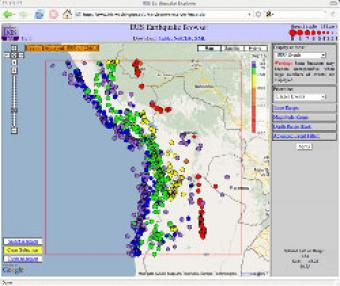
The IRIS Earthquake Browser (IEB) is an interactive tool for exploring millions of seismic event epicenters (normally earthquakes) on a map of the world. Selections of up to 5000 events can also be viewed in 3D and freely rotated with the 3D Viewer companion tool.


