


Add this KMZ file to your existing Google Earth content files
When a major earthquake occurs, people want to understand why it happened. To answer the questions, IRIS has developed a World Series of animations of seismically significant areas to address tectonic forces and the resulting earthquakes.
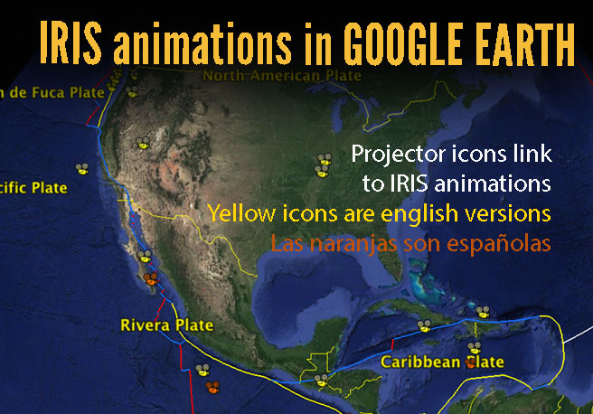
IRIS World Series animations have been placed in a Google Earth file. The yellow (English) and orange (Spanish) projector icons link to IRIS' regional tectonic and earthquake animations. These animations look at the tectonics that affect regional earthquake history, as well as the mechanics of earthquakes in the region.
STEPS IF YOU HAVE GOOGLE EARTH:
1) Click "Download all" button
2) Find the downloaded kmz file called "IRIS_Regional_Animations.kmz" on your computer.
3) Double-clicking the file will place the folder in Google Earth.
4) Toggle the folder in Google Earth to see the list of links
IF YOU DON'T HAVE GOOGLE EARTH, search internet for "download google earth" to get a free copy.
TEASER: Intro to IRIS's "Geographic Region" series. Our "World Series" addresses regional tectonic forces and resulting recent and historic earthquakes around the world (ex. Japan, Alaska, Peru-Chile, Central America, Mexico, Pacific Northwest).


