


Why did that earthquake happen there?
TEASER: IRIS's World Series addresses regional tectonic forces and resulting recent and historic earthquakes around the world (ex. Japan, Alaska, Peru-Chile, Central America, Mexico, Pacific Northwest). This series complements our existing collection of Earth-science animations.
CLOSED CAPTIONING: A .srt file is included with the download. Use an appropriate media player to utilize captioning.
TEASER: Intro to IRIS's "Geographic Region" series. Our "World Series" addresses regional tectonic forces and resulting recent and historic earthquakes around the world (ex. Japan, Alaska, Peru-Chile, Central America, Mexico, Pacific Northwest).
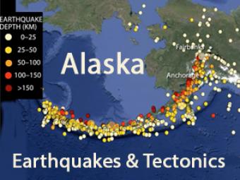
Alaskan tectonics are dominated by the Pacific-North American plates. The megathrust boundary between the plates results in both the 4,000-km-long Aleutian Trench and in the arc of active volcanoes that lie subparallel to the trench.
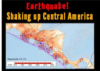
Central America is one of the most vulnerable and highest risk areas in the world for earthquakesis. It is squeezed by five tectonic boundaries, including a subduction zone boundary where the Cocos Plate dives beneath the Caribbean Plate. High risk is due to the complicated complicated tectonic landscape is populated by 50 million people, often in villages built before earthquakes were understood.
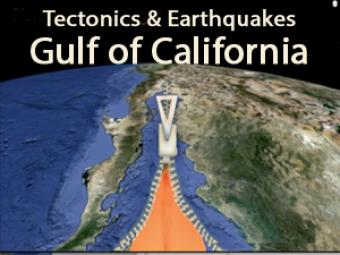
This animation depicts the evolution of the spreading ridge that marks the boundary between the Pacific and North American Tectonic Plates. The on-land part of this submarine spreading ridge extends into Baja California, Mexico and the Imperial Valley of California where it is transitioning from ridge-transform boundary to the continental boundary along the San Andreas fault zone.
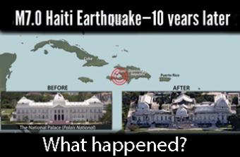
On the tenth anniversary of the January 12, 2010 magnitude 7.0 earthquake in Haiti, it is important to reflect on the plate tectonic context and human impact of that event.
This earthquake was five times more fatal than any historical magnitude 7 earthquake and the fourth most lethal earthquake of any magnitude in the last 100 years.
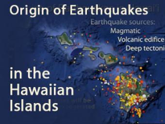
Thousands of earthquakes are recorded in the Hawaiian Islands every year. Most occur in and beneath the Big Island. What causes these earthquakes? This animation offers three general sources for the earthquakes.
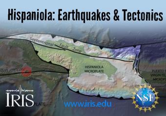
Hispaniola straddles four plates: the Caribbean Plate and the Gonâve, Hispaniola, and North Hispaniola microplates. It is squeezed between the North American and Caribbean Plates. The island, which includes both Haiti and the Dominican Republic, is home to 22 million people.
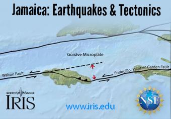
Jamaica straddles the Caribbean Plate and the Gonâve Microplate, the largest of four microplates that are caught in a crunch between the North American and Caribbean Plates. Jamaica has had a long history of deadly earthquakes.
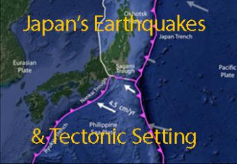
Japan has more measurable earthquakes than any other country and has over 100 active volcanoes. These both result from Japan being wedged among four major tectonic plates. The tectonics are complicated, but in this animation we attempt to look at the basic mechanics of the region. We focus on two famous earthquakes: the 1995 Kobe (Great Hanshin) earthquake and the 2011 Tohoku Oki earthquake.
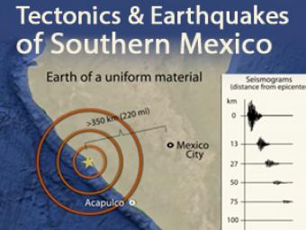
In 1985, a Great, magnitude 8.1 subduction zone earthquake occurred beneath the coast of Michoacan, Mexico causing over 9,000 fatalities over 350 km away. What caused it and how has Mexico instituted their Earthquake Early Warning system? This animation describes the mechanics.
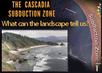
The Cascadia Subduction Zone of the Pacific Northwest is comprised of a collection of major geographic features, including the subducting plate, the subduction plate boundary, the Coast Range, the Puget-Willamette lowlands, and the Cascades Mountain Range.
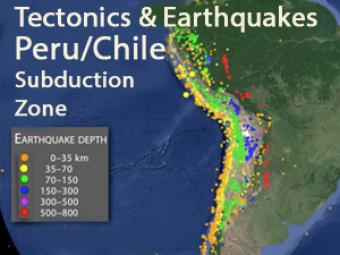
This animation explores three major mechanisms for earthquakes in South America due to the interaction of the Nazca and South American plates.
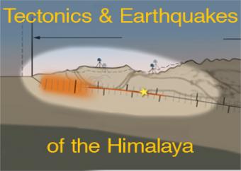
Regional compression produces broadly distributed earthquakes north of the Himalayan plate boundary. However, the historical earthquake record indicates that the largest occur on the shallow portion of the megathrust boundary. This animation discusses regional processes and focusses on the 2015 Nepal earthquake. Watch video footage of Kathmandu with a graph of GPS motion at 2min 55sec provided by UNAVCO.
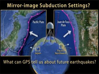
This UNAVCO animation compares Japan's subduction zone at the location of the 2011 earthquake with a mirror-image subduction zone in the Pacific Northwest. There are many similarities.
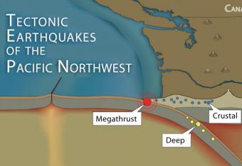
It is common knowledge that the Pacific Northwest can expect a subduction-zone megathrust earthquake in the future. But did you know that there are other types of damaging earthquakes. This animation uses analogies and cartoon block diagrams to teach about the three types of earthquakes.
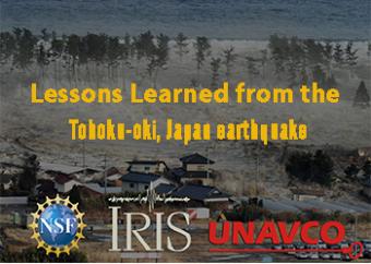
The March 11, 2011 earthquake and tsunami was a tragedy. Research done since that earthquake has revealed ways in which earthquake and tsunami alerts can be done much more quickly.
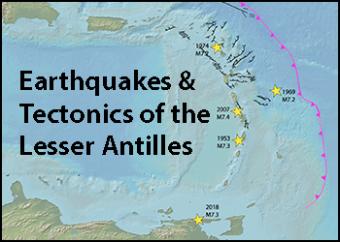
The islands of the Lesser Antilles are formed by the subduction of the North and South American Plates (referred here as the "Atlantic plate") beneath the Caribbean Plate.


