What can GPS tell us about future earthquakes?
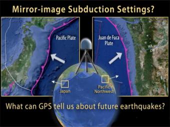
This animation by UNAVCO shows that GPS stations along the coast of Japan had been moving to the west before the March 11, 2011 earthquake, and rebounded back to the east following the earthquake. This animation compares that subduction zone with a mirror-image subduction zone in the Pacific northwest by illustrating how the shallow portion of the Cascadia plate boundary is locked by friction thus compressing the overlying North American Plate in a NE direction during subduction of the Juan de Fuca Plate. Using a spring to emphasize the strain within the overlying plate, we will see the displacements of GPS receivers along the entire leading edge of the North America continental margin. Ultimately, the continental margin will rebound suddenly to the southwest as the stored elastic energy is released for the first time since the last great Cascadia earthquake on January 26, 1700.
This animation was made by UNAVCO in collaboration with the Cascadia EarthScope Earthquake & Tsunami Education Program CEETEP and IRIS. The animation with related resources can be found on the UNAVCO site.
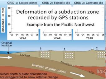
Subduction zones show that there are 3 distinct areas of movement in the overlying plate:
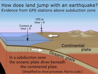
GPS can record the movement of the leading edge of the overlying continental plate in a subduction zone. The plates are locked and the overlying plate is forced back. When friction is overcome and strain is released, the GPS receiver will snap back toward its original position.
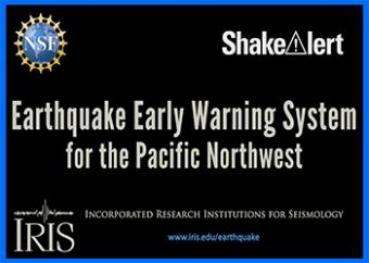
This animation by UNAVCO shows us how an earthquake warning system uses existing seismic networks to detect moderate to large earthquakes. Computers, communications technology, and alarms are devised to notify the public while an earthquake is in progress.
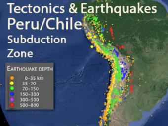
This animation explores three major mechanisms for earthquakes in South America due to the interaction of the Nazca and South American plates.
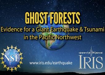
Ghost forests are part of the evidence that a Great earthquake and devastating tsunami occurred last on January 26th, 1700 in the Pacific Northwest. How do we know this?
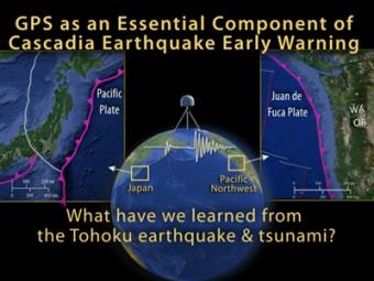
On March 11, 2011, a devastating magnitude-9 earthquake struck off the coast of Tohoku, Japan, where the Pacific Plate dives beneath the Okhotsk Plate. On January 26th, 1700, the West Coast of the United States experienced a similar tsunami-generating megathrust earthquake. An earthquake like this will strike the Cascadia subduction zone again. How can we protect ourselves?
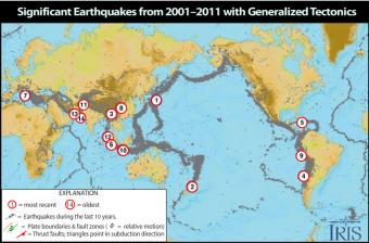
Causes and casualties of the 14 most-significant earthquakes of that decade. This Flash rollover reveals facts about each of the earthquakes.
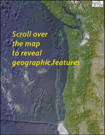
Scroll over the bathymetric relief map to learn about the geographic provinces of the Pacific Northwest.
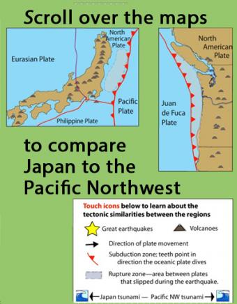
Learn how the Pacific Northwest tectonic setting and megathrust earthquake of January 1700 is similar to the catastrophic earthquake in Japan in 2011 by touching icons on this interactive map.