


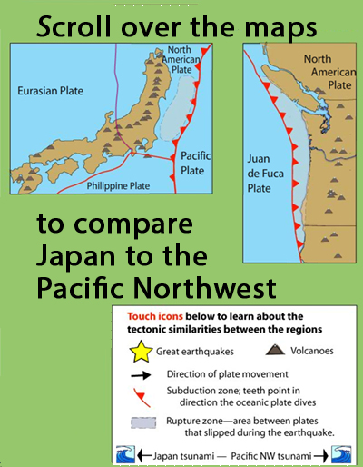
Learn how the Pacific Northwest tectonic setting and megathrust earthquake of January 1700 is similar to the catastrophic earthquake in Japan in 2011 by touching icons on this interactive map. Includes, location of Great earthquakes, volcanoes, direction of plate movement, subduction zone, rupture zone and tsunami extent.
ABOUT TO GO AWAY: IRIS is going to discontinue Flash animations in 2020. If you have a Flash player app and would like a copy, download this .swf file.
What do these subduction zones have in common?
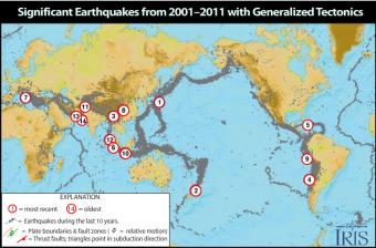
Causes and casualties of the 14 most-significant earthquakes of that decade. This Flash rollover reveals facts about each of the earthquakes.
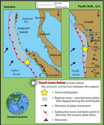
This rollover compares the an earthquake of 1700 in the Pacific Northwest with the 2004 Sumatra earthquake and tsunami. The tectonic settings are similar.
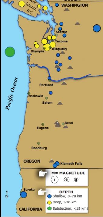
The Pacific Northwest is host to three kinds of earthquakes revealed in this Flash rollover. Subduction zone great earthquakes, shallow crustal quakes, and earthquakes within the subducting plate.
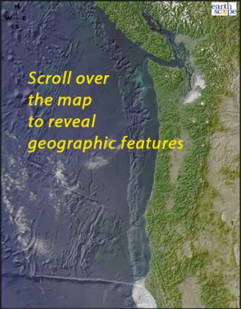
Scroll over the bathymetric relief map to learn about the geographic provinces of the Pacific Northwest.
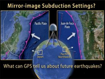
This UNAVCO animation compares Japan's subduction zone at the location of the 2011 earthquake with a mirror-image subduction zone in the Pacific Northwest. There are many similarities.


