


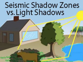
Can light shadows be compared to Earth's seismic shadow zones?
The wave properties of light are used as an analogy to help us understand seismic-wave behavior. Most shadows aren't black; that's because light reflects off of nearby objects and the redirected and reduced light energy strikes and brightens the area in shadow. Light can also bend, for example refracting at the water surface illuminating objects below the surface, or appearing to make half-submerged objects bend. Seismic waves also reflect and refract off layers in the Earth.
CLOSED CAPTIONING: A .srt file is included with the download. Use an appropriate media player to utilize captioning.
Properties of light give information about seismic shadow zones:
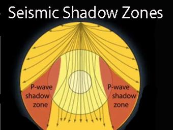
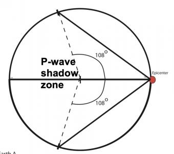
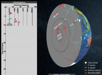
Seismic shadow zones have taught us much about the inside of the earth. This shows how P waves travel through solids and liquids, but S waves are stopped by the liquid outer core.
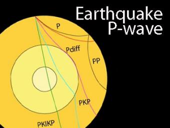
The shadow zone is the area of the earth from angular distances of 104 to 140 degrees from a given earthquake that does not receive any direct P waves. The different phases show how the initial P wave changes when encountering boundaries in the Earth.
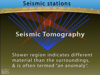
Seismic tomography is an imaging technique that uses seismic waves generated by earthquakes and explosions to create computer-generated, three-dimensional images of Earth's interior. CAT scans are often used as an analogy. Here we simplify things and make an Earth of uniform density with a slow zone that we image as a magma chamber.
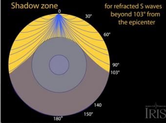
The shadow zone results from S waves being stopped entirely by the liquid core. Three different S-wave phases show how the initial S wave is stopped (damped), or how it changes when encountering boundaries in the Earth.
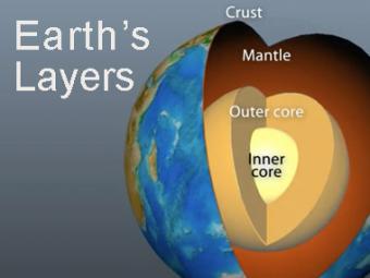
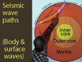
The Earth has 3 main layers based on chemical composition: crust, mantle, and core. Other layers are defined by physical characteristics due to pressure and temperature changes. This animation tells how the layers were discovered, what the layers are, and a bit about how the crust differs from the tectonic (lithospheric) plates, a distinction confused by many.
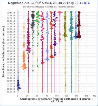
Learning occurs as students work first in small groups and then as a whole class to compare predicted seismic wave travel times, generated by students from a scaled Earth model, to observed seismic data from a recent earthquakes. This activity uses models, real data and emphasizes the process of science.
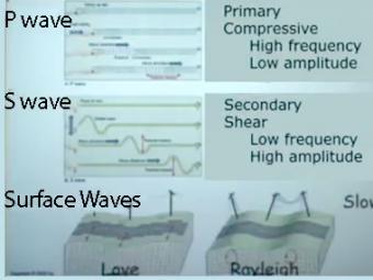
Video lecture on wave propagation and speeds of three fundamental kinds of seismic waves.
Seismic Waves is a browser-based tool to visualize the propagation of seismic waves from historic earthquakes through Earth’s interior and around its surface. Easy-to-use controls speed-up, slow-down, or reverse the wave propagation. By carefully examining these seismic wave fronts and their propagation, the Seismic Waves tool illustrates how earthquakes can provide evidence that allows us to infer Earth’s interior structure.


