


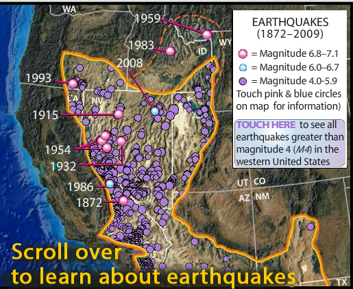
Interactive map reveals seismology, geology, and geologic history of the midwest.
The links above to other interactives, video and animations offer detail about other basin-range features.
ABOUT TO GO AWAY: IRIS is going to discontinue Flash animations. If you have a Flash player app and would like a copy, download this .swf file
Rolling over pink and blue location buttons buttons reveals:
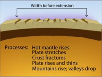
Over most of the last 30 million years, movement of hot mantle beneath the region caused the surface to dome up and then partially collapse under its own weight, as it pulled apart. Currently, there is very little actual stretching going on, and the small amount is concentrated on the Western and Eastern edges of the Basin and Range.
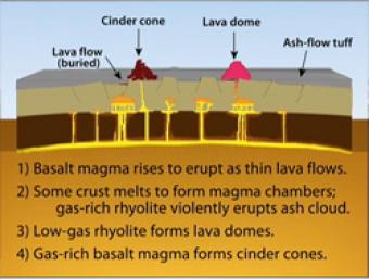
During Basin & Range extension, the plates pull apart, the mantle rises and melts due to lower pressures near the surface. The style of eruption depends on how long the magma sits in the crust and undergoes processes such as crystallization and melting and assimilation of wall rock.
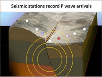
Cross section of the shallow crust in the Basin & Range. Earthquake produces seismic waves that bump an array of seismic stations. One station records the arrival of the seismic waves on a seismogram.
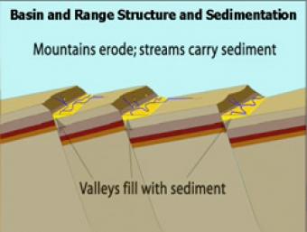
As extension and uplift occur, erosion and sedimentation happen simultaneously but at slower rates. As extension slows down, erosion and sedimentation can overcome mountain building.
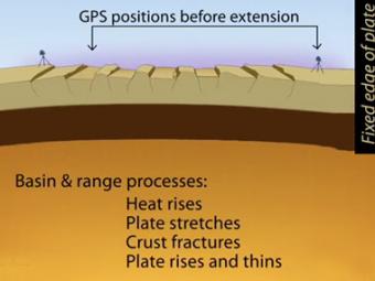
Simplified extension of the basin and range province as reflected in the GPS (global positioning system) stations at distant ends of the region. Tension created by movements of Earth's tectonic plates have stretched the earth's surface to the breaking point. The entire region has been pulled apart, fracturing the tectonic plates and creating large faults.

Interactive map reveals seismology, geology, and geologic history of the midwest.
(IRIS is going to discontinue Flash animations in 2020)
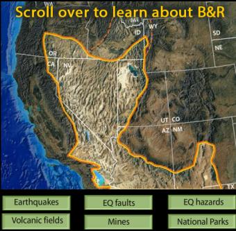
This interactive map of the Basin and Range Province reveals earthquakes, faults, hazards, volcanoes, mines, and National Parks.
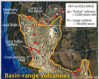
This interactive map of the Basin-Range Province reveals information about the youngest volcanic features associated with the region.


