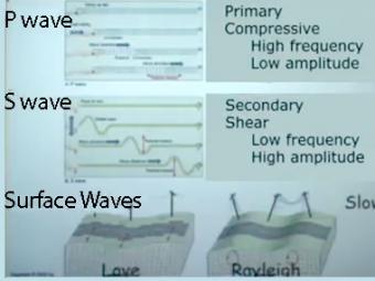
Video lecture on wave propagation and speeds of three fundamental kinds of seismic waves.
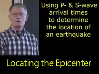
The arrival times of P and S waves are used to determine the distance to an earthquake using standard travel-time curves.
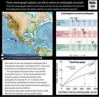
Each station on the interactive map recorded an earthquake with a characteristic seismogram. Roll over the stations to see the epicenter triangulated. Touch buttons to watch movie of seismic waves, or touch "Walk-run" button to see wave travel can be demonstrated with a class.
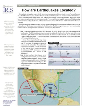
Knowing precisely where an earthquake occurred is an important piece of scientific information. It can help seismologists identify and map seismic hazards. It is also a fundamental piece of information necessary for facilitating studies of Earth's internal structures. This fact sheet provides an overview of the S-P process to locate an earthquake.
NOTE: Out of stock; self-printing only.
The epicenter is the map location on Earth’s surface, above where earthquake began. An earthquake actually begins inside the earth at the hypocenter. Learn more!