7min 15s Novice Spanish

I thought that Puerto Rico was on the Caribbean Plate. What's up with that?
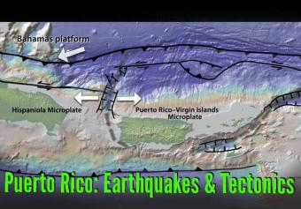
Puerto Rico in the northeast Caribbean Sea is home to over 3 million people with an additional 150,000 people living on the nearby Virgin Islands. In January 2020, Puerto Rico was rattled for more than three weeks by over 400 earthquakes greater than M3. Before addressing that sequence, let’s look at the broader tectonic setting and earthquake history.
Plate boundary subduction zone earthquakes are important hazards for Puerto Rico and the Virgin Islands. However, as demonstrated recently, shallow earthquakes on the microplate boundaries also present important earthquake and tsunami hazards.
CLOSED CAPTIONING: A .srt file is included with the download. Use an appropriate media player to utilize captioning.

TEASER: Intro to IRIS's "Geographic Region" series. Our "World Series" addresses regional tectonic forces and resulting recent and historic earthquakes around the world (ex. Japan, Alaska, Peru-Chile, Central America, Mexico, Pacific Northwest).

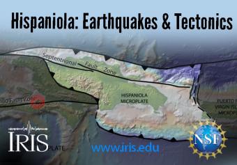
Hispaniola straddles four plates: the Caribbean Plate and the Gonâve, Hispaniola, and North Hispaniola microplates. It is squeezed between the North American and Caribbean Plates. The island, which includes both Haiti and the Dominican Republic, is home to 22 million people.

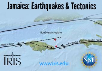
Jamaica straddles the Caribbean Plate and the Gonâve Microplate, the largest of four microplates that are caught in a crunch between the North American and Caribbean Plates. Jamaica has had a long history of deadly earthquakes.
En enero del 2020, Puerto Rico fue sacudido durante más de tres semanas por más de 400 terremotos de magnitud mayor de 3. Antes de abordar esta secuencia, veamos el escenario tectónico general y la historia sísmica de Puerto Rico.