EqLocate is an interactive app that allows users to locate earthquakes using real seismic data. The event list includes the latest earthquake in the news, as well as selected historic mega earthquakes. Users select the stations to include in the location process, conduct quality control on the waveforms, pick seismic arrivals, and apply one of the three included location methods to find a solution. User solutions are then compared to the USGS accepted solution. Users can explore historic seismicity in the region where they located the event by seamlessly connecting to the IRIS Earthquake Browser (IEB).
Earthquake Location Methods

To understand plate tectonic processes and hazards, and to better understand where future earthquakes are likely to occur, it is important to locate earthquakes as they occur. In this activity students use three-component seismic data from recent earthquakes to locate a global earthquake.
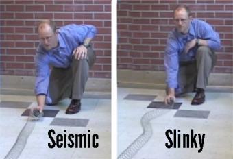
Students will produce P and S waves using a Slinky© to understand how seismic waves transfer energy as they travel through solids. All types of waves transmit energy, including beach waves, sound, light, and more. The velocity difference between the faster compressive P wave and the slower shearing S wave helps seismologists locate an earthquake’s epicenter.

Let’s say a big earthquake occurs and you want to learn more about it. In this lab you can explore how to download broadband data for this earthquake, conduct a simple event location,and determine the bodywave magnitude.
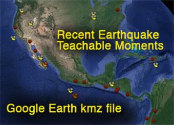
The Incorporated Research Institutions for Seismology has plotted over 100 Recent Earthquake Teachable Moment presentations into Google Earth, available as a .kml file that is updated whenever a new RETM is released by IRIS. These teachable moments are rapid-response presentations for educators following worldwide earthquakes of greater than magnitude 7.0, and newsworthy smaller earthquakes.
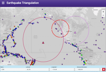
Easily plot stations and distance circles on an interactive world map to demonstrate how earthquakes can be located using the time difference in the arrivals of P and S waves at a set of seismic stations.
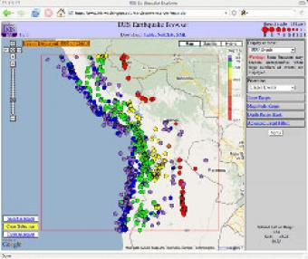
The IRIS Earthquake Browser (IEB) is an interactive tool for exploring millions of seismic event epicenters (normally earthquakes) on a map of the world. Selections of up to 5000 events can also be viewed in 3D and freely rotated with the 3D Viewer companion tool.
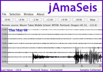
jAmaSeis is a free, java-based program that allows users to obtain and display seismic data in real-time from either a local instrument or from remote stations.
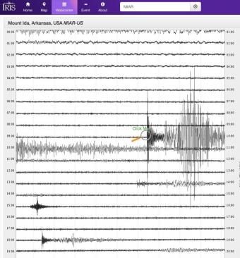
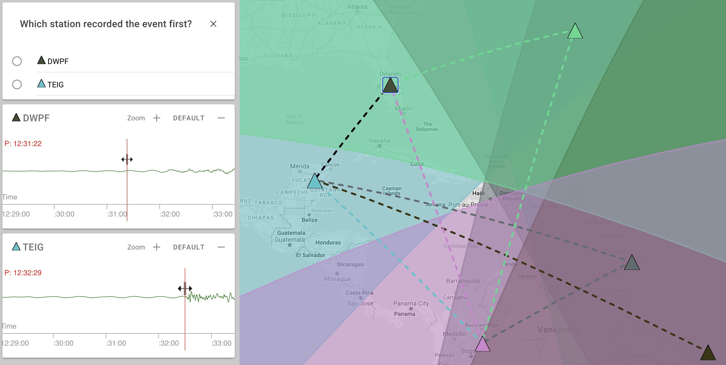
Explore earthquakes near you or from around the globe using the new IRIS Station Monitor app! Select from hundreds of seismic stations throughout the world. View up-to-the-minute recorded ground motions or see recordings from previous days and past events. Get information about recent events and choose to annotate wave arrivals.
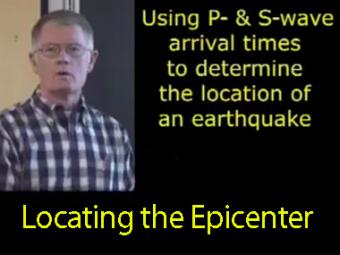
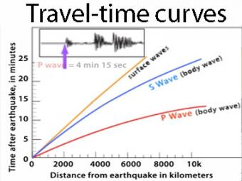
The arrival times of P and S waves are used to determine the distance to an earthquake using standard travel-time curves.
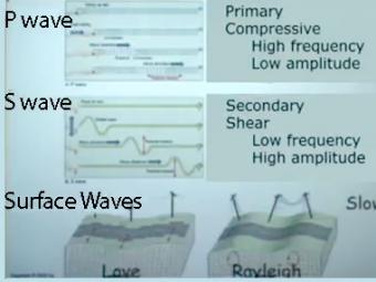
Video lecture on wave propagation and speeds of three fundamental kinds of seismic waves.
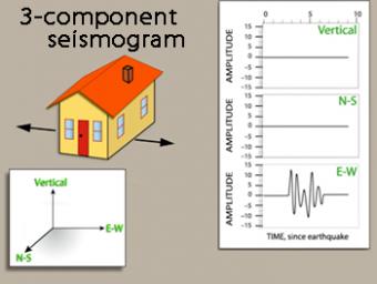
We use exaggerated motion of a building (seismic station) to show how the ground moves during an earthquake, and why it is important to measure seismic waves using 3 components: vertical, N-S, and E-W. Before showing an actual distant earthquake, we break down the three axes of movement to clarify the 3 seismograms.
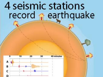
A cow and a tree in this narrated cartoon for fun and to emphasize that seismic waves traveling away from an earthquake occur everywhere, not just at seismic stations A, B, C, and D. A person would feel a large earthquake only at station A near the epicenter. Stations B, C, D, and the cow are too far from the earthquake to feel the seismic waves though sensitive equipment records their arrival.
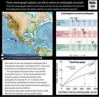
Each station on the interactive map recorded an earthquake with a characteristic seismogram. Roll over the stations to see the epicenter triangulated. Touch buttons to watch movie of seismic waves, or touch "Walk-run" button to see wave travel can be demonstrated with a class.