


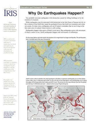
Many people associate earthquakes with destruction caused by falling buildings or by the creation of a tsunami. While earthquakes may be associated with destruction in the time frame of human activity, in the evolution of the Earth they signal the geological forces that build our mountains and create our oceans. This fact sheet provides an introduction to the causes of earthquakes.
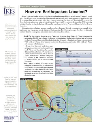
Knowing precisely where an earthquake occurred is an important piece of scientific information. It can help seismologists identify and map seismic hazards. It is also a fundamental piece of information necessary for facilitating studies of Earth's internal structures. This fact sheet provides an overview of the S-P process to locate an earthquake.
NOTE: Out of stock; self-printing only.

Earth is an active place and earthquakes are always happening somewhere. In fact, the National Earthquake Information Center locates about 12,000-14,000 earthquakes each year! This fact sheet illustrates information on the frequency of earthquakes of various magnitudes, along with details on the effects of earthquakes and the equivalent energy release.
NOTE: Out of stock; self-printing only.
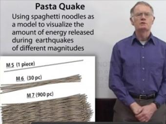
Understanding the magnitude change, thus the relative energy released from say, magnitude 7 to magnitude 8 can be challenging. Dr. Robert Butler (Univ. of Portland) uses spaghetti to illustrate the concept by breaking pasta to show how each step up in magnitude represents a huge jump in the size of the pasta bundles. Each step in magnitude is represented by 32 times more spaghetti noodles.
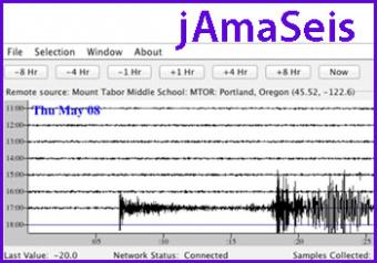
jAmaSeis is a free, java-based program that allows users to obtain and display seismic data in real-time from either a local instrument or from remote stations.
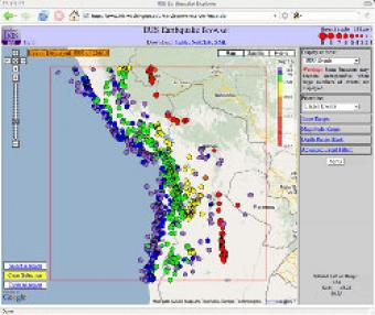
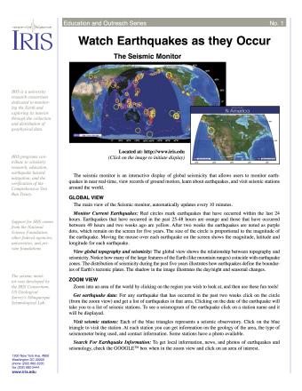
The IRIS Earthquake Browser (IEB) is an interactive tool for exploring millions of seismic event epicenters (normally earthquakes) on a map of the world. Selections of up to 5000 events can also be viewed in 3D and freely rotated with the 3D Viewer companion tool.
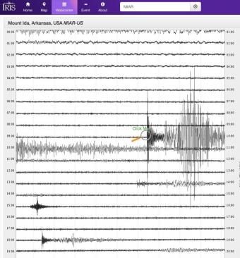
Explore earthquakes near you or from around the globe using the new IRIS Station Monitor app! Select from hundreds of seismic stations throughout the world. View up-to-the-minute recorded ground motions or see recordings from previous days and past events. Get information about recent events and choose to annotate wave arrivals.


