


Collaboration between Oregon State University and IRIS
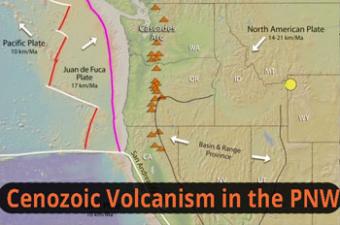
The Pacific Northwest is a volcanological wonderland. The western margin of North America has long been dominated by subduction and dextral transtension. Ocean-ridge rifting produces submarine volcanism offshore. Subduction of the young Juan de Fuca Plate creates the arc of Cascades volcanoes. Hot-spot volcanism drives the Yellowstone caldera system. Continental extension of the Basin and Range province, plus a northward migrating triple junction add to a complex volcanic history. (Created for a Plenary talk by Dr. Anita Grunder at the 2017 IAVCEI meeting in Portland, OR.)
Using map view in concert with cross sections, this animation steps the viewer through both volcanic and simplified tetonic processes.
CLOSED CAPTIONING: A .srt file is included with the download. Use an appropriate media player to utilize captioning.
Tectonics of the Pacific Northest yield:
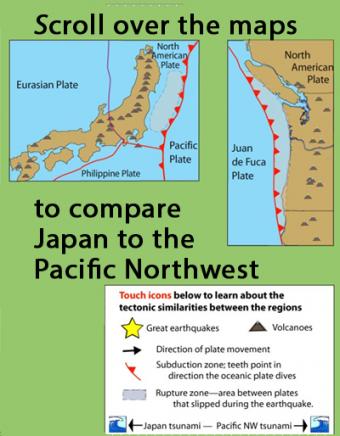
Learn how the Pacific Northwest tectonic setting and megathrust earthquake of January 1700 is similar to the catastrophic earthquake in Japan in 2011 by touching icons on this interactive map.
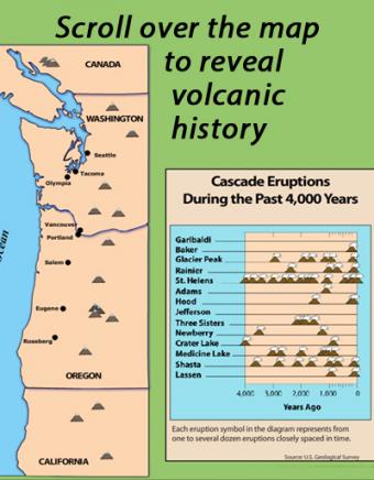
Learn about the volcanoes of the Pacific Northwest Cascade Range mountains by scrolling over individual volcanoes on this interactive map.
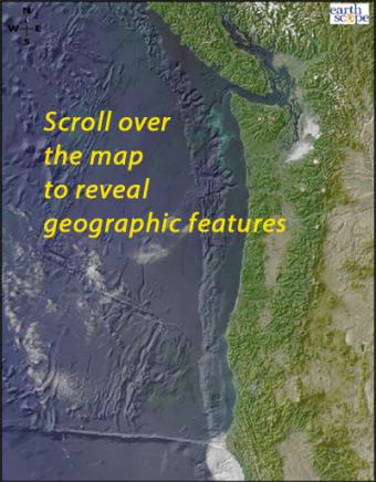
Scroll over the bathymetric relief map to learn about the geographic provinces of the Pacific Northwest.
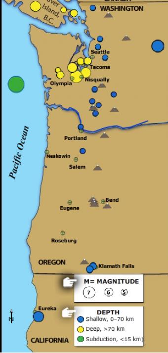
The Pacific Northwest is host to three kinds of earthquakes revealed in this Flash rollover. Subduction zone great earthquakes, shallow crustal quakes, and earthquakes within the subducting plate.
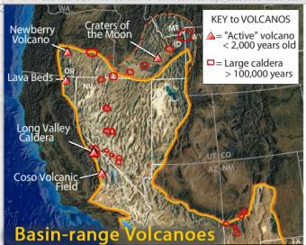
This interactive map of the Basin-Range Province reveals information about the youngest volcanic features associated with the region.
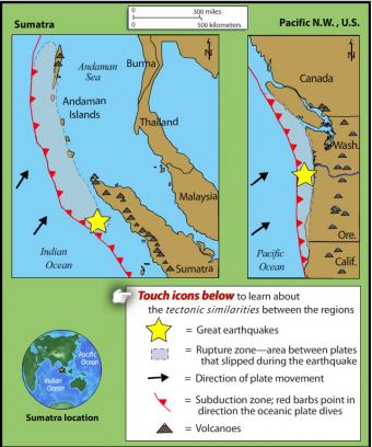
This rollover compares the an earthquake of 1700 in the Pacific Northwest with the 2004 Sumatra earthquake and tsunami. The tectonic settings are similar.
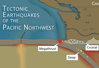
It is common knowledge that the Pacific Northwest can expect a subduction-zone megathrust earthquake in the future. But did you know that there are other types of damaging earthquakes. This animation uses analogies and cartoon block diagrams to teach about the three types of earthquakes.
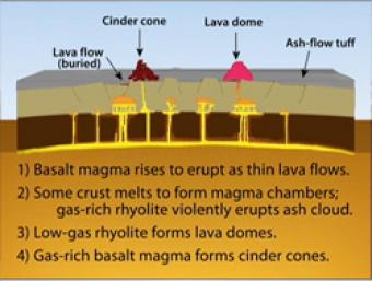
During Basin & Range extension, the plates pull apart, the mantle rises and melts due to lower pressures near the surface. The style of eruption depends on how long the magma sits in the crust and undergoes processes such as crystallization and melting and assimilation of wall rock.
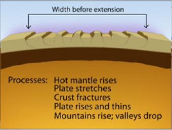
Over most of the last 30 million years, movement of hot mantle beneath the region caused the surface to dome up and then partially collapse under its own weight, as it pulled apart. Currently, there is very little actual stretching going on, and the small amount is concentrated on the Western and Eastern edges of the Basin and Range.
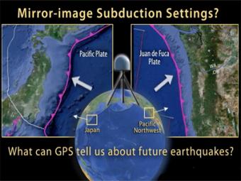
This UNAVCO animation compares Japan's subduction zone at the location of the 2011 earthquake with a mirror-image subduction zone in the Pacific Northwest. There are many similarities.


