
Subduction Zone in Four Dimensions, or SZ4D, is an initiative in the U.S. research community to study subduction zones – the places where tectonic plates converge and collide – through both space and time, with a focus on the fundamental processes underlying geologic hazards such as great earthquakes, tsunamis, landslides, and volcanic eruptions.
The "SZ4D Vision Document" workshop report developed in 2016 identified three key components to pursue: 1) an interdisciplinary science program, 2) a modeling collaboratory, and 3) a community infrastructure program. These were developed through two National Science Foundation-funded Research Coordination Networks, or RCNs, from 2018 to 2021 and now make up the SZ4D Initiative: a unified, concrete community plan for a decade-long coordinated research effort. In 2022, a collaborative NSF proposal was funded for:
Through this collaborative award, IRIS and UNAVCO will provide technical expertise for project management and lead the organization of a community workshop in Fall 2022. Staff will work closely with the SZ4D Executive Committee, Steering Committee, the four SZ4D Working Groups: Landscapes and Seascapes, Faulting and Earthquake Cycles, Magmatic Drivers of Eruption, and the two SZ4D Integrative Groups: the Modeling Collaboratory for Subduction, and Building Equity and Capacity in Geoscience; some staff may also serve on these and other SZ4D committees.
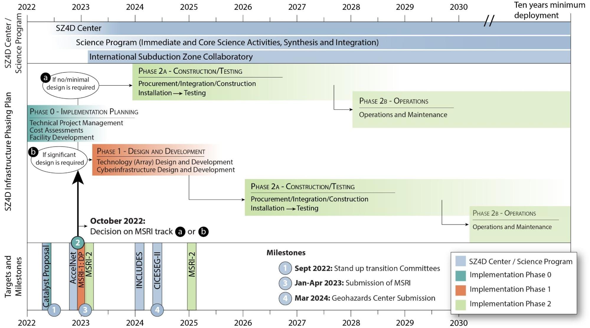
Timeline and milestones for SZ4D including the current Catalyst proposal and future implementation.
This project is supported by funding from the National Science Foundation under award EAR-2221949.
