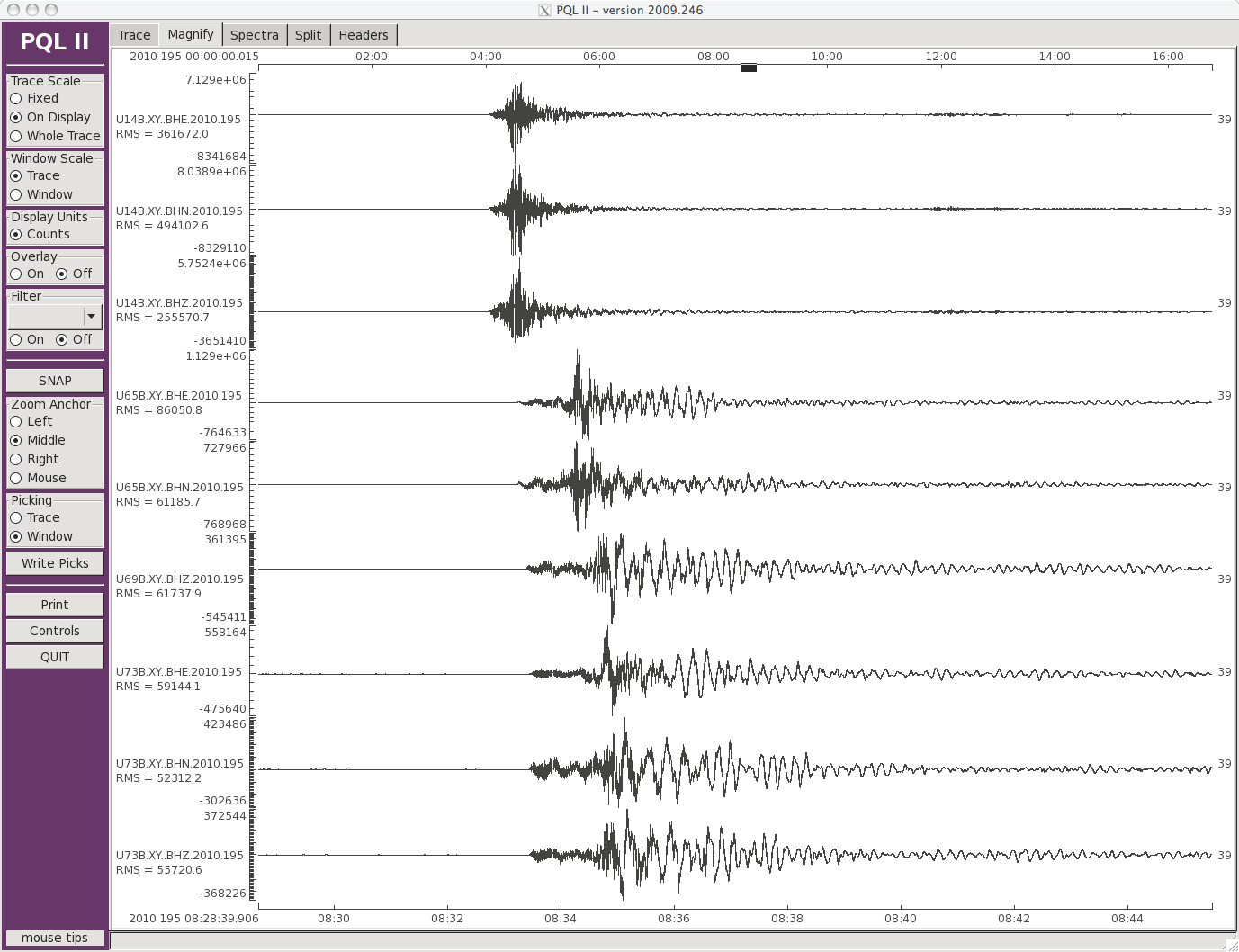
Working with the University of Chile, real-time telemetry has been installed at four of the RAPID-funded CHAMP stations. Records of the July 14, 2010 Mw=6.5 aftershock are shown from three of these stations. The data are telemetered (cell modem) to the University of Chile where they are extremely useful to them in their real-time earthquake monitoring. These real-time data can also be retrieved through the BUD system at the IRIS DMC.
|
|
North-south, east-west and vertical components from the July 14, 2010 Mw=6.5 aftershock in Chile as recorded by three RAPID-funded CHAMP stations. Data were transmitted via cell modem in real-time to the University of Chile. Click on the image to view a larger version. |
The first set of data from the CHAMP deployment of 58 portable instruments to record aftershocks of the February 27, 2010 Mw=8.8 Chile earthquake are now available at the IRIS Data Management Center. The data available cover the time from initial deployment (starting ~March 20) until the end of a preliminary data run (ending ~April 20). The data are unrestricted and freely available. Interested individuals or groups are encouraged to consider submitting proposals for analysis and research. Additional data are being recovered during a service run May 20 - June 4 and should be available through the Data Management Center later in June. The network will be operated until mid-September.
Data are available through standard Data Management Center access tools. The SeismiQuery search/request utility is recommended for making a query over "archived waveforms" and the resultant breq_fast request reports what data is available. The utility enables a user to get dataless, miniseed, fullseed, and a copy of the breq_fast, all at the same time. The dataset is designated as Network XY for year 2010. Access SeismiQuery at http://dev.iris.edu/SeismiQuery/breq_fast.phtml
Station operating dates are available on the network map.
Most vertical channels operated continuously. Problems with power and offset of horizontal sensors caused by tilts resulted in lost data at some stations. The attached document provides details on the time periods when the horizontal data are not available. Details can be determined using Seismic Query or Metadata Aggregator.
Two record sections have been generated (see below):
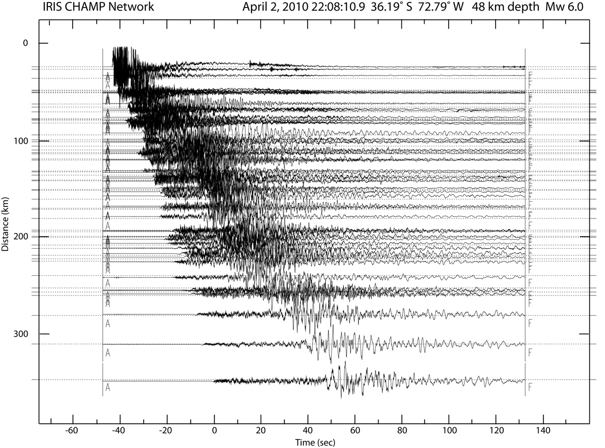 |
This record section from a magnitude 6 aftershock on April 2, 2010, was generated from vertical component data recorded by 50 stations in the IRIS CHAMP network. Click on the image to view a larger version.
|
 |
The IRIS CHAMP network recorded the magnitude 7.2 Baja event. Click on the image to view a larger version. |