 |
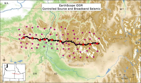
| IDOR seismic stations (purple diamonds) currently deployed in Idaho and eastern Oregon. The black line indicates the location of the ~2600 sensors used in August 2012 and the stars are the controlled shot locations. |
Comprehensive investigations into the formation of North America require a team with a broad range of expertise, as well as considerable logistical support, and a small army of volunteers. The IDOR project is integrating seismology, geochronology, geochemistry, and structural geology studies to gain a better understanding of the geologic history of a portion of western North America. The project is examining a region of eastern Oregon and western Idaho where a sharp boundary between continental and oceanic lithosphere formed about 150 million years ago during the plate tectonic collision and accretion of oceanic terranes to North America. This distinct boundary, which marks the edge of the North American craton (ancient continent), was steepened by compression about 100 million years ago along the Western Idaho Shear Zone (WISZ). A series of younger magmatic and tectonic events then affected the region. Deformation and magmatism were partly controlled by the pre-existing boundary between continental and accreted lithosphere but also modified it. The WISZ now separates the Blue Mountains and Columbia River volcanic rocks to the west and the Idaho Batholith to the east.
As part of the project, 85 seismometers (see map) were deployed in a rectangular grid and will remain in place for two years to record earthquakes from around the globe. Data from these stations will be used to image the physical properties and structure of the deep lithosphere and upper mantle beneath the array. In addition to detecting seismic waves from earthquakes, researchers also conducted a controlled-source survey, also called a seismic refraction experiment, where approximately 2600 portable sensors recorded seismic waves generated by buried explosive shots. Using the precise timing and location of the seismic sources, the team can deduce detailed information about the composition and structure of the crust and upper mantle across the WISZ. Geochemistry and geochronology are being used to understand the magmatism on either side of the WISZ and provide the timing of tectonic events. Structural geology will constrain the major tectonic boundaries and their deformation.
IDOR activities during summer 2012 provided an excellent opportunity to engage undergraduate students as field assistants. Two students who were engaged in the IRIS Undergraduate Internship Program helped plan and conduct the controlled-source survey as part of their summer research. Additional undergraduate field assistants were recruited from IRIS Educational Affiliate members and from contacts developed through the IRIS Internship Minority Recruitment Lecture series. In total, there were 61 individuals involved in the controlled-source experiment last summer. Most were student volunteers that came from 22 different institutions. The students received training in the installation of seismographs and then deployed the instruments across diverse and scenic landscapes. All project professors participated, allowing multidisciplinary interaction and a guided field trip to learn the geology of the area.
More information is available on the IDOR website.
 |
 |
 |
|
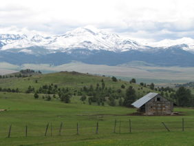
The mountains near Prairie City, Oregon, including Strawberry Mountain above, are comprised of terranes accreted to North America.
|
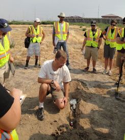
George Slad of IRIS-PASSCAL trains the crew how to deploy a seismometer (the orange sensor and the recording unit wrapped in a plastic bag).
|
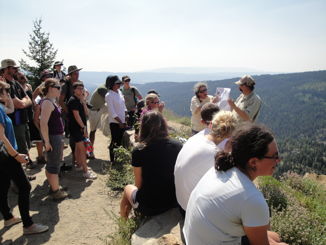
Basil Tikoff (standing center right), one of the IDOR project Principal Investigators and a professor at the University of Wisconsin, Madison, with Annia Fayon, a professor at the University of Minnesota, brief the crew about the Idaho Batholith and Western Idaho Shear Zone during a mid-project field trip.
|
 |
 |
 |
|
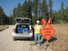
Rich Gaschnig, a post-doctoral student volunteer from the University of Maryland, poses with a safety sign. The crew followed all Forest Service requirements for road work.
|
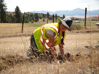
Maureen Kahn, an undergraduate student volunteer from Carleton College, deploys a seismograph in eastern Oregon.
|
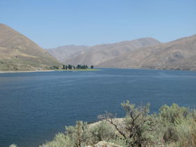
The controlled-source seismic line crossed the Snake River gorge at the Idaho-Oregon state line.
|
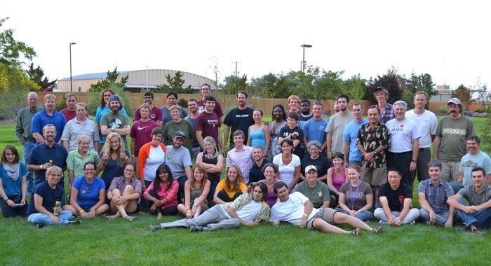 |
| The IDOR controlled-source field crew was one of the largest and most diverse teams assembled for an IRIS-facilitated experiment. |
Principal Investigators and Institutions:
John Hole (Virginia Tech)
Ray Russo (University of Florida)
Basil Tikoff (University of Wisconsin - Madison) (lead PI)
Jeff Vervoort (Washington State University)
Field Dates:
Broadband earthquake sensors: summer 2011 - summer 2013
Controlled-source shots and sensors: August 2012
Funding Source:
National Science Foundation, Earth Sciences - EarthScope Program: IDOR Award