"Future Geophysical Facilities Required to Address Grand Challenges in the Earth Sciences"
(Final Report Submitted to NSF, 29.2 MB .pdf)
(Downsampled Version, 8 MB .pdf)
Workshop Breakout Summaries:
Session 1 Session 2 Session 3 Session 4
Assorted Workshop Materials:
Summary
Multi-use, multi-user facilities to support geoscience research require durable infrastructure, built and used over significant time periods, rarely less than five years and sometimes for twenty years or more. Investment in these facilities can be utilized by numerous investigators in diverse fields but only if the facilities incorporate capabilities required for individual research projects that may be proposed long after a facility is designed.
NSF/EAR has indicated its plan to recompete the management and operation of its seismic and geodetic facilities in 2018 (see 2009 Dear Colleague Letter on Plans for Integration and Recompetition of EAR Solid Earth Deformation Facilities). In order to inform this recompetition, IRIS, UNAVCO, and the EarthScope National Office (ENO) are working together to gather community input for NSF on the key scientific questions and emerging areas of research the geosciences community will be pursuing in 2018 and beyond, and the seismic and geodetic facility capabilities that will be required to support this research. We plan to describe two types of capabilities:
- Foundational facilities are those seismic and geodetic capabilities without which geoscience research, as practiced today, could not continue
- Frontier facilities are new capabilities, beyond those that might presently exist, which will be required to make rapid progress in addressing one or more science grand challenge questions
Workshop
The 2 ½ day workshop will be organized around broad geoscience research and outreach needs beyond 2018: rheology and global geodynamics, fault and volcano systems, evolving landscapes, and discovery-mode Earth science. For each topic, several concise presentations and Q&A periods in plenary sessions, including at least one focusing on broader impacts, will be followed by breakout sessions charged to address questions about emerging science opportunities, required facilities, and broader impacts.
Location and Dates
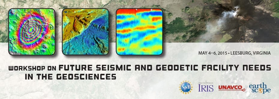
The workshop will be held at the Lansdowne Resort and Conference Center in Leesburg, VA about 8 miles from Dulles International Airport and a 40 min drive from Washinton, DC. The Workshop will begin in the late afternoon of Sunday May 3rd and continue through lunch on Wednesday May 6th.
Participation
Participation in the workshop will be limited to 100 researchers and educators from the geoscience community. Applications to attend the workshop will be accepted between December 1, 2014 and February 15, 2015. The Workshop Organizing Committee will choose participants to represent the seismological, geodetic, and broader geoscience research communities, with special attention to including early-career investigators, women, and underrepresented minorities. Attendees will be notified by March 2, 2015.
Whitepapers and Community Webinars
Whitepapers will be solicited from the IRIS, UNAVCO and EarthScope communities, and researchers and educators in allied geoscience disciplines. These short (1-2 pages) documents will describe an important scientific question or problem the community member expects to be working during the next decade and the seismic or geodetic facility capabilities that would enable further progress in addressing this scientific issue or support related broader impact needs. The goal of these whitepapers is to gather input from a broad cross-section of the geoscience community, since attendance at the workshop will be limited.
Community Webinars: Several disciplinary communities in the geosciences have already identified science grand challenges and future research opportunities. Webinars will review and, if necessary, produce updates to the earlier reports and describe how complementary facilities of other agencies (USGS, NASA, NOAA, and DOE) are expected to support research.
Workshop Report
A written workshop report will be produced to summarize both foundational and frontier, seismic and geodetic facility capabilities required post-2018. A draft report assembled by a Writing Committee will summarize recommendations of the workshop attendees and will be available for public comment before the report is finalized. After the report is complete, the lead editors of the report will brief NSF upper management and Division Directors within GEO.
Organizing Committee
Lucy Flesch, Co-Chair |
Purdue University |
Karen Fischer, Co-Chair |
Brown University |
Greg Beroza |
Stanford University |
Roland Burgmann |
University of California, Berkeley |
Jay Famiglietti |
University of California, Irvine and JPL |
Kristine Larson |
University of Colorado |
Cathy Manduca |
Carleton College |
Susan Schwartz |
University of California, Santa Cruz |
Leigh Stearns |
University of Kansas |
Rebecca Walker |
Mt. San Antonio College |
Kelin Whipple |
Arizona State University |
Doug Wiens |
Washington University |
Writing Committee
Rick Aster, Co-Editor |
Colorado State University |
Mark Simons, Co-Editor |
California Institute of Technology |
Roland Burgmann |
University of California, Berkeley |
Estelle Chaussard |
University of California, Berkeley |
Gary Ebert |
Oregon State University |
Natalya Gomez |
McGill University |
Bill Hammond |
University of Nevada, Reno |
Steve Holbrook |
University of Wyoming |
John Hole |
Virginia Tech |
Thorne Lay |
University of California, Santa Cruz |
Steve McNutt |
University of South Florida |
Michael Oskin |
University of California, Davis |
Brandon Schmandt |
University of New Mexico |
David Schmidt |
University of Washington |
Leigh Stearns |
University of Kansas |
John Vidale |
University of Washington |
Lara Wagner |
Carnegie Institution for Science |
Paul Winberry |
Central Washington University |
Breakout Session Charge
The goal of each Breakout Session is to define both the foundational and frontier geodetic and seismic facility capabilities required to advance geoscience research and education post-2018. Foundational facility capabilities are those without which geoscience research, as practiced today, could not continue. Frontier facilities capabilities are those new capabilities, beyond those which might presently exist, which will be required to make rapid progress in addressing one or more science grand challenge questions.
Each Breakout Session will develop written recommendations that address these questions:
- What key scientific questions, emerging science opportunities and technical advances will geoscientists be pursuing in 2018 and beyond?
- What foundational and frontier geodetic and seismic facility capabilities will be required to support geoscience research in 2018 and beyond?
- What facility capabilities are needed to support broader impact needs post-2018 (EPO, training and workforce development, international)?
The Lansdowne Resort and Conference Center is located in Leesburg, VA about 8 miles from Dulles International Airport (IAD) and a 40 min drive from Washington, DC. Lansdowne provides a paid shuttle service to and from Dulles International Airport for a cost of $30.00 per person each way.
Support for Attendees
Participants selected by the Organizing Committee, will be provided with up to $500 to cover the cost of transportation including airfare, parking, taxis and other costs. Lodging and meals during the Workshop will be paid directly by the conference organizers.
Housing Reservations
Lodging will be provided at the Lansdowne Resort and Conference Center. Participants selected by the Organizing Committee will receive information on lodging in early March.
Sunday, May 3rd
Sunday, May 3rd, 2015, 12:00–8:30pm
|
3:00 pm 7:00 pm
|
Registration - Amphitheater Foyer
|
7:30 pm 7:40 pm
|
Welcome and Workshop Goals - Amphitheater
(Workshop Organizing Committee)
|
7:40 pm 8:30 pm
|
Pop-up talks (< 5 minutes) on: "exciting things to work on with the facilities of the future."
|
6:30 pm 9:00 pm
|
Dinner is available to overnight guests in Riverside Hearth
|
Monday, May 4th
Monday, May 4th, 2015, 7:00am–7:30pm
|
7:00 am 7:00 am
|
Breakfast
|
8:00 am 8:15 am
|
NSF on Workshop Expectations (Anderson and Kelz)
|
8:15 am 8:30 am
|
Workshop Organization (Workshop Organizing Committee)
|
8:30 am 10:10 am
|
Plenary Session I: Earth structure, rheology and geodynamics
- Report from Plenary Session I webinar (5 minutes plus 5 minutes of discussion)
- Three speakers, 20 minutes each plus 10 minutes of discussion
-
Barbara Romanowicz: Frontiers in global-scale Earth structure and dynamics and the facilities needed to cross them
-
Andrew Nyblade: Frontiers in regional scale seismology and on the synergy between seismological and geodetic facilities and capacity building Presentation
-
Thorsten Becker: Key questions in mantle dynamics and what is needed from seismology and geodesy to address them Presentation
|
10:10 am 10:40 am
|
Morning break
|
10:40 am 12:20 pm
|
Breakout Session I: Earth structure, rheology and geodynamics
Breakout Sessions charged with identifying foundational and frontier post-2018 geodetic and seismic facility needs (see Breakout Session charge).
- The case for long-term, global-scale seismic, geodetic and MT arrays
- The case for temporary, targeted seismic, geodetic and MT arrays
- The case for new types of observations
- Supporting undergraduate and graduate education in the U.S. and abroad
|
12:30 pm 1:30 pm
|
Lunch
|
1:30 pm 3:20 pm
|
Plenary Session II: Time-variant behavior of faults and magmatic systems
- Report from Plenary Session II webinar (5 minutes plus 5 minutes of discussion)
- Three speakers, 20 minutes each plus 10 minutes of discussion
-
Jeff McGuire: Earthquake processes: Research frontiers and facility priorities
-
Paul Segall: Magmatic processes: Research frontiers and facility priorities Presentation
-
Richard Allen: Earthquake early warning: Research frontiers and facility priorities
|
3:20 pm 3:50 pm
|
Afternoon break
|
3:50 pm 4:30 pm
|
Breakout Session II: Time-variant behavior of faults and magmatic systems
Breakout Sessions charged with identifying foundational and frontier post-2018 geodetic and seismic facility needs (see Breakout Session charge).
- The case for long-term, observatory style monitoring
- The case for short-term, targeted experiments.
- The case for new types of observations
- Enhancing societal use of seismic and geodetic data
|
6:00 pm 7:30 pm
|
Dinner
|
7:30 pm 9:00 pm
|
[Open]
|
Tuesday, May 5th
Tuesday, May 5th, 2015, 7am–9pm
|
7:00 am 8:00 am
|
Buffet Breakfast
|
8:00 am 9:00 am
|
Reports from day one breakout session leaders (20 minutes with 10 minutes for questions/comments)
Session 1 Breakouts
Session 2 Breakouts
|
9:00 am 10:10 am
|
Plenary Session III: Evolving landscapes and global environmental change
- Report from Plenary Session III webinar (5 minutes plus 5 minutes of discussion)
- Four speakers, 20 minutes each plus 10 minutes of discussion
-
Jay Famiglietti: The importance of seismic and geodetic facilities in studies of hydrology and water resources
-
Helen Fricker: The importance of seismic and geodetic facilities in glaciology Presentation
-
Natalya Gomez: Glacial isostatic adjustment and sea level problems and the types of geodetic and seismological data that will be needed
-
Ramon Arrowsmith: Tectonic geomorphology and ideas for communicating science data and results to the public, based on experience with Earthscope Presentation
|
10:10 am 10:40 am
|
Morning break
|
10:40 am 11:40 am
|
Third and fourth talk in plenary session
|
11:50 am 12:50 pm
|
Lunch
|
12:50 pm 2:30 pm
|
Breakout Session III: Evolving landscapes and global environmental change
Breakout Sessions charged with identifying foundational and frontier post-2018 geodetic and seismic facility needs (see Breakout Session charge).
- Hydrology and critical zone imaging
- Glaciology: Instrumenting glaciers and ice sheets
- Polar networks and glacial isostatic adjustment
- Tectonic geomorphology and 4D topographic imaging
- Strengthening broad understanding of Earth and Earth Science: K-12 education, informal education, and public outreach
|
2:30 pm 3:50 pm
|
Plenary Session IV: Links to industry and discovery-mode science from new technologies
Six speakers, 10 minutes each plus 2 minutes of questions
-
Victor Tsai: Frontiers in seismological methods (including Large N arrays, arrays of arrays)
-
Estelle Chaussard: Frontiers in geodetic methods Presentation
-
James Gaherty: Seafloor sensors Presentation
-
Louise Kellogg: Cyberinfrastructure: High performance computing, big data
-
Steven Whitmeyer: Effective use of data and visualizations in geoscience education: Past, present, and future
-
Geoff Abers: Potential human-induced events and the geophysical tools needed to understand them
|
3:50 pm 4:30 pm
|
Afternoon break
|
4:20 pm 6:00 pm
|
Breakout Session IV: Links to industry and discovery-mode science from new technologies
Breakout Sessions charged with identifying foundational and frontier post-2018 geodetic and seismic facility needs (see Breakout Session charge).
- Links to resources and the exploration industry
- Large N arrays, arrays of arrays
- GPS/InSAR/LiDAR: New technologies
- Cyberinfrastructure: High performance computing, big data
- Seafloor sensors
- New technology, new students, new research: Blue sky thinking about broader impacts in a changing world
|
6:00 pm 7:30 pm
|
Dinner
|
7:30 pm 9:00 pm
|
[Open]
(Leaders of all four Breakout Sessions meet to consolidate notes and recommendations for presentation in Day 3 AM session)
|
Wednesday, May 6th
Wednesday, May 6th, 2015, 7am–5pm
|
7:00 am 8:00 am
|
Buffet Breakfast
|
8:00 am 9:00 am
|
Reports from day two breakout session leaders (20 minutes with 10 minutes for questions/comments)
Session 3 Breakouts
Session 4 Breakouts
|
9:00 am 10:00 am
|
Report from early career caucus and synthesis of breakout reports
|
10:00 am 10:30 am
|
Morning break
|
10:30 am 12:00 pm
|
Facilities of the Future: Top Priorities
Based on breakout reports, identify top science facility priorities and cross-cutting themes
|
12:00 pm 1:30 pm
|
Lunch
Meeting adjourns except for the Workshop Report Committee
|
1:30 pm 5:00 pm
|
Workshop Report Committee meets to assemble first draft of workshop report and recommendations
|
Notice:
The
application
period for this workshop closed at
Sun, February 15, 2015 - 11:59:00 PM.
Notice:
The abstract submission period for this workshop closed at
.
-
Authors
-
Becky Flowers, John Hole, Terry Pavlis, Lara Wagner, Steve Whitmeyer, Mike Williams
-
Image Caption
-
(No image, but it is important to highlight that the text in the fields above is a subset of a larger 4-page white paper that will serve as the focal point of a pre-meeting workshop at the Vermont ESNM meeting. We would prefer to submit the full white paper for discussion at this IRIS Future Needs workshop instead of the shorter, edited version encapsulated by this web form.)
-
Keywords
-
Community Geologic Model, Cyberinfrastructure, continental evolution, geochronology
-
Title
-
4D-Earth Initiative: A Community Geologic Model and New Scientific Initiative for the 4D Evolution of the North American Continent
-
Email
-
whitmesj@jmu.edu
-
First Name
-
Steven
-
What facility capabilities are needed to support broader impact needs post-2018 (education,outreach,training & workforce development,international)?
-
The 4D-Earth Initiative, almost by definition, will have huge broader impact, education, and outreach components. It, like EarthScope, has something for nearly everyone and every place. It embodies place-based-education and teaching and facilitates investigations of specific places through time. Through the new cyberinfrastructure that will underpin the community geologic model, there is great potential for the seamless integration of scientific publications and other forms of dissemination into the model framework, with relevance to organizations such as the Geological Society of America and the American Geophysical Union as they move toward entirely open access content. The model infrastructure will incorporate significant student training components in database tools and also in tools for collecting, processing, and exporting geologic and geochronologic data. We envision that outreach activities will increasingly move toward a coordinated community approach that capitalizes on the inherent but incompletely tapped public interest in Earth history. This will be an excellent opportunity to demonstrate to the broader community how the geosciences can unravel both deep and shallow time and the 4D evolution of our continent.
-
Last Name
-
Whitmeyer
-
What key scientific questions, emerging science opportunities and technical advances will you be pursuing in 2018 and beyond?
-
We envision a new interdisciplinary 4D-Earth Initiative as a natural successor to the EarthScope program, aimed at (1) expanding the primarily 3-D geophysical focus that captured a snapshot of present day North America into the 4th dimension of time, and (2) illuminating the crustal component that was below the resolution of much of the USArray image. This initiative will integrate new infrastructure and new science within an overarching scientific motivation to develop a Community Geologic Model for the 4-D Evolution of the North American continent. The goal is to unravel how and why the continent evolved to the current state and to firmly answer long-standing questions of how the time-integrated processes of plate tectonics and surface processes produce the crustal structures we see today. This effort will bring to fruition one of the original goals of the EarthScope program, to build a 4-dimensional image of the continent, and will also usher in a new way of conducting Earth science research.
21st century geologic data is as inherently sharable and quantifiable as the geophysical data that were the center of EarthScope. What is currently lacking is a mechanism that can merge geoscience data into a common framework and focus data and researchers toward achieving fundamental new advances. Our vision for the 4-D Earth Initiative will include improved access to a network of geochronologic and analytical facilities and a new cyberinfrastructure for data and model integration.
-
What foundational or frontier geodetic and seismic facility capabilities will be required to support geoscience research in 2018 and beyond?
-
Community Geologic Model
We envision development of an open source multidimensional model of North American continental evolution. As a starting point, we picture a set of time slices such as those published by Whitmeyer and Karlstrom (2007), but each time slice would be a digital model in itself, incorporating data sets, hypotheses, simulations, models of structure, stratigraphy, geochronology, geomorphology, petrology, lithospheric and crustal dynamics, and high resolution geophysics and environmental sensing enabled by observational networks such as those built by EarthScope. These digital time slices will function as a platform for discussion and collaboration, through which they will undergo iterative development and improvement as new data and models are added.
The project will have important linkages with Earth Cube and related cyberinfrastructure initiatives. It will require extensive new computing infrastructure with enough flexibility to integrate geologic data, images, and models at all scales and interact with other existing databases. The model will succeed only if it provides immediate “added value” for processing new and existing geologic data. As such, it must implement open sources tools for collecting, processing, integrating, and plotting diverse datasets, including map- and field-based data, and it must have visualization tools that allow for production of both 2D and 3D images in a variety of user-defined formats at different snapshots through time.
-
Select Whitepaper Category
-
Discovery Mode Science
-
Authors
-
Hersh Gilbert
-
Image Caption
-
NA
-
Keywords
-
terrane boundaries, petrology, geologic databases
-
Title
-
Improved tools for integrating geologic and geophysical data
-
Email
-
hersh@purdue.edu
-
First Name
-
Hersh
-
What facility capabilities are needed to support broader impact needs post-2018 (education,outreach,training & workforce development,international)?
-
Strengthening the ability of researchers to incorporate multiple datasets into a single format has direct benefits to expanding the broader impact of earth science. Visualizing disparate types of data in a single format will facilitate scientific discovery and exhibit relationships that have not been previously recognized. To achieve such comparisons, it has been more and more common for researchers to import their data into commonly used formats such as GIS and Google Earth.
The public has also become more familiar with data visualization in packages similar to Google Earth by seeing them used in print and television media. The scientific community can take advantage of this familiarity by sharing results and data for educational and outreach purposes in Google Earth type formats. This would lead to opportunities to convey the spatial and/or dynamic nature of geologic data in ways that may not be as easy using only static images of results.
-
Last Name
-
Gilbert
-
What key scientific questions, emerging science opportunities and technical advances will you be pursuing in 2018 and beyond?
-
The data collected by the EarthScope and IRIS programs, as well as other programs has yielded spectacular seismic results with unprecedented levels of detail. The expansive lateral extents of many of these images make them ideal for investigating signatures of continental evolution across North America. However, limiting studies to seismic observations leaves a great deal ambiguity while attempting to link specific features identified in images to events during the tectonic evolution of a region. This ambiguity can be further complicated in regions that possess long histories of modification. Therefore, further progress into understanding continental growth and how it has evolved temporally in North America, will need to come from combining geologic observations with the results of seismic investigations.
My future efforts in the next five to ten years will be to take advantage of geologic datasets and integrate them with the results of seismic studies to improve temporal constraints on continental evolution. Observations from other areas of geoscience, including petrology, geochemistry, structural geologic, and geodesy can be better leveraged to strengthen interpretations of seismic data. Improved incorporation of additional datasets into the analysis of seismic results will help clarify the origin of seismically imaged structures, such as the polarity of ancient subduction zones or the extent of Precambrian calderas.
-
What foundational or frontier geodetic and seismic facility capabilities will be required to support geoscience research in 2018 and beyond?
-
The IRIS facility has already created a lot of the infrastructure necessary for incorporating multiple datasets into a single framework. The tools and datasets within the Earth Model Collaboration constructed by the IRIS Data Management Center already possess a range of types of seismic models that span regional to global scales. The ability of users with a range of familiarity to seismic data to access models such as selected cross sections or even the raw model is very powerful and expands how the model can be used in a range of types of studies.
Access to raw seismic models helps realize part of the EarthScope 2010 Science Plan to utilize cyber infrastructure to facilitate analyzing and comparing multiple datasets. The next step of incorporating results from geologic, and other types of investigations, into a similar format would expand the ability of researchers to incorporate temporal information into their geophysical data. The addition of geologic data will help illuminate how many of the geophysically imaged processes evolve.
Achieving this research goal does not require creating a new database. Instead it can be achieved by manipulate data in a range of formats into a common format just as was achieved in the construction of the Earth Model Collaboration. IRIS Data Services can connect with efforts such as the Integrated Earth Data Applications website earthchem.org and the NAVDAT datacenter to facilitate comparing seismic and geologic data.
-
Select Whitepaper Category
-
Global / Regional Structure, Rheology and Geodynamics
-
Authors
-
David Chadwell
-
Keywords
-
seafloor geodesy, megathrust earthquake
-
Title
-
Sub-meter Accuracy Seafloor Geodesy using Multibeam Sonar: A B4 Survey for the Cascadia Subduction Zone
-
Email
-
dsandwell@ucsd.edu
-
First Name
-
Sandwell
-
What facility capabilities are needed to support broader impact needs post-2018 (education,outreach,training & workforce development,international)?
-
Need access to ship time on UNOLS vessels.
Once the technique is demonstrated we need to perform a high resolution survey of the toe of the Cascade megathrust zone to serve as the reference benchmark for post-event surveys as well as provide high resolution imagery for paleoseismic analysis.
-
Last Name
-
David
-
What key scientific questions, emerging science opportunities and technical advances will you be pursuing in 2018 and beyond?
-
Active plate boundaries, especially subduction zones, pose significant hazards in the form of earthquakes and tsunamis, such as those associated with the 2011 M9.0 Tohoki-Oki earthquake. However, our ability to monitor such areas and events are severely limited because current seafloor geodetic instruments are either too inaccurate or cost-prohibitive. Multibeam sonar, despite its relatively poor resolution, holds great potential as a cheap and effective geodetic tool due to its high spatial coverage, but the limits of its accuracy are still an active area of research. In a previous experiment at very low ship speed ~1 knot we demonstrate that a patch of seafloor (~3000 m deep) can be re-positioned to an accuracy of better than 1 meter using the sidescan data from a 12 kHz multibeam sonar. In addition to the slow ship speed, the repeated surveys were performed within the critical baseline for interferometry. This displacement accuracy is at least 30 times better than has been achieved through repeated multibeam surveys at transit ship speed.
-
What foundational or frontier geodetic and seismic facility capabilities will be required to support geoscience research in 2018 and beyond?
-
Need to perform a series of shipboard experiments to better understand how seafloor position accuracy depends on: reference-to-repeat baseline offset; the ship speed; the sonar frequency/bandwidth; and variations in upper ocean sound velocity.
Also we need to instrument survey vessels with at lest 3 high rate, high precision GPS receivers in order to monitor the position and orientation of the ship to a accuracy of a few centimeters.
-
Select Whitepaper Category
-
New Technologies
-
Authors
-
Jeffrey Ryan
-
Title
-
Broader impacts cannot be disentangled from science – a case for robust BI support in future geodetic/seismic support facilities
-
Email
-
ryan@mail.usf.edu
-
First Name
-
Jeffrey
-
What facility capabilities are needed to support broader impact needs post-2018 (education,outreach,training & workforce development,international)?
-
Individual investigators will not have either the experience or resources to provide the kinds of compelling arguments needed to justify scientific investments to a skeptical public or to the policy-makers who must approve these kinds of investments. More and more, it will be the role of community-based networks and facilities to gather these data, and to make those cases based on the accumulated results of that community. Any successor enterprise to the current UNAVCO and IRIS facilities must have as a central part of its structure a robust education and community outreach enterprise that both supports individual investigators in making the case for the societal benefits of their work, and especially in gathering the results of these many PI-led efforts in terms of their societal impacts (education, insfrastructure, preparedness, sustainability, etc.) and making a coherent national-level case for the need for future investigations. This entity will require the resources to fully support PI-led Broader Impact activities, to ensure that these activities yield the intended outcomes, and to gather from all investigators information about these outcomes to make a community-level case for the importance of these scientific efforts.
-
Last Name
-
Ryan
-
What key scientific questions, emerging science opportunities and technical advances will you be pursuing in 2018 and beyond?
-
UNAVCO and IRIS supported science already focuses on a wide range of issues of critical societal importance: hazardous deep-Earth event prediction and analysis; climate change; global water resources; hazardous weather/atmospheric events prediction and analysis. The growing applications of TLS and related Earth imaging technologies will inevitably lead into a wider range of societally critical questions to answer, which any successor enterprise must inevitably support and facilitate.
-
What foundational or frontier geodetic and seismic facility capabilities will be required to support geoscience research in 2018 and beyond?
-
The ability to explicitly address the societal relevance and impacts of science is becoming all the more critical in an age where the overwhelming expansion of (largely un-vetted) information leads to public confusion and doubt about the importance of science in their daily lives. As such, at every level, being able to make a compelling case to non-scientific constituencies, both in proposing new investigations and in documenting the outcomes and benefits of scientific investments is an absolute necessity.
-
Select Whitepaper Category
-
Broader Impacts
-
Whitepaper Image Upload
-
2013-10_rel-haz-maps_pratt-sitaula.jpg
-
Authors
-
Robert Butler
-
Image Caption
-
The Astoria, Oregon team of K-12 teachers, parks and museum interpreters, and emergency management educators examine the relative earthquake hazard map for their community.
-
Keywords
-
K-16 Earth Science Education
-
Title
-
Professor
-
Email
-
butler@up.edu
-
First Name
-
Robert
-
What facility capabilities are needed to support broader impact needs post-2018 (education,outreach,training & workforce development,international)?
-
From 2008 to 2010, Teachers on the Leading Edge (TOTLE) offered one six-day workshop each summer for K-14 teachers featuring EarthScope science and Cascadia geologic hazards. Much of the earthquake science and pedagogical approaches came from IRIS EPO. Educational resources on geodesy were adaptations of activities developed by UNAVCO EPE. The Cascadia EarthScope Earthquake and Tsunami Education Program (CEETEP) is offering six four-day workshops during 2013-16 for educators in Cascadia coastal communities. CEETEP PIs work closely with IRIS EPO and UNAVCO EPE to develop earthquake, tsunami, and geodesy classroom activities and align those activities with the Next Generation Science Standards. A TOTLE innovation was developing animations to translate earthquake, tsunami, and volcanic processes for novice learners. TOTLE, IRIS EPO, UNAVCO EPE, and CEETEP have funded a growing collection of animations that are used by K-16 Earth science instructors and emergency management educators. Animations are posted on the IRIS EPO and UNAVCO EPE web sites and on YouTube where these animations have received over 2 million views and viewership is growing rapidly. With the assistance of education program(s) within the Future Seismic and Geodetic Facility, regional educational programs like TOTLE and CEETEP can seize future opportunities to feature seismology and geodesy for students and the public. Without such support, these opportunities will be severely limited.
-
Last Name
-
Butler
-
What key scientific questions, emerging science opportunities and technical advances will you be pursuing in 2018 and beyond?
-
I hope to continue working with Jenda Johnson to develop animations that translate earthquake, tsunami, and volcanic processes for novice learners. Collaborations with IRIS EPO and UNAVCO EPE or their successor geoscience education organization(s) is essential to continuing this education research and development.
-
What foundational or frontier geodetic and seismic facility capabilities will be required to support geoscience research in 2018 and beyond?
-
There must be a core staff of geoscience educators within the Future Seismic and Geodetic Facility to support regional and state programs that promote earthquake and geodesy education in their areas.
-
Select Whitepaper Category
-
Broader Impacts
-
Authors
-
Fred W. Schroeder, Derek Schutt
-
Keywords
-
Training, repository, teacher, education
-
Title
-
Geophysics Teaching Repository
-
Email
-
fwschro@yahoo.com
-
First Name
-
Fred W
-
What facility capabilities are needed to support broader impact needs post-2018 (education,outreach,training & workforce development,international)?
-
A strength of the geophysics community is its members’ commitment to teaching excellence. With existing communication technology, a new facility can help leverage this teaching expertise so that students around the globe can benefit.
The IRIS facility’s InClass and Early Career webinars are a great beginning towards this goal. Both programs should be expanded. A master plan should be developed such that a world-class geophysics teaching repository is available to science teachers for all grade levels. For K-12, age-appropriate teaching resources (videos, slides, documents, activities) would exist for common earth science topics. For high school, there would be multi-lesson units that build upon one another in a cohesive manner. Other geophysics teaching resources could be designed for undergraduate and graduate geoscience courses.
A distinct feature of the current and future expanded teaching repository is that it will be filled proactively. To insure a coherent and complete set of materials, contributions would not be accepted passively, rather, the new facility’s staff would develop lists of topics and then solicit volunteers from within member institutions and elsewhere. Educators would contribute materials using common templates and styles, with material curated by facility staff. The impact of this project on students K through grad school would be phenomenal, by enabling a far wider range of populations to be educated in Earth Sciences.
-
Last Name
-
Schroeder
-
What key scientific questions, emerging science opportunities and technical advances will you be pursuing in 2018 and beyond?
-
In 2018 and beyond Fred Schroeder hopes to be contributing educational materials to such a geophysics teaching repository.
-
What foundational or frontier geodetic and seismic facility capabilities will be required to support geoscience research in 2018 and beyond?
-
Outside my area of expertise.
-
Select Whitepaper Category
-
Other
-
Whitepaper Image Upload
-
nica_volcanoes_extended.jpg
-
Authors
-
Stephen McNutt, Chuck Connor
-
Image Caption
-
Map of volcanoes in Central America.
-
Keywords
-
volcano seismology, infrasound, deformation, volcanic lightning
-
Title
-
Integrated Geophysical Studies of Volcanoes in Central America
-
Email
-
smcnutt@usf.edu
-
First Name
-
Stephen
-
What facility capabilities are needed to support broader impact needs post-2018 (education,outreach,training & workforce development,international)?
-
At USF a computational laboratory will be needed to properly record incoming data, perform data quality checks, perform automated analyses, display data, and store and archive databases. The project will also require a team of scientists and technicians to achieve critical mass, cover all the relevant scientific disciplines, and provide adequate coverage of ongoing eruptive activity.
The project is intended to be complementary to existing efforts at USF. It builds on and extends capabilities for basic research in volcanology. It is complementary to an existing multi-purpose GPS deployment in Costa Rica and the data from the new instruments can be shared between and across disciplines for a variety of studies. The planned deployments and infrastructure will also allow additional studies of other natural events, for example large earthquakes or tropical storms. These phenomena will produce signals on the same instruments but require separate analyses and interpretations. This is an illustration of the fact that the instruments, once in place, will have potential for growth of scientific issues beyond those that drove the original installation.
The project will position USF and collaborators at the forefront of modern volcanological research with good access and potential collaborations in Central America, South America, and the Caribbean regions.
-
Last Name
-
McNutt
-
What key scientific questions, emerging science opportunities and technical advances will you be pursuing in 2018 and beyond?
-
Volcanology has progressed as a science when high quality data sets become available for key eruptions. The eruptions of Mount St. Helens in 1980 and Montserrat in the 1990’s are two recent examples. Thus an effective strategy is to set up the required instruments in advance so that the onset and all phases of activity can be recorded and analyzed. We envision a comprehensive network of instruments on volcanoes in Central America that will provide a rich source of scientific data to understand processes, and a fundamental improvement in the ability to forecast and assess hazards from eruptions. We intend to instrument 7 active volcanoes in Nicaragua and 5 in El Salvador. Installation will be done in stages so some data will be coming in year 1 and other data in later years. We plan for USF and collaborators to take the lead on installation and initial maintenance working with partners from Nicaragua and El Salvador. Eventually maintenance will be handed off to scientists and technicians from those countries. Data would be telemetered to USF and/or IRIS and to the relevant agencies in Nicaragua and El Salvador. Data will be immediately available for study by scientists, for demonstrations to students, and for use by other interested parties via the world wide web.
-
What foundational or frontier geodetic and seismic facility capabilities will be required to support geoscience research in 2018 and beyond?
-
The specific instruments needed are 1) broadband, 3-component high-dynamic-range seismometers, 2) GPS receivers, 3) infrasound sensors, and 4) lightning detectors. The numbers and locations of instruments will be determined by logistics, cost, property ownership, etc. and will vary from one volcano to another. This suite of instruments will allow a broad range of modern studies to be performed, from underground processes that occur before eruptions, active processes that occur during eruptions, and atmospheric processes that occur after eruptions as the ash column moves downwind. The permanent instruments will be augmented by portable instruments for selected topical studies when conditions warrant.
-
Select Whitepaper Category
-
Fault and Volcano Systems
-
Whitepaper Image Upload
-
figure_elsierra_mayor.jpg
-
Authors
-
Timothy Melbourne
-
Image Caption
-
See attached.
-
Keywords
-
real-time GNSS
-
Title
-
Facility Requirements for Real-time GPS Seismic and Geodetic Monitoring
-
Email
-
tim@geology.cwu.edu
-
First Name
-
Timothy
-
What facility capabilities are needed to support broader impact needs post-2018 (education,outreach,training & workforce development,international)?
-
Unresolved issues bearing on the integration of real-time GPS with seismic streams include:
• Should high-rate GPS time series be archived alongside conventional seismic data streams?
• If so, which organization will be tasked with doing so? Currently neither the IRIS DMC or UNAVCO, INC archive high-rate GPS data at full-resolution and without down-sampling.
• If high-rate products are saved, should processing be specified (RTK; PPP; products used, etc).
• If high-rate, real-time GPS becomes widely adopted by agencies tasked with hazards mitigation (principally USGS, NASA and NOAA), which agencies will support the continued real-time operations of these networks, given that the real-time aspect of their nature lends itself more to hazards monitoring, which is not typically the focus of NSF, rather than basic science, which is.
-
Last Name
-
Melbourne
-
What key scientific questions, emerging science opportunities and technical advances will you be pursuing in 2018 and beyond?
-
Over the past century, seismic networks have provided the primary source of rapid earthquake characterization that inform first responders. However, as earthquakes grow large and exhibit fault rupture times exceeding several seconds in duration and fault ruptures of tens of kilometers, the complexity and extended coda of local body waveforms, coupled with saturation on local networks, can make accurate magnitude estimation and finiteness of rupture difficult to ascertain without depending on teleseismic waveforms and their attendant travel-time delays of minutes. As a result, rapid and accurate magnitude estimation of the largest earthquakes based solely on local seismic measurements remains challenging.
-
What foundational or frontier geodetic and seismic facility capabilities will be required to support geoscience research in 2018 and beyond?
-
Because near-field (static) deformation grows linearly with respect to earthquake moment, as opposed to the moment rate that controls far-field, teleseismic amplitudes, GNSS position measurements computed in real-time can, provided sufficient instrument density, be highly complementary to traditional seismometers in characterizing large earthquake sources rapidly. EarthScope’s Plate Boundary Observatory now contains over 300 continuously-telemetered GPS receivers, most of which were upgraded to this capacity from supplemental ARRA funding from NSF under the Cascadia Initiative. In conjunction with other real-time networks, currently over 600 GPS blanket the San Andreas and Cascadia fault systems that define the North American plate boundary, while another ~thousand or so instruments operate throughout the Pacific Rim. These instruments can provide on-the-fly characterization of transient ground displacements highly complementary to traditional seismic strong-motion monitoring, and are proving to be incredibly useful for rapid earthquake characterization, tsunami excitation, and volcanic unrest. A myriad of different University and federal agencies are currently developing new algorithms to better employ the existing and incipient real-time streams for a wide variety of applications that depend on accurate, rapid earthquake characterization, including Earthquake Early Warning, tsunami excitation and volcanic inflation.
-
Select Whitepaper Category
-
Other
-
Authors
-
Ronni Grapenthin, Susan Bilek
-
Title
-
Permanent seafloor geophysical networks
-
Email
-
rg@nmt.edu
-
First Name
-
Ronni
-
What facility capabilities are needed to support broader impact needs post-2018 (education,outreach,training & workforce development,international)?
-
It is crucial for the public to be well educated and informed about the benefits that big investments into these networks will bring in terms of protecting lives and economic infrastructure (e.g., supply chain dynamics). It is ironic that the US invests heavily into perceived threats with relatively small footprint and likelihood (terrorism), while investments into natural hazard mitigation and early detection are rather sparse. Clearly, such decisions are made at high political levels. However, as the process of moving the California demonstration earthquake early warning system towards a public system shows what an impact effective communication with policy makers can have. Hence, the community that operates these facilities will need to be clear about communicating how surveying and monitoring the ocean bottoms can substantially improve our understanding of geologic hazards.
-
Last Name
-
Grapenthin
-
What key scientific questions, emerging science opportunities and technical advances will you be pursuing in 2018 and beyond?
-
Due to our lack of comprehensive geophysical networks on the seafloor, we remain with a limited understanding of megathrust earthquakes and microseismicity along convergent margins. Similarly, we do not know about interseismic strain accumulation, co-seismic deformation, post-seismic relaxation, and micro- and moderate seismicity in oceanic intra-plate environments. Our lack of high-resolution observations turns complex earthquakes like the rupture during the 2012 Indian Ocean event into a surprise. The large amount of slip at the trench in 2011 Tohoku earthquake also challenges our understanding of the shallowest part of the megathrust zone. Permanent, maybe even real-time observations of seismicity and motion of the seafloor will enhance the spatial and temporal resolution of these processes and inform about underlying mantle dynamics. These observations can be achieved with permanent geophysical networks on the ocean floor.
-
What foundational or frontier geodetic and seismic facility capabilities will be required to support geoscience research in 2018 and beyond?
-
The Cascadia Initiative OBS deployment over a 4-year period provides a good test case of long-term seismic monitoring of a plate boundary, but the lack of geodetic monitoring limits its impact. Cost is certainly a big issue, as seafloor geophysical equipment is likely to remain expensive because of the lack of other “customers”. But the larger cost factor is ship time for deployment. Particularly, if techniques like seafloor geodesy require a ship to remain in place for an extended time (days) to repeatedly ping ocean bottom transceivers for increased precision, this effort that can only be accomplished with community facility support. While progress is being made in testing autonomous ocean vehicles (such as LiquidRobotics’s Waveglider), the ability for timely travel over long distances (e.g., along the Aleutian trench) and precise navigation in the face of strong currents is limited.
Fundamentally, we need our facilities to be involved in both the seismic and geodetic instrumentation that meet the science needs. But the facility also needs to drive the development and testing of autonomous ocean vehicles that can operate at sea for extended periods of time, navigate precisely, and propel themselves rapidly. This should happen in collaboration with industry partners that include manufacturers, but also other potential consumers (such as the energy industry). The goal should be the creation of a facility that unifies the current isolated efforts in advancing our abilities.
-
Select Whitepaper Category
-
Global / Regional Structure, Rheology and Geodynamics
-
Authors
-
Estelle Chaussard
-
Keywords
-
Precursory signals of eruption, volcano-tectonic interaction, monitoring
-
Title
-
Needs for hazards monitoring
-
Email
-
estelle@seismo.berkeley.edu
-
First Name
-
Estelle
-
What facility capabilities are needed to support broader impact needs post-2018 (education,outreach,training & workforce development,international)?
-
To ensure the success of volcano monitoring we need data storage facilities (Unavco), data and result sharing platforms for across-fields datasets (WovoDat, vhub) , collaboration between these entities and Volcano Observatories.
Supercomputers with free access for data processing and modeling are also a necessary resource for future geodetic and seismic science.
-
Last Name
-
Chaussard
-
What key scientific questions, emerging science opportunities and technical advances will you be pursuing in 2018 and beyond?
-
The most fundamental issue still faced in volcano monitoring is the lack of a global inventory of the number of active volcanoes and their style of activity. Thus, to reach forecast of activity on longer timescales, develop a warning system for volcanoes temporarily quiescent, and monitor ongoing eruptions we need global, long term, continuous, and semi-real time monitoring based on remote sensing by satellite and aerial systems tracking surface deformation, temperature fields and gas emissions and potential for deployment of ground-based seismogram at edifices with unrest. This comprehensive global monitoring will also help elucidate coupling of related systems, including earthquake-volcano interactions, volcano-volcano interactions, and climate-volcano interactions.
We additionally need to define the relationship between deformation, seismicity, intrusions, and eruptions to develop predictive models of volcanic eruptions by characterizing the physical mechanisms controlling the rates and styles of eruptions. To do so analysis of long time series of multi-method volcano monitoring records, requiring complete monitoring of a few edifices with seismic, gravity, geodesy, and gas data for long periods and development of physics-based numerical models of eruptive cycles able to reproduce the timing of each observation are necessary. Such models would be the first step towards achieving modeling capabilities with a predictive power.
-
What foundational or frontier geodetic and seismic facility capabilities will be required to support geoscience research in 2018 and beyond?
-
To ensure the success of volcano monitoring we need to develop an infrastructure that enables incorporating multiple datasets into a single framework. The Unavco facility host data storage for geodesy and IRIS for seismology. An integration of these resources would lead to a more efficient way to develop multidisciplinary research.
-
Select Whitepaper Category
-
Fault and Volcano Systems
-
Authors
-
Samantha Hansen, Richard Aster, John Hole, Sridhar Anandakrishnan, Ralph Stephen, Jake Walter, and Zhongwen Zhan
-
Keywords
-
Polar, Wavefields, Cryosphere, Solid Earth Structure
-
Title
-
Wavefields Initiative: Polar Investigations
-
Email
-
shansen@geo.ua.edu
-
First Name
-
Samantha
-
What facility capabilities are needed to support broader impact needs post-2018 (education,outreach,training & workforce development,international)?
-
To facilitate large N polar deployments, international collaborations will be crucial. Many countries have a vested interest in polar investigations, particularly in Greenland and Antarctica. Partnerships between international institutions have a strong history and will continue to promote scientific and technological advancements above and beyond that possible in single-nation efforts. Future initiatives will also require education and training of the next generation of polar scientists, particularly as the associated science and technology evolves. Course content, international mini-courses, and workshops could facilitate knowledge exchange. These avenues also provide a wealth of broad outreach opportunities, including educating the public about the importance of polar investigations in climate change research, enhancing K-12 teacher training, and providing undergraduate research experiences.
-
Last Name
-
Hansen
-
What key scientific questions, emerging science opportunities and technical advances will you be pursuing in 2018 and beyond?
-
This white paper summarizes discussion from an online community workshop that was held in June 2014 as part of IRIS’s Wavefields Initiative, which is focused on promoting the scientific value of recording the full seismic wavefield. This submission highlights relevance to polar investigations. Imaging of many scientific targets, at a variety of spatial scales, can be significantly advanced via dense station coverage to produce high-resolution images of sources and structures. Such targets include ice streams, icecap systems, sub- and en-glacial hydrological systems, and ice shelves.
Large N arrays show great promise for improved understanding of glacial characteristics, including basal properties and internal ice structure. Key targets for these efforts include estimating ice and water flow, temperature variations, ice shelf strength, and the roles of sediments and hydraulic conditions at the glacier bed. GPS strain estimates may also be valuable to study these processes. Large N deployments would also improve studies of rupture dynamics of faulting within ice, slip along ice-rock interfaces, and processes arising from ocean-ice-atmospheric interactions.
Wavefield investigations also provide new avenues to investigate solid earth structure and tectonic processes that are coupled with the cryosphere. Densification of polar instrumentation would vastly improve resolution of crustal and mantle structure and the ability to monitor volcanic/tectonic sources at all ranges.
-
What foundational or frontier geodetic and seismic facility capabilities will be required to support geoscience research in 2018 and beyond?
-
While technological requirements were not the focus of the Wavefields workshop, improvements in efficient deployment strategies, power, and communications are especially critical for polar investigations, where field costs may be very high. Many geographic regions of interest are either difficult to access and/or are hazardous, making easy-to-deploy (e.g., aerially or otherwise remotely-deployed) stations desirable to expand coverage. Thus, on-ground surveying and cabling needs to be minimized or eliminated. Stations must also evolve so that they can run autonomously for up to several seasons in some scenarios, which will require new, renewable (or longer-lasting) power sources as well as improved communications technology to telemeter recorded data in real-time at a sufficient data rate. Both the associated hardware and software should be shared across the international community, possibly with internationally-shared development costs. Ultimately, the goal is to identify and inspire the next generation of facilities that allow the community to pursue the most promising new science directions in the most cost- and time-effective manner.
-
Select Whitepaper Category
-
Atmosphere, Hydrosphere, Cryosphere, Lithosphere Interactions
-
Whitepaper Image Upload
-
goodwillie_unavco_education_data_white_paper_image.jpg
-
Authors
-
Andrew Goodwillie, Missy Holzer, Mike Passow
-
Image Caption
-
Examples of data ready for use in education. (Main image, generated with GeoMapApp) Aleutian arc seismicity: Contours show depth to the top of the subducting slab (Syracuse and Abers, 2006). White line is location of inset profile across the slab, S to N. Earthquakes (circles) are coloured by magnitude, scaled by depth. EarthScope PBO (triangles) and USArray stations (squares) are in grey. Large inset: Geodetic data explained in Groom et al.’s UNAVCO module on Cascadia Episodic Tremor and Slip.
-
Keywords
-
student engagement, student retention, education modules, STEM, workforce,
-
Title
-
Authentic Scientific Data in the Classroom: Improving Student Engagement, Understanding, and Retention
-
Email
-
andrewg@ldeo.columbia.edu
-
First Name
-
Andrew
-
What facility capabilities are needed to support broader impact needs post-2018 (education,outreach,training & workforce development,international)?
-
In addition to operating domain-specific data management centers, the next generation seismic and geodetic facilities will likely be tasked with delivery of substantial broader impacts to help address the STEM capabilities and interests of students at the school, college and graduate levels. Existing UNAVCO and IRIS learning activities are aimed at students across the K-16+ levels and provide good examples of education modules that use authentic, research-grade scientific data to enhance student interest in our field. One key aspect of increasing the value of scientific data for adoption in the classroom or lab is to ensure that data sets are made available in accessible formats, ideally as part of carefully-constructed education modules. For instance, an earthquake catalogue derived from an OBS array is more easily appropriated by educators than the underlying SEG-Y data.
Taking that lead, a successor seismic-geodetic facility should feature a strong team of education and outreach specialists who, through close interaction with investigators, curriculum developers, and evaluation experts can build upon current successes and continue to bridge the gap between cutting-edge research, student engagement, and retention.
References:
Gonzales and Keane, 2010. Who Will Fill the Geoscience Workforce Supply Gap? DOI: 10.1021/es902234g
NSTC, 2013. Federal STEM Education 5-Year Strategic Plan. National Science and Technology Council. https://www.whitehouse.gov/administration/eop/ostp
-
Last Name
-
Goodwillie
-
What key scientific questions, emerging science opportunities and technical advances will you be pursuing in 2018 and beyond?
-
Seismic and geodetic techniques including earthquake analysis, InSAR, and terrestrial laser scanning are directly relevant to societal concerns such as earthquake propagation, volcanic flank inflation, and fault release deformation. Making data sets available in formats accessible to learners at all levels, particularly through integration in cohesive education modules, can help educators increase the broader impacts of the underlying science.
-
What foundational or frontier geodetic and seismic facility capabilities will be required to support geoscience research in 2018 and beyond?
-
The NSTC Committee on STEM Education identifies key reasons for improving the scientific and technical skills of students and of the general public, noting the importance of a vibrant, STEM-literate population (NSTC, 2013). In addition, studies of demand and supply in the geosciences workforce indicate a gap between the increasing number of job opportunities available, which include positions in research and government institutions and in the natural resources sector, compared with the number of qualified individuals available to fill them (e.g. Gonzales and Keane, 2010). Addressing that STEM workforce pipeline is a goal of the NSF GEO Directorate (see the NSF Dynamic Earth: Geo Imperatives and Frontiers 2015-2020 report) and includes two readily identifiable components: How to attract students to geoscience courses, and how to retain their interest in the subject.
Interaction with authentic scientific data in the classroom is one approach that educators can adopt to successfully boost student engagement, understanding, and retention through:
• better grasp of the uses and limitations of data,
• the development and promotion of critical reasoning and mathematical skills,
• strengthening of spatial thinking capabilities,
• improvement in an ability to make inferences based upon data, and,
• enhanced familiarity with tools and techniques used by scientists.
-
Select Whitepaper Category
-
Broader Impacts
-
Authors
-
Sarah Kruse, Mitchell Craig, Rhett Herman, Rosemary Knight, Heather Lehto, George Tsoflias
-
Keywords
-
undergraduate education, underrepresented minorities, community colleges
-
Title
-
Increasing Field Research Opportunities for Diverse Undergraduate Populations Through a Dedicated Teaching/Research Equipment Pool
-
Email
-
skruse@usf.edu
-
First Name
-
Sarah
-
What facility capabilities are needed to support broader impact needs post-2018 (education,outreach,training & workforce development,international)?
-
We propose a foundational expansion of the equipment pool to include (a) a range of instruments prioritized for use by in small-scale geophysics teaching/research equipment pool, (b) the creation of training and teaching material targeting undergraduates and their instructors, and (c) an electronic forum for publishing results of small-scale integrated geophysical studies. Equipment would be prioritized for broad access by faculty and students and faculty at institutions that currently lack cutting-edge research programs and equipment—predominantly undergraduate institutions, minority-serving institutions, and community colleges. Such studies require an instrument pool that complements and expands the existing suite. Although the inventory has grown from seismographs and GPSs to include magnetotellurics and terrestrial lidar (TLS), it is insufficient for large-scale teaching and research that involves many students. We propose to supplement existing equipment with instruments that will allow larger groups of students to gather and interpret complementary geophysical data: additional Geodes for small active seismic setups, surface wave streamers, additional TLS, resistivity and electromagnetic instruments, ground-penetrating radar, gravimeters, magnetometers, and perhaps fiber optic thermal and strain cables and a nuclear magnetic resonance (NMR) system. Staff training and support will clearly be essential for this task.
-
Last Name
-
Kruse
-
What key scientific questions, emerging science opportunities and technical advances will you be pursuing in 2018 and beyond?
-
The primary objectives of this Broader Impacts whitepaper are to increase field research opportunities for large numbers of undergraduate students and to increase participation of underrepresented minorities in geophysics. We propose the acquisition of dedicated geophysics teaching/research equipment pool, and the creation of a forum for publishing results of small-scale integrated geophysical studies. Educational research targets might include, for example, subsidence associated with groundwater withdrawal or sinkholes, local hydostratigraphy, coastal morphology, or imaging of small-scale fault structures. However, the proposed geophysics equipment pool would also permit researchers to tackle problems at many scales in new ways with multiple complementary methods. In particular, seismic and geodetic studies of hydrostratigraphy, aquifer structure, and watershed processes are generally more easily interpreted and more robust when simultaneous electrical or electromagnetic are collected.
-
What foundational or frontier geodetic and seismic facility capabilities will be required to support geoscience research in 2018 and beyond?
-
Geoscience research will require a deep and diverse workforce. The National Academy of Sciences recommends expanding support for “undergraduate … STEM programs focused on increasing the participation and success of underrepresented minority students through engaged mentoring, enriching research experiences, and opportunities to publish, present, and network” (italics added). Although the NAS report does not explicitly name field experiences, we know that field work by its nature requires ‘engaged mentoring’, and that any organized data acquisition forms a research experience.
The education and outreach portfolios of the current programs offer great strength at two ends of the spectrum for undergraduate education: (a) intensive internship opportunities for a few; and (b) quality web-accessed teaching materials for classes that serve many. In between these end members lies a gap, and an opportunity to scale-up access to geophysical field investigations for many undergraduates at many institutions. We propose a way to fill the gap, as described in the broader impacts section.
-
Select Whitepaper Category
-
Broader Impacts
-
Authors
-
Susan Bilek
-
Keywords
-
earthquake, rapid response, aftershocks
-
Title
-
High density rapid response earthquake studies
-
Email
-
sbilek@nmt.edu
-
First Name
-
Susan
-
What facility capabilities are needed to support broader impact needs post-2018 (education,outreach,training & workforce development,international)?
-
Clearly this sort of facility has significant societal broader impacts as it directly relates to earthquake hazard. This facility has a broader reach, as it would provide important training for students for later employment in government agencies, private industry, and academia. As the academic landscape shifts, our community needs to increase our efforts to prepare our students for those private sector jobs, including in risk management and insurance companies. Use of this facility for earthquakes will lead to increased training in earthquake processes and hazards, preparing students for these sorts of jobs. Should the facility be used for an international response, it can aid in training and education in those countries.
-
Last Name
-
Bilek
-
What key scientific questions, emerging science opportunities and technical advances will you be pursuing in 2018 and beyond?
-
We have made significant new discoveries about the earthquake rupture process in the last decade because of fortuitous location of dense seismic arrays, including USArray, and some experiments that have managed to quickly deploy instruments within an aftershock zone. Given the earthquake hazard along the country’s plate boundaries and increasingly within the interior of the country, it is very likely that the seismological community will be called up to respond to a significant earthquake in the coming years. The community should be prepared to respond with a facility that can provide high quality data so we can make the next advances in our understanding of the earthquake process. Being able to capture a more complete aftershock sequence for comparison with patterns in the main rupture, and obtaining details about how earthquakes, from large to small, rupture are important observations that will impact rupture modeling efforts, hazard analysis, and earthquake early warning efforts, among other areas.
-
What foundational or frontier geodetic and seismic facility capabilities will be required to support geoscience research in 2018 and beyond?
-
Given the public’s interest in induced seismicity and other earthquakes, it would be a shame if the US seismic community response is limited by current instrumentation, which is not the right equipment to be used in a rapid response effort, and will limit the ability to make that next leap in our understanding of earthquakes. One possible structure for a rapid response facility is the availability of a mixed-mode network of several hundred instruments, with a subset of these being easy to deploy broadband instruments (such as the “all-in-one” direct bury instruments) and the remainder being short period 1 or 3 component instruments that have even easier deployment methods such that an entire network could be deployed within a day after the mainshock. Speed of deployment is a critical issue to be able to capture the earthquakes in the aftershock sequence, which will affect options for how to structure the facility. In an ideal world, an OBS deployment would also be of interest because of the possibility of a large earthquake offshore, but I do not think the rapid component (few days) for the oceans could not be met in the near future.
-
Select Whitepaper Category
-
Fault and Volcano Systems
-
Authors
-
Mike Poland, Dan Dzurisin, Mike Lisowski, Maurizio Battaglia
-
Keywords
-
gravity, volcanology, hydrology, monitoring, change detection
-
Title
-
Providing support for microgravity as a volcanology/hydrology research and monitoring tool
-
Email
-
mpoland@usgs.gov
-
First Name
-
Michael
-
What facility capabilities are needed to support broader impact needs post-2018 (education,outreach,training & workforce development,international)?
-
In addition to the need for facility support for instrumentation and software, training in microgravity methods will be critical to insuring its widespread use. IRIS and UNAVCO conduct numerous workshops each year on how to analyze and interpret seismic, GPS, InSAR, and TLS data, and this approach could also be used to train new users, especially students, in the operation of gravimeters and analysis of gravity data. A gravity facility could also serve as an anchor for the community, providing a mechanism to stimulate international collaborations and exchanges (or personnel and equipment), and it could help coordinate government, industry, and academic users who now may not communicate as frequently as they could.
-
Last Name
-
Poland
-
What key scientific questions, emerging science opportunities and technical advances will you be pursuing in 2018 and beyond?
-
Quantification of changes in subsurface mass via microgravity measurements is a key capability in volcanology and hydrology. At volcanoes, magma accumulation documented by gravity can occur without surface deformation, thus providing a new window into magma systems at depth. In hydrology, gravity measurements provide information regarding subsurface water storage—important for monitoring water resources and assessing the porosity and permeability of aquifers. While microgravity data are usually collected during episodic campaigns, continuous gravimeter deployments have also shown great promise, being used to measure such factors as the density of Kilauea’s summit lava lake and the level of water in reservoirs.
In the past few years, delicate spring-based gravimeters have been supplemented by a variety of more sensitive, rugged, and less-power-hungry models, including absolute instruments that are field portable and that do not require major funding initiatives to purchase (although they are still too expensive for most individual researchers). As a result, gravity is poised to become a tool that enjoys much more widespread use among geophysicists in the years to come, which should spur development of models and methods that address long-standing problems in the field—for instance, separating gravity change contributions caused by variations over time in snow/ice, groundwater, magma dynamics, and tectonic activity.
-
What foundational or frontier geodetic and seismic facility capabilities will be required to support geoscience research in 2018 and beyond?
-
The seismology and geodesy communities have an excellent record of supporting their instrumentation needs through UNAVCO and IRIS. For example, seismic experiments can apply to IRIS to borrow instruments, and continuous GPS networks can rely on UNAVCO for equipment and installation support. There is no similar facility for gravity, which is a barrier to more widespread use of the technique. Because gravimeters are expensive and require specialized maintenance, scientists who want to experiment with the technique or use it for a single project have few avenues for obtaining reliable instruments and expert guidance. Many major universities own gravimeters suitable for microgravity measurements, but these instruments tend to be in need of maintenance and upgrading. A gravity component to a geodetic facility could solve these issues by establishing an instrument pool (through new purchases and loans of underutilized equipment) and could also develop software for data processing and analysis, test the capabilities of different instrument models, and explore the best practices for both continuous and campaign deployments. Such service would parallel the development of UNAVCO’s GPS facility, which helped bring that tool to a larger user group over a shorter period of time than would otherwise have been possible had individual investigators been left on their own.
-
Select Whitepaper Category
-
New Technologies
-
Whitepaper Image Upload
-
2009_resess_interns.jpg
-
Authors
-
Susan Eriksson
-
Image Caption
-
2009 RESESS interns are currently working in geoscience, are in graduate school, or completing advanced degrees in 2015.
-
Keywords
-
evaluation, strategic planning, education, using data, collaboration
-
Title
-
Education and Outreach Supporting Community Science
-
Email
-
susan.eriksson@gmail.com
-
First Name
-
Susan
-
What facility capabilities are needed to support broader impact needs post-2018 (education,outreach,training & workforce development,international)?
-
Facilities E&O programs:
Use collective community’s scientific knowledge. Example: S. Wdowinski’s knowledge of geodesy and E&O staff’s understanding of audience helped UNAVCO reach a broad scientific audience and influenced government decision-makers in Earth Science budgets.
Hire professionals who use evidence-based practice to create programs using data and latest research. Example: R. Arrowsmith and UNAVCO staff collaborated on the first national, education short course on airborne lidar at GSA.
Build programs to tap the collective expertise and human capacity of researchers, faculty, teachers, and students. Example: K. Ellins has used UNAVCO, IRIS, and ES materials for teacher professional development in Texas and will disseminate to an international audience as a Fulbright Fellow.
Sustain long-term projects. Example: RESESS (2005-2015) students are in the geoscience workforce and will receive PhD degrees in 2015.
Have authority associated with NSF-funded initiatives.
Example: Facility and large projects have credibility in ‘broader impacts’ reviews of individual and community grant proposals.
Measuring the impact of this work provides evidence for programs’ relevance, effectiveness, efficiency, impact and sustainability. Evaluation should be integrated into planning, and activities should be monitored. The value of Education and Outreach will be then documented using the multiple lines of evidence valued in scientific research.
-
Last Name
-
Eriksson
-
What key scientific questions, emerging science opportunities and technical advances will you be pursuing in 2018 and beyond?
-
I will support scientific research by helping plan and evaluate geoscience projects, particularly their broader impacts.
-
What foundational or frontier geodetic and seismic facility capabilities will be required to support geoscience research in 2018 and beyond?
-
From my experience in education and from my interest of water-related issues, any capabilities that support water-related research will be extremely important in the long term.
-
Select Whitepaper Category
-
Broader Impacts
-
Authors
-
Ronni Grapenthin
-
Keywords
-
real-time GPS, early warning, hazard monitoring
-
Title
-
Real-time Capabilities for Hazard Monitoring and Early Warning
-
Email
-
rg@nmt.edu
-
First Name
-
Ronni
-
What facility capabilities are needed to support broader impact needs post-2018 (education,outreach,training & workforce development,international)?
-
Here, it is important to lobby state and federal governments to generate political support for the early warning and monitoring activities, and necessary network expansions. Associated station deployments should be multi-disciplinary, so the facilities should have the means to reach out to other disciplines potentially interested in adding sensors at the marginal cost of power and data bandwidth increases; similar to what is now being done with the GPS-MetPack co-location for TLALOCNet in Mexico. This outreach to disciplines such as hydrology, meteorology should include advertisement of the products we can already create to increase the use of both geodetic data, but also derived products (e.g., PBOH2O, derived models etc).
-
Last Name
-
Grapenthin
-
What key scientific questions, emerging science opportunities and technical advances will you be pursuing in 2018 and beyond?
-
Hazard monitoring and early warning are areas that provide opportunities for scientific and technical advances, and tremendous impact on society. Over recent years, for example, earthquake early warning in the US moved towards functional demonstration mode (ShakeAlert project). Both seismic and GPS data contribute unique observables to answer questions of event time and location, magnitude, and slip distribution necessary for early warning and rapid response. This effort pushes the development of methodologies to combine seismic and high-rate GPS/GNSS data at various stages (data acquisition, modeling, etc.); an opportunity that is still in its infancy and that requires the full range of observables from all instruments in easily digestible formats to effectively develop these methods. In addition to earthquake early warning, related opportunities lie with volcano monitoring, albeit on a different, more relaxed time scale.
A more recent opportunity for contributions from geodesy to hazard monitoring is regional scale aquifer monitoring (and injection well monitoring for that matter). GPS (as well as InSAR and, of course, gravity surveys) can contribute vital information on the state of aquifers on a broader scale than observation wells. However, monitoring of both aquifers and injection wells requires GPS station placement in environments geodesits currently try to avoid: sediment filled basins with little to no stable bedrock.
-
What foundational or frontier geodetic and seismic facility capabilities will be required to support geoscience research in 2018 and beyond?
-
For any early warning and rapid response (~minutes after an event) application, the most pressing need is a continued and expanded real-time GNSS network, particularly along the Western US. To cut latencies and minimize dependency on a single node of the public Internet, the signals should be distributed in a redundant manner; preferably directly from the station to the consumers.
It is crucial that seismic and geodetic facility operators, scientists and manufacturers keep in open communications to ensure that available equipment meets the of the scientific community. For example, the recent trend towards onboard positioning for GPS receivers and streaming of position time series concerns me. My worry stems from the slight, but imaginable possibility that commercial receivers may no longer export phase and pseudorange observables (or require additional fees). Obviously this would cripple many of the amazing non-positioning GPS applications that have been developed. Complete independence of a black-box trend might be worthwhile to contemplate and think about adding receiver manufacturing as a capability to our facilities.
-
Select Whitepaper Category
-
Atmosphere, Hydrosphere, Cryosphere, Lithosphere Interactions
-
Whitepaper Image Upload
-
carpenter_wp_fig.jpg
-
Authors
-
Brett Carpenter, Judith Chester, Stephen Hickman, Jeff McGuire, Clifford Thurber, Hiroki Sone
-
Image Caption
-
(A) 3-D view of the volume surrounding the SAFOD borehole, with microearthquakes shown as black dots (Zoback et al., 2011). (B) Location of repeating microearthquake clusters (SF, LA, and HI), within the plane of the SAF, showing the borehole intersection point (asterisk). The three patches produce nearly identical microearthquakes (M~2) every few years. (C) Cross-sectional view of the same micorearthquake clusters looking parallel to the SAF, with the noted fault traces (red lines).
-
Keywords
-
earthquake source, seismic hazards, seismology, scientific drilling
-
Title
-
Capturing the Seismic Cycle: Installing a Seismic and Geodetic Observatory Directly within an Earthquake Nucleation Patch
-
Email
-
brett.carpenter@ingv.it
-
First Name
-
Brett
-
What facility capabilities are needed to support broader impact needs post-2018 (education,outreach,training & workforce development,international)?
-
Previous phases of the SAFOD project excelled at providing education and outreach opportunities via onsite visits and offsite meetings. Additionally, a significant number of Bachelors, Masters, and PhD students assisted with both onsite and offsite activities, gaining valuable training and access to materials for their respective projects. Finally, SAFOD science has been produced by a large contingent of U.S. and international scientists. This work has defined the geophysical and geologic conditions in the SAFOD borehole and surrounding region to an unprecedented extent, and through exhaustive studies of SAFOD downhole measurements and recovered core, led to fundamental discoveries about fault zone structure and evolution, and the physical and chemical processes responsible for fault creep. The opportunity to penetrate, sample and instrument a repeating earthquake-generating patch from SAFOD would allow us to realize one of the original goals of SAFOD and EarthScope, providing an unprecedented window into the SAF and enabling us to answer fundamental questions about the physics and chemistry of earthquake generation. We envision that future work at the SAFOD site would continue to achieve broader impacts, in addition to the science outcomes, via public outreach, training of students, and international collaboration.
-
Last Name
-
Carpenter
-
What key scientific questions, emerging science opportunities and technical advances will you be pursuing in 2018 and beyond?
-
Sampling, down-hole measurements and instrumentation of active faults at seismogenic depths have produced significant advances in our understanding of fault zone evolution, structure, composition and behavior. These efforts have advanced our understanding of the physics of faulting and earthquake generation by addressing the following key questions: How do earthquakes start, propagate and arrest? How do fault zone structure and composition evolve over time, including during the seismic cycle? What is the absolute strength of faults? What are the mineralogy, deformation mechanisms and constitutive properties of fault rocks? What are the processes that lead to spatial and temporal variations in slip behavior, including the transition from creeping to locked (seismogenic) behavior? What are the physical and chemical processes that control faulting and earthquake recurrence?
These questions are especially relevant for large, plate-boundary faults capable of producing damaging earthquakes. In this light, we propose targeting an accurately located, repeating seismogenic (nucleation) patch in a well-characterized fault system, where new observations from recovered material, downhole measurements and monitoring can be directly compared to previous studies. Only by studying the composition, properties and mechanical behavior of a known seismic patch through multiple earthquake cycles can we begin to tie laboratory data and rupture dynamics models to observations of fault behavior.
-
What foundational or frontier geodetic and seismic facility capabilities will be required to support geoscience research in 2018 and beyond?
-
It is critical that future efforts to address the above questions build off previous efforts to bridge the gaps in our understanding of fault-slip behavior over all spatial and temporal scales. The SAFOD borehole provides a unique opportunity to observe and sample a repeating earthquake rupture patch. We propose to use and expand the current SAFOD borehole by drilling an additional multilateral borehole off the main borehole to penetrate the M2 Hawaii repeating earthquake patch, located ∼100m beneath the main borehole. Before such a project can be undertaken, however, a multi-level seismic array should be installed in the current SAFOD borehole to total depth. This array would allow for wide-aperture observations and accurate absolute location of the HI target earthquake, as needed to ensure that a new multilateral borehole would penetrate the seismogenic rupture patch. Sampling of fault and country rocks, downhole measurements, and monitoring long-term fluid pressure, deformation and seismicity within this new multilateral would provide unique information on the composition, physical properties, and deformational behavior of a repeating earthquake patch, for direct comparison with similar samples and observations already obtained. With the infrastructure now in place, we could then test numerous hypotheses explaining the existence of these isolated, repeating earthquakes within the SAF zone, and the processes responsible for earthquake nucleation, propagation, and arrest.
-
Select Whitepaper Category
-
Fault and Volcano Systems
-
Authors
-
Derek Schutt
-
Keywords
-
broader impacts, teaching, computers, software
-
Title
-
Democratizing science: the interplay between broader impacts and optimizing the scientific endeavor
-
Email
-
Derek.Schutt@Colostate.edu
-
First Name
-
Derek
-
What facility capabilities are needed to support broader impact needs post-2018 (education,outreach,training & workforce development,international)?
-
The potential exists for the new facility to provide a dramatically improved set of broader impacts, by expanding the diversity of the workforce and the breadth of training, through a relatively small investment. Today, students’ opportunities in seismology and geodesy are largely limited by the training available where they attend college or graduate school. The means exist to vastly expand training and further democratize our science, with consequential expansion of student opportunities, workforce diversity, and scientific productivity. While in-person classes such as the USArray Short Course will remain the golden standard of training effectiveness and should be expanded, the demand for these currently is far beyond the capacity of the current facility, with current funding, to supply. To augment these, a structured series of webinars in theory and method; downloadable tutorials and primers, e-textbooks and user’s guides (i.e. “A User’s Guide to Aki and Richards”); and a carefully structured and populated teaching repository can all be created at relatively small expense by providing financial incentives for experts to produce these, and the necessary database, editing, and other support by the facility. An important consequence of community-created leaning resources is that it reduces class preparation time, which in turn creates a more positive work-life balance, which is one factor that has been cited in reducing diversity in the workforce.
-
Last Name
-
Schutt
-
What key scientific questions, emerging science opportunities and technical advances will you be pursuing in 2018 and beyond?
-
Deep earth geoscience will become increasingly interdisciplinary, integrating new developments in subfields such as materials science, environmental science, mineral physics, acoustics, as well as traditional fields such as geophysics, seismology, hydrology, geochemistry, and petrology. As well, computationally intensive simulations that attempt to incorporate a larger range of physical and chemical processes, more complete explorations of model space, and a wider range of observeables, will become essential parts of a geoscientists’ toolbox. However, one cannot be an expert in all things, and the ability to perform cutting edge science will be increasingly predicated upon the availability of user-friendly software, training, and educational materials that expands the ability of a scientist into regions she or he is less familiar in.
-
What foundational or frontier geodetic and seismic facility capabilities will be required to support geoscience research in 2018 and beyond?
-
The innovative approach of the IRIS facility and its founders of creating a pool of seismic instruments that any NSF-funded PI can use, and the storage of open-access data, transformed seismology in the U.S. and has served as a model to the rest of the world. These features democratized seismology, and allow any researcher with a laptop to perform relevant seismology research in their field of expertise. Yet, it is still common that many undergraduate students are not exposed to geophysics or research at all, that graduate students use similar analysis methods to their mentors, and one’s future realm of expertise is typically formed by the courses taken as an undergraduate and graduate. A new facility that supported a wide range of software, course materials, and training materials would enable a much wider range of research and a broaden the training students outside large and relatively wealthy geoscience departments receive. Consider, for instance, on-line or in-person training that would allow any motivated student, such as a physics student at a community college, to learn common seismological data analysis procedures and perform real research with a facility-provided mentor; or how much a teaching repository of quality upper level courses or course modules could enable a wider variety of geophysics being taught at small institutions; or an open-access seismology e-textbook that incorporates simulations and a full derivation and explanation of all equations.
-
Select Whitepaper Category
-
Broader Impacts
-
Authors
-
David Voorhees
-
Keywords
-
education, science literacy
-
Title
-
Bringing seismology to everyone
-
Email
-
dvoorhees@waubonsee.edu
-
First Name
-
David
-
What facility capabilities are needed to support broader impact needs post-2018 (education,outreach,training & workforce development,international)?
-
There needs to be continued improvement in bringing real-time seismology to as many as possible. This includes continued development and improvement of jAmaseis and InClass. In its current version, jAmaseis is an important step in allowing real time seismic data viewable over the internet. However, there are some issues that need to be addressed, as well as providing quick and reliable technical support. To that end, there needs to be full time support dedicated solely to jAmases and SIS issues. Regional networks are a start, but there will be many entities not able to join or become part of a present or nascent Regional Seismic Network.
InClass can be argued as a starting point to a fully engaged populace in seismology, as a fully functional and well promoted InClass would be able to easily support the currently flummoxed K-12 instructors trying to initiate the Next Generation Science Standards. A fully engaged K-12 teacher populace could lead to a fully engaged K-12 student population, as well as potentially identifying future seismologists. In addition to the InClass opportunities, a robust version of Seismographs in Schools (SIS) can be transformative. Witnessing a seismic event being recorded real-time IN a classroom by students can be transformative. Imagine the effect of viewing an event, and then being able to communicate with other students or a seismic expert after that event (or during it) using twitter or some other rapid communication method.
-
Last Name
-
Voorhees
-
What key scientific questions, emerging science opportunities and technical advances will you be pursuing in 2018 and beyond?
-
As our society becomes more and more technologically advanced, so does the understanding of the world around us. In this world of ubiquitous iPhones and twitter, the ability to obtain real-time information becomes easier and easier. To that end, I think that the development and promotion of real-time seismic data and seismology to any and all interested parties can be transformative to the science of seismology. It could be argued that earthquakes are as engaging to a majority of the public, as are dinosaurs to young children. Leveraging that initial interest after major seismic events or long term trends (i.e. hydraulic fracturing) into an overall improved understanding of the earth through seismology, can be a step in the right direction to increasing the overall scientific literacy of the United States, currently at an embarrassingly low level, at least in the opinion of this geoscience educator.
At a recent meeting of the Advisory Committee for the Geosciences Directorate of NSF, an extended topic of discussion was ways to document a ‘return on investment’ of NSF Research funds. It could be argued that a well-engaged population in the science of seismology is an excellent ROI. Additionally, this well-engaged population would make inroads into elevating the low level of respect that the geosciences have been receiving of late in the media and Congress.
-
What foundational or frontier geodetic and seismic facility capabilities will be required to support geoscience research in 2018 and beyond?
-
To enable these real-time seismological modalities, a well designed website will be critical. If it is truly important to expose the non-seismologist to seismology, the IRIS web page needs to be user friendly to the non-seismologist, much as it is now. When an earthquake occurs, the new user of the website will need to be able to find information, data, and other resources appropriate to that event.
-
Select Whitepaper Category
-
Broader Impacts
-
Authors
-
Jeff Ryan, Rick Bennett, Bruce Douglas, Lisa Ely, Andrew Goodwillie, Jay Cassidy, David Schmidt, Becca Walker
-
Keywords
-
Diversity, RESESS
-
Title
-
Diversification of the Seismic and Geodetic Workforce as a Core Broader Impact of Any Future Facility
-
Email
-
ryan@mail.usf.edu
-
First Name
-
Jeffrey
-
What facility capabilities are needed to support broader impact needs post-2018 (education,outreach,training & workforce development,international)?
-
Any successor facility seeking to support the geodesy and/or seismology research communities will need to continue play a key facilitative role in fostering diversity, through outreach to students from under-represented groups to introduce them to these fields, and through the longer-term support of interested students through research experiences and efforts to mentor them into these professions. The scale of these efforts, and the time commitments required for their success, argue for a centralized, community-supported approach that a facility is uniquely able to provide. Diversity-focused activities need to be central to the broader impacts mission of any future facility supporting these disciplines, and arguably to the missions of any Federally-funded research support facility.
-
Last Name
-
Ryan
-
What key scientific questions, emerging science opportunities and technical advances will you be pursuing in 2018 and beyond?
-
N/A
-
What foundational or frontier geodetic and seismic facility capabilities will be required to support geoscience research in 2018 and beyond?
-
A critical benefit arising from facility support for the geodesy and seismology research communities has been the ability to foster long-term, community-scale efforts to engage students from communities and demographic groups that are under-represented in STEM fields. Effective diversity outreach activities involve extensive mentoring and support for students, who usually come from challenged circumstances and lower performing schools; provisions for extended support over time in their academic careers, to get these students past recognized hurdles on their way through degree programs; and a long-term commitment to providing such opportunities, so as to establish working relationships with other institutions and projects with similar goals and to “move the needle” in terms of numbers, given the extensive individual investments required. The RESESS program overseen by UNAVCO is a type example of a successful, long-lived diversity outreach effort that leverages the expertise of the UNAVCO facility and its PI community to provide transformative research experiences to under-represented students.
-
Select Whitepaper Category
-
Broader Impacts
-
Authors
-
Jeff Ryan, Rick Bennett, Bruce Douglas, Lisa Ely, Andrew Goodwillie, Jay Cassidy, David Schmidt, Becca Walker
-
Title
-
Workforce Development can/should be supported by future research facilities
-
Email
-
ryan@mail.usf.edu
-
First Name
-
Jeffrey
-
What facility capabilities are needed to support broader impact needs post-2018 (education,outreach,training & workforce development,international)?
-
The coordination of sustainable internship and/or undergraduate research programs is a large job that is outside the purview and capabilities of most academic departments, so initiating and running such programs often falls to the very largest departments or institutions, or it is supported through consortium efforts (e.g., the Keck Consortium). Federally supported research facilities can fulfill this need for the disciplinary areas they support, handling the substantial logistics component of such programs, and using their network of participating investigators to ensure that students obtain rich and engaging research experiences, and that they begin developing a professional network that will support them into graduate school and (ideally) to the Ph.D. As such, any future facility supporting seismic and/or geodetic research should have as part of its portfolio of Broader Impacts activities an effort to develop and coordinate undergraduate research and/or internship programs for their communities.
-
Last Name
-
Ryan
-
What key scientific questions, emerging science opportunities and technical advances will you be pursuing in 2018 and beyond?
-
N/A
-
What foundational or frontier geodetic and seismic facility capabilities will be required to support geoscience research in 2018 and beyond?
-
A key Federal objective in the support of STEM education is the training of the future STEM workforce, specifically (in the case of NSF) the future Ph.D. workforce in the sciences. IRIS and UNAVCO have played important parts in this effort through the coordination and facilitation of internship and research opportunities for undergraduate students, helping to introduce them to the fields of seismology and geodesy, and connecting them to Ph.D. professionals in these fields, first as mentors, and later as future graduate advisors. The new GeoLaunchPad project at UNAVCO seeks to reach interested students at an even earlier stage in their undergraduate careers, engaging them in geodetic/remote sensing research experiences during their first two years in college, both to “hook” them on the discipline, and to encourage their persistence in STEM fields overall.
-
Select Whitepaper Category
-
Global / Regional Structure, Rheology and Geodynamics
-
Authors
-
Derek Schutt, Christian Poppeliers
-
Keywords
-
education, early career
-
Title
-
Early Career Investigator Activities at IRIS
-
Email
-
harmony.colella@asu.edu
-
First Name
-
Harmony
-
What facility capabilities are needed to support broader impact needs post-2018 (education,outreach,training & workforce development,international)?
-
As described above, professional development for ECIs is essential to maximize their potential. Notably, not all ECIs have equal access to mentoring, professional connections, teaching materials, and research software, regardless of their capabilities, and a new facility could readily provide an equality of access and a commensurate equality of opportunity (especially for ECIs from smaller, financially-limited, or non-research oriented institutions) that currently is lacking. Moreover, it is imperative, particularly in the current domestic economic, government funding, and employment climate, that the next large-scale, community-wide facility (or facilities) provide(s) a broader awareness for ECIs of all potential employment options. ECIs need guidance on how to frame the skills and technical expertise acquired through a geoscience education to make them marketable for any career path. Many students are only exposed to career paths in academics or the oil/gas/energy industry – and this only at certain universities - while many employment opportunities exist outside of these arenas. The existence of an ECI-specific entity or component of an Education and Outreach Program within the new facility would expand the opportunities available to ECIs and reduce some of the barriers that have contributed to reducing the diversity of professional geophysicists and geodesists.
-
Last Name
-
Colella
-
What key scientific questions, emerging science opportunities and technical advances will you be pursuing in 2018 and beyond?
-
See below.
-
What foundational or frontier geodetic and seismic facility capabilities will be required to support geoscience research in 2018 and beyond?
-
Early career investigators (ECIs), loosely defined as senior graduate students through pre-tenure faculty, are the next generation of scientists – those that will heavily rely on the next generation of large-scale, community-wide consortium, to succeed. For instance, ECIs must develop confidence as independent researchers and establish collaborations beyond their initial advisors and colleagues. Many ECIs also become classroom instructors, despite limited teacher training in graduate school. Additionally, many ECIs experience minimal mentoring and guidance, making an already difficult transitional period more stressful. In effort to lower the barriers that hinder newly-minted (or soon to be) scientists, researchers, and educators from thriving in a diverse range of career paths, the new infrastructure should include a program that supports the development of ECIs. Key aspects of this program should (1) organize practical resources and professional development opportunities for ECIs as they complete graduate school, navigate post-docs and other temporary research positions, apply to permanent jobs in and outside academia, etc., and develop as managers, administrators, or apply for tenure; (2) foster an ECI community and resources that can be virtually housed within the facility; (3) provide experience, knowledge, and funding opportunities (e.g., conferences, travel funds for individual research projects); and (4) potentially build and provide a mentoring network for ECIs.
-
Select Whitepaper Category
-
Broader Impacts
-
Authors
-
Michael Oskin and Greg Beroza
-
Keywords
-
Earthquake response, geodesy, seismology, lidar
-
Title
-
SAGE/GAGE Rapid Scientific Response to Earthquakes
-
Email
-
meoskin@ucdavis.edu
-
First Name
-
Michael
-
What facility capabilities are needed to support broader impact needs post-2018 (education,outreach,training & workforce development,international)?
-
Rapid scientific response to strong, damaging earthquakes within the United States is essential to the missions of the SAGE and GAGE facilities. Post-earthquake rapid scientific response will be most effective if it is a team effort that spans the earthquake research community. As research consortiums, SAGE and GAGE are natural catalysts for fostering community response efforts in seismology and geodesy, respectively.
-
Last Name
-
Oskin
-
What key scientific questions, emerging science opportunities and technical advances will you be pursuing in 2018 and beyond?
-
Major earthquakes present valuable opportunities to improve physics-based understanding of earthquake phenomena. Post-earthquake field data collection efforts must commence as quickly as possible, while aftershocks, transient motions, and surface rupture are strongest and best expressed: (1) Aftershock frequency decays quickly. Because aftershocks illuminate many aspects of fault-zone structure and its post-seismic evolution, it is critical to enhance aftershock monitoring with additional instrumentation as soon as possible. Quick instrument deployment alsoincreases the chances of capturing the nucleation process of a large aftershock. (2) Rapid geodetic measurements, especially within the near field, are needed to separate post-seismic afterslip from coseismic displacement. Where permanent station coverage is sparse, significant effort and equipment will be needed to survey campaign benchmarks around the rupture. (3) Post-seismic deformation is a natural experiment for probing the rheology of the lithosphere with tectonic geodesy. Like aftershocks, post-seismic deformation decays rapidly as well, so the sooner that the rupture trace and its endpoints are defined, and the sooner that instruments are deployed, the better the results. (4) Fault-zone imaging with terrestrial lidar and structure-from-motion techniques should commence as soon as possible, before fragile features decay or are destroyed.
-
What foundational or frontier geodetic and seismic facility capabilities will be required to support geoscience research in 2018 and beyond?
-
There are two realms of rapid scientific response to earthquakes for which the SAGE and GAGE facilities should be prepared: (1) managing access to data products from permanent station networks operated by the facilities, and (2) making field instrumentation available for immediate post-earthquake response. Both tasks require time and resources that need to be considered in planning for the facilities. Ideally, after a major earthquake, SAGE seismometers, and GAGE campaign geodesy and terrestrial lidar instrumentation will be in place and surveys underway within one day of the event origin time. Some ways that the SAGE and GAGE could prepare ahead of time for a rapid scientific response to a major earthquake include: (1) Develop a strategy document for post-earthquake instrument deployment, including consideration ahead of time of at what level the interruption of another ongoing experiment (moving instruments) is warranted. (2) Develop coordination plans ahead of time with partner institutions in the various states with earthquake activity, and, as appropriate, with the U.S. Geological Survey. (3) Include initial rapid response as part of the core facility funding, so that the initial, and most critical response is not delayed by funding uncertainty. (4) Consider housing some field equipment at locations along the west coast where it can be deployed as quickly as possible after an earthquake.
-
Select Whitepaper Category
-
Fault and Volcano Systems
-
Whitepaper Image Upload
-
figure.jpg
-
Authors
-
David Sandwell, David Chadwell, Dan Basset, Bruce Applegate
-
Image Caption
-
Time series of the orientation of the RV Revelle acquired during a 2003 GPS-A cruise at the Juan de Fuca Ridge. High rate data (blue line) were acquired by a system consisting of geodetic GPS measurements, attitude sensed from laser-ring gyroscopes, and linear velocities from accelerometers. Lower rate orientation data (red dots) were acquired by three geodetic GPS receivers; two on the stern and one on the bridge. The GPS data capture the full 3-D ship motions to an accuracy of < 10 cm.
-
Keywords
-
seafloor geodesy, subduction zone processes, kinematic GPS
-
Title
-
Need for high-rate, high-accuracy ship positioning and orientation measurements
-
Email
-
dsandwell@ucsd.edu
-
First Name
-
David
-
What facility capabilities are needed to support broader impact needs post-2018 (education,outreach,training & workforce development,international)?
-
We propose that at least 3 high-accuracy GPS receivers be placed on all UNOLS vessels to support both the well-established GPS-A investigations as well as the emerging surface sonar methods. UNAVCO has the technical experience to deploy, and archive data from high-accuracy, high-rate GPS sensors in a variety of extreme environments such as the Antarctic ice and other remote locations having little infrastructure. We believe UNAVCO should develop the expertise to deploy and archive the position and orientation of all UNOLS vessels to support the emerging geodetic and seismic applications. As shown in Figure 1, the GPS sensors can augment the real-time ship orientation that is currently supplied with multibeam sonars.
-
Last Name
-
Sandwell
-
What key scientific questions, emerging science opportunities and technical advances will you be pursuing in 2018 and beyond?
-
One of the eight high-level science questions posed in the recent NRC Decadal Report (NRC, 2015) was “How can risk be better characterized and the ability to forecast geohazards like mega-earthquakes, tsunamis, undersea landslides, and volcanic eruptions be improved?” The tools of GPS and InSAR are used to monitor crustal deformation onshore, but in the Cascadia Subduction Zone the locked portion of the megathrust is suggested to lie entirely offshore. The up-dip limit of the seismogenic zone, which is the most important for tsunami generation, is particularly poorly constrained by onshore observations and the ability to monitor surface deformation offshore is a key component of characterizing the likely dimensions, hazards and underlying physical properties associated with the Cascadia seismogenic zone.
-
What foundational or frontier geodetic and seismic facility capabilities will be required to support geoscience research in 2018 and beyond?
-
GPS-Acoustics (GPS-A) and self-calibrating pressure recorders (SCPR) offer cm-accuracy for horizontal and vertical positioning respectively, but require significant ship expenses and recurring visits for maintenance of seafloor equipment. We are investigating the possibility of decimeter-level accuracy positioning of seafloor patches using sidescan data that is routinely collected by multibeam sonars on UNOLS vessels. One of the main limitations of the archive multibeam data is that the standard GPS equipment does not achieve the centimeter accuracy needed for monitoring the ship location. Moreover the positions of the transponders and hydrophones on the hull of the ship undergo significant high frequency (10 seconds) motions associated with the roll, pitch, and yaw of the ship (Figure 1).
-
Select Whitepaper Category
-
Fault and Volcano Systems
-
Authors
-
Stefany Sit
-
Keywords
-
K-12 education, undergraduate training, broaden participation, teaching resources
-
Title
-
Educational Resources in Schools and for the Public
-
Email
-
ssit@uic.edu
-
First Name
-
Stefany
-
What facility capabilities are needed to support broader impact needs post-2018 (education,outreach,training & workforce development,international)?
-
Planning for our future needs, I see top priorities as a) education and training for undergraduate and graduate students and b) education and outreach for K-12 and the general public. We should capitalize on our disciplines’ vast datasets and computational analysis. Therefore, I strongly believe in the development of a teaching repository and online software mini-courses. This would allow students and faculty from research universities, small liberal arts schools, community colleges, and international schools an opportunity to learn cutting edge techniques from academia and industry. Efforts to create better teaching resources can be used for all types of students and would help broaden representation in our field. An additional priority would be outreach to public communities and schools, meeting our audience through technology with an easy to use website, smart phone apps, software development of jAmaseis and InClass to help bring awareness and prestige to the seismic and geodetic fields. Especially, as more K-12 schools adopt the Next Generation Science Standards, it will be important to show how our topics intertwine crosscutting concepts and Science and engineering practices.
-
Last Name
-
Sit
-
What key scientific questions, emerging science opportunities and technical advances will you be pursuing in 2018 and beyond?
-
My current interests are in geoscience education. Key questions include, how can we effectively teach and train undergraduates in scientific analysis and what are effective pathways to introduce and support students in geoscience majors. Within the field of seismology and geodesy, there are opportunities to better evaluate and assess how our students are learning on how well they understand the disciplines’ critical concepts.
-
What foundational or frontier geodetic and seismic facility capabilities will be required to support geoscience research in 2018 and beyond?
-
Attracting the curiosity of students at an early age, while also focusing on the training of undergraduate and graduate students can provide the foundation for a more diverse and innovative workforce in seismology and geodesy. Foundationally, the facilities have provided key educational resources for students of all ages, like accessible data and easy software for K-12 teachers, IRIS and RESESS internships, professional development and student training, and support for Early Career Investigators. Continued efforts will make these resources more affordable and accessible to students from diverse and non-traditional backgrounds. The facilities also provide important means to help scientists and educators communicate and engage with the public through pamphlets, video animations, smart phone apps, and museum displays, which all help to elevate the prestige of our discipline. Along with education and outreach efforts, the facilities also have unique opportunities to facilitate the collection of education data, assessment, and research furthering our understanding of how the public and students conceptualize and learn key principles in our discipline.
-
Select Whitepaper Category
-
Broader Impacts
-
Authors
-
Stefany Sit
-
Keywords
-
IRIS internships, undergraduate training
-
Title
-
IRIS internships and increasing access for undergraduates
-
Email
-
ssit@uic.edu
-
First Name
-
Stefany
-
What facility capabilities are needed to support broader impact needs post-2018 (education,outreach,training & workforce development,international)?
-
To increase the number of well-qualified and trained geoscientists, the achievements of the IRIS internship program, including computational training, field experiences, and camaraderie, can be used to broaden participation and provide more opportunities for young scientists to get involved. For instance, future facilities can help develop and distribute mini lectures and/or tutorials on seismic processing and analysis. Perhaps, the facility would host a supercomputer with basic versions of data processing and modeling available for different students to use. Additionally, the facility could act as a job/volunteer “matching site” for seismic and geodetic field experiments. A “matching site” may also be useful for researchers whose work is visually and manually intensive to find student help outside of their institution (perhaps at community college or small, liberal arts school). Students could potentially find an on-campus mentor and sign up for independent research hours once a match has been formed. These steps can ensure we will have a diverse set of students being introduced to our discipline.
-
Last Name
-
Sit
-
What key scientific questions, emerging science opportunities and technical advances will you be pursuing in 2018 and beyond?
-
N/A
-
What foundational or frontier geodetic and seismic facility capabilities will be required to support geoscience research in 2018 and beyond?
-
The IRIS internship program is a well developed and executed program that continues to provide critical training, experiences, and support to a new generation of seismologists. As a former intern, I found that the internship program challenged me intellectually, while providing social support. Coming from a small, liberal arts college, I didn’t have any exposure to seismology as an undergraduate, but the program gave me snippets of seismic techniques and broad questions I could pursue in the field. Moreover, the internship program provided an academic community of mentors and peers that I could utilize as an intern and as I continued on in academia. The IRIS facility provides a cohesive and friendly community that has fostered the development of young scientists.
-
Select Whitepaper Category
-
Broader Impacts
-
Authors
-
Susan Schwartz, Geoff Abers, Ramon Arrowsmith, Rob Evans, Jeff Freymueller, Jim Gaherty, Haiying Gao, Gabi Laske, Stephen McNutt, Emily Roland, Doug Toomey, Peter van Keken, Doug Wiens
-
Keywords
-
amphibious array, continent-ocean boundary,
-
Title
-
The Need for a Seismic/Geodetic Facility to Support Coordinated Amphibious Science
-
Email
-
syschwar@ucsc.edu
-
First Name
-
Susan
-
What facility capabilities are needed to support broader impact needs post-2018 (education,outreach,training & workforce development,international)?
-
Amphibious array deployments target coastlines of major societal risk. Great subduction zone earthquakes generate large shaking and tsunamis. Volatile-rich subduction volcanoes exhibit high explosivity, compounding the risks. To understand and manage the hazards requires an amphibious, integrative, and multi-disciplinary approach facilitated by coordinated community efforts.
When data from such a deployment can be transmitted and disseminated in real time, the seismic and geodetic sensors will contribute to systems for earthquake, tsunami and volcano monitoring. This could include both traditional near real time earthquake location and truly real time earthquake early warning. Data from the Cascadia deployment have already been used for these purposes.
The Cascadia deployment has demonstrated the broad impact of community-driven science. Community-planned and managed experiments can be cost-effective ways to achieve high overall scientific impact since a large PI community can be mobilized. It is not limited to primary users but brings together diverse groups to study earth processes. Open and rapid access to data likewise facilitates scientist involvement and enhances data quality control. Community science enables early-career scientists and students, lowering barriers of access to sophisticated projects. Overall, individual PI contributions hang together as part of a larger synoptic effort enabling many synergies and more sophisticated approaches to the problems.
-
Last Name
-
Schwartz
-
What key scientific questions, emerging science opportunities and technical advances will you be pursuing in 2018 and beyond?
-
Significant and societally relevant systems in the solid earth cross continent-ocean boundaries. Their study requires amphibious projects with marine and terrestrial observation. Critical systems include:
Subduction Factory and Magma-Volatiles. Crustal rocks, magmas, and other materials cycle through subduction zones. As volatiles, fluids, and melts are stored, transferred and released, these cycles control the long-term budget of H2O and CO2 and evolution of earth’s crust, and regulate the planet’s most explosive volcanoes. These cycles also significantly affect the rheology and dynamics of the crust and upper mantle.
Passive Margins and Transform Faults. Passive margins record how rifting initiates and ocean basins form, how critical magmatism is to continental breakup, and what controls segmentation of rifts and ridges. Transform margins offer excellent opportunities to directly sample major faults that reach the surface.
Seismogenic Processes at Subduction Margins. Recent great earthquakes have highlighted our ignorance of megathrust rupture processes and tsunamigenesis, such as the controls on spatial variability in rupture. The few sea-floor measurements off Tohoku, Japan have clearly shown enormous slip magnitudes, and strain transients remain intriguing features of many subduction zones.
Studying these systems relies upon simultaneous onshore and offshore seismic and geodetic observations, because most interesting phenomena cross the shoreline.
-
What foundational or frontier geodetic and seismic facility capabilities will be required to support geoscience research in 2018 and beyond?
-
Amphibious sensor arrays are a critical component to understanding these earth systems. The Amphibious Array Facilities presently deployed in Cascadia (2011-2015) offer a prototype of what could be done: 60 OBSs, 27 land seismic stations and 232 high-sample-rate GPS stations. New technologies include OBS with current and trawl shielding, atomic clocks, accelerometers and absolute pressure gauges, as well as high-sample-rate real-time GPS onshore. This project was designed and managed by open community workshops that coordinated deployment strategies and had rapid open data dissemination. An evaluation of this facility, along with recommendations for future deployments, can be found in the Amphibious Arrays Facilities Workshop Report: http://geoprisms.org/wpdemo/wp-content/uploads/2014/06/AAFW-Report-2015.pdf.
Beyond the OBS and onshore facilities deployed at Cascadia, several frontier capabilities are evident. These include sea-floor geodesy for both horizontal and vertical (pressure) displacement, both passive and controlled-source electromagnetic methods onshore and offshore, complementary amphibious field geological observations, scientific drilling, and integrative geodynamical modeling. While observational needs should be tailored to specific sites, the basic principle of coordinated amphibious observation has tremendous potential. We will need to combine onshore and offshore seismic and geodetic measurements to fully address the key scientific questions.
-
Select Whitepaper Category
-
New Technologies
-
Whitepaper Image Upload
-
gage-sage.png
-
Authors
-
Kristine M. Larson
-
Keywords
-
reflections
-
Title
-
Environmental Applications of GNSS: soil moisture, snow depth, vegetation, sea level, volcanic ash
-
Email
-
kristinem.larson@gmail.com
-
First Name
-
Kristine
-
What facility capabilities are needed to support broader impact needs post-2018 (education,outreach,training & workforce development,international)?
-
UNAVCO is a leader in outreach, training, and workforce development of GNSS geodesy. These new GNSS environmental applications also need strong support by UNAVCO, both in training researchers and helping scientists choose GNSS sites that can be used for both positioning and reflections. I think UNAVCO could also expand outreach via online tools rather than focused schools (although those are useful as well). A well-made video or animation can be a great way to reach a lot of people. And a final comment - I operate two websites, one for GPS-derived water products and the other focused on the public. I can pretty sure that I am making a greater impact via that second website.
-
Last Name
-
Larson
-
What key scientific questions, emerging science opportunities and technical advances will you be pursuing in 2018 and beyond?
-
While my group has made advances in using GPS receivers to characterize environmental conditions (soil moisture, snow depth, vegetation water content, sea level, ash in plumes), I honestly think this field is just in its infancy. There are over ten thousand GPS receivers around the world which are currently tracking GPS signals; there could easily be twice that number in five years viewing signals from multiple GNSS constellations. The geodetic community has a great opportunity to engage in environmental research - and to interact with these new geoscience communities, significantly broadening the impact of our research, particularly in water management and climate monitoring. I think we are also likely to see GNSS routinely deployed at volcanos to detect ash-laden plumes.
-
What foundational or frontier geodetic and seismic facility capabilities will be required to support geoscience research in 2018 and beyond?
-
UNAVCO runs a state of the art GNSS archiving facility, with raw GNSS observations stored and made easily accessible. Many other archives simply store RINEX files - in many cases degrading their quality - and neglect to archive signal strength data. Most networks fail to track or do not archive new GNSS signals. We need UNAVCO to be a leader in this area - hopefully leading other archives and network operators to adopt more modern protocols. Finally, it would be extremely helpful if the UNAVCO community treated GNSS-derived environmental data products like traditional products (positions). Environmental products are science products like any other - they just don’t tell you anything about faults and earthquakes. That is not a bad thing! We need to stop having science sessions called “Other Applications of GNSS,” and putting everything that isn’t related to faults/earthquakes in it.
-
Select Whitepaper Category
-
New Technologies
-
Whitepaper Image Upload
-
addoss_concept.jpg
-
Authors
-
Jonathan Berger, Gabi Laske, John Orcutt, Jeff Babcock
-
Image Caption
-
Concept of Offshore GSN Station. A wave glider hovers about a ocean floor seismic station. Data is telemetered from ocean floor to ocean surface via acoustic link and then to shore via satellite link with the wave glider acting as the ocean surface gateway.
-
Keywords
-
Earthquake monitoring, seismic imaging, ocean bottom seismology, global seismic network
-
Title
-
Expansion of the Global Seismic Network into the Oceans
-
Email
-
jberger@ucsd.edu
-
First Name
-
Jonathan
-
What facility capabilities are needed to support broader impact needs post-2018 (education,outreach,training & workforce development,international)?
-
For the next years, and beyond 2018, a better integration of land and ocean going research is desirable. Currently, even amphibious seismic experiments, such as the Cascadia Initiative are not fully integrated because of persistent issues with instrumentation disparity and meta data. Many current studies therefore lack a truly amphibious seismic data analysis. While some of the current hurdles could be overcome by standardized equipment, the broader user community would benefit greatly from better awareness and training on how to deal with a diverse pool of seismic data.
-
Last Name
-
Berger
-
What key scientific questions, emerging science opportunities and technical advances will you be pursuing in 2018 and beyond?
-
In 2004, the IRIS global seismic network (GSN) standing committee announced in an article in EOS that the GSN reached its design goal. At the time, the GSN reached the best global station coverage that can be attained by land-based observatory installations. This includes sometimes rather costly borehole installations on small ocean islands. An original goal set by GSN included that no point on the globe be farther away from a seismic station that 1000 km. While this goal was met for virtually all dry land, vast areas in the oceans remain out of reach. A multitude of consequences includes an increased detection threshold for earthquakes as well as a dramatic lack of seismic imaging fidelity in uncovered regions that affects all depth ranges from the crust to the inner core. The situation remains particularly severe in the South Pacific ocean, but parts on other oceans also still lack coverage. The next big goal for GSN therefore needs to include its expansion to the ocean floor. Broad-band ocean bottom seismometer technology has made significant progress, after advances in high-density lithium battery technology as well as low-power data acquisition systems. Year-long deployments are now standard in broadband OBS experiments, and some OBS installations reach low noise levels seen on land stations, at least on the vertical seismometer component.
-
What foundational or frontier geodetic and seismic facility capabilities will be required to support geoscience research in 2018 and beyond?
-
We assume that the GSN remains one the top three core facilities at IRIS. As far as current OBS deployments go, the main problem is that the data remain out of reach until the instruments are recovered a year later. For some applications, such as earthquake and tsunami monitoring, this is not acceptable. Sea cables or moorings that can provide continuous power and real-time data access are prohibitively costly, and the locations of existing sea cables may be incompatible with the expansion needs of the GSN. Wave gliders can provide an un-tethered real-time data link through a pair of acoustic modems. The wave glider link currently tested for the ADDOSS project (Autonomously Deployable Deep-Ocean Seismic System) provides continuous 1-Hz data for 4 channels (3 seismometer channels plus pressure). In addition, data at a higher sampling rate can be requested for short intervals. Power requirement by the modem currently cuts deployment times to less than a year, after which time a OBS site needs to be revisited for instrument turn-around. The next-generation wave glider are large enough to tow smaller, disposable OBS packages to a remote deployment site without the need of a ship. This provides independence from ship schedules, ship costs, and the possibility of deployments in very remote ocean locations.
-
Select Whitepaper Category
-
New Technologies
-
Authors
-
Shimon Wdowinski, Kristin Larson
-
Keywords
-
Hydrology, water resources, GPS, InSAR
-
Title
-
Hydro-geodesy: Space geodetic applications for hydrology
-
Email
-
shimonw@rsmas.miami.edu
-
First Name
-
Shimon
-
What facility capabilities are needed to support broader impact needs post-2018 (education,outreach,training & workforce development,international)?
-
Communicating results with hydrologists – Hydro-geodetic observations provide only partial information on hydrological processes and often in “strange” non-typical hydrological data presentation. For example, InSAR wetland detects surface water level changes, whereas hydrologists need “absolute” water level values in order to derive the hydrological head that drives the surface flow. Similarly, measurements of land subsidence induced by groundwater changes, are not that useful for hydrologists. In both examples and other usage of hydro-geodetic observations, the observations should be translated to useful hydrological data or parameters that can be used by hydrologists.
In order to improve (or establish) communication between hydro-geodesists and hydrologists, we suggest planning joint workshops and special sessions at meetings.
-
Last Name
-
Wdowinski
-
What key scientific questions, emerging science opportunities and technical advances will you be pursuing in 2018 and beyond?
-
One of the major challenges of the 21st century is securing freshwater supply for the increasing world population as well as for preserving natural ecosystems. Geodetic techniques, which provide highly accurate measurements of the Earth’s solid and aquatic surfaces and their changes over time, are very useful tools in monitoring changes of available water resources.
Future hydro-geodetic research should address the following issues:
1) Separating hydrological load signal from other signals – Geodetic observations provide an accurate measure of surface displacements and gravity changes induced by hydrological and non-hydrological processes, as tectonics, atmosphere, ocean, or mantle (GIA). Separating the effects of the various loads is important for both hydrologic and tectonic usage of the observations.
2) Obtaining meaningful hydrological interpretations – Hydro-geodetic observations typically describe the Earth’s surface or gravity response to hydrological processes. Full usage of the observations requires understanding and modeling of the hydrological process.
3) Subsidence hazard – Increased water demand by growing population have led to significant land subsidence in many urban areas, which often results in structural damage to buildings and infrastructure. Geodetic observations can serve as useful tools for identifying hazard zones and when combined with hydro-mechanical modeling can forecast future propagation of the hazard, which can be used by local authorities.
-
What foundational or frontier geodetic and seismic facility capabilities will be required to support geoscience research in 2018 and beyond?
-
For supporting hydro-geodetic research, geodetic facilities should include:
1) Network of continuously operating GPS stations
2) GPS data archive
3) InSAR data archive
-
Select Whitepaper Category
-
Atmosphere, Hydrosphere, Cryosphere, Lithosphere Interactions
-
Authors
-
Shimon Wdowinski
-
Keywords
-
Climate change, sea level rise, land subsidence, tide gauges, GPS
-
Title
-
Sea level rise and coastal flooding hazard
-
Email
-
shimonw@rsmas.miami.edu
-
First Name
-
Shimon
-
What facility capabilities are needed to support broader impact needs post-2018 (education,outreach,training & workforce development,international)?
-
Education – Prepare a land subsidence module that can be taught in natural hazard classes.
Outreach – There is a need to educate the public on the issue of land subsidence and its contribution to coastal flooding hazard.
International – Assist other nations that suffer from coastal subsidence (e.g., Bangladesh, Indonesia) by setting up continuous GPS networks.
-
Last Name
-
Wdowinski
-
What key scientific questions, emerging science opportunities and technical advances will you be pursuing in 2018 and beyond?
-
Flooding hazard due to sea level rise (SLR) is a global problem. It affects about 10% of the Earth’s population, roughly 700 million people, who live in low-lying coastal areas. One of the most vulnerable areas to SLR is the US Atlantic coast due to its low elevation, large population concentrations, and economic importance. Further vulnerability arises from accelerating rates of SLR, which began in the early 2000’s and caused a significant increase in flooding frequency in several coastal communities. Several studies have suggested that the accelerating rates of SLR are due to the slowing down of the northern Atlantic circulation, in particular possible weakening of the Gulf Stream.
Future geodetic research should address the following issues:
1) How much of the relative rate of SLR, as measured by tide gauges, reflect land subsidence? What are the spatial scales and causes of the subsidence?
2) What are the relations between ocean current dynamics and accelerating rate of SLR along the US Atlantic coast?
-
What foundational or frontier geodetic and seismic facility capabilities will be required to support geoscience research in 2018 and beyond?
-
For supporting SLR research, geodetic facilities should include:
1) Expanding continuously operating GPS networks to the Atlantic and Gulf coasts. Also co-locating GPS stations with tide-gauges (in collaboration with NOAA).
2) GPS data archive
3) InSAR data archive
4) Develop GPS-buoy systems that will provide offshore long-term, high temporal monitoring of sea surface height (SSH) observations. In other words, develop offshore tide gauge stations that will be deployed along the Gulf Stream and other currents.
-
Select Whitepaper Category
-
Atmosphere, Hydrosphere, Cryosphere, Lithosphere Interactions
-
Whitepaper Image Upload
-
remus_obs.jpg
-
Authors
-
Jeff McGuire, John Collins, Norm Farr, Mike Purcell, Jonathan Ware
-
Image Caption
-
Graphical illustration showing the capability under development at WHOI. A REMUS Autonomous Underwater Vehicle (AUV) ‘loiters’ above an Ocean Bottom Seismograph (OBS) as it downloads high-frequency (100 Hz) data at rates of 20 Mbits/s via an Optical Modem. The offset of the OBS clock relative to the GPS-synchronized clock carried on the AUV is measured. The improving endurance, onboard processing and satellite communication will allow AUVs to support extended data retrieval missions that can re
-
Keywords
-
Subduction Zone Observatories, Earthquake Monitoring, Seafloor Geodesy
-
Title
-
Long Term, Cost Effective, Seismic and Geodetic Observatories Above Subduction Zone Thrust Interfaces
-
Email
-
jmcguire@whoi.edu
-
First Name
-
Jeff
-
What facility capabilities are needed to support broader impact needs post-2018 (education,outreach,training & workforce development,international)?
-
Understanding subduction zone earthquakes is an inherently international problem. With the notable exception of Japan, the vast majority of countries located above subduction zones are not currently able to afford major investments in offshore monitoring infrastructure. Moreover, if we want to deeply understand the 500+ year earthquake cycle in subduction zones, we need to study many of them that are currently at different stages and piece this information together into an understanding of the full cycle. While Japan can invest seemingly unlimited resources in studying its subduction zones, this is not true of many strongly affected countries in Central and South Americia. Germany has taken a strong lead in helping Chile develop offshore instrumentation and in many ways is ahead of the U.S. in this international outreach effort. The development of a cost-effective offshore monitoring system could go a long way towards helping the numerous countries along the eastern Pacific subduction zones advance their earthquake monitoring efforts to actually cover the locked zone.
-
Last Name
-
McGuire
-
What key scientific questions, emerging science opportunities and technical advances will you be pursuing in 2018 and beyond?
-
A spectacular number of great subduction earthquakes and tsunamis have occurred in recent years. Each has reminded us that the vast majority of fault motion happens offshore underneath the continental shelf. The near complete lack of modern seismic and geodetic instrumentation in the source regions of these great earthquakes has resulted in deep limitations in our understanding of the underlying processes. In the weeks before the M9 Tohoku Japan earthquake a swarm of microearthquakes migrated along the thrust interface at a speed of a few km/day. Onshore GPS data and seafloor pressure gauge data indicated that there was considerable aseismic slip in the two days before the mainshock. A large section of the plate boundary was evolving rapidly, likely as a result of coupled fluid flow and aseismic fault slip, but the motion was only barely detectable because the closest seismometers were 100 km away, onshore. Subsequently, the slip distribution of the main Tohoku rupture surprised the scientific community: not only did the rupture propagate through the nominally velocity strengthening part of the fault, but the largest slip occurred there. The physical mechanisms that allowed this slip profile probably included a combination of dynamic weakening, thermal pressurization, dynamic stress concentration, and overshoot. Yet, no instruments were deployed near the main asperity to record the wavefield and resolve the mechanical details of this extraordinary event.
-
What foundational or frontier geodetic and seismic facility capabilities will be required to support geoscience research in 2018 and beyond?
-
Operating in campaign mode has held back the OBS community by discouraging investment in data quality, limiting data continuity, and decreasing data utilization. In contrast, Japan undertook a massive investment in large-scale networks connected to shore via fiber-optic cables. While this is a superb approach, the infrastructure and maintenance costs likely prohibit deploying such stations in sufficient numbers to adequately cover the U.S. subduction zones in the foreseeable future. A more cost-effective observatory is needed.
We propose to combine new technologies to enable cost-effective, observatories. A network of long-term OBSs deployed in a subduction zone could be routinely visited by Autonomous Underwater Vehicles for data offload (via optical modem) and clock synchronization. An AUV could leave from shore, transit across the continental shelf and offload the data from each OBS. The data from ~25 OBSs could be retrieved in 2 days with a crew of 2 engineers. Compared to the two multi-week cruises with 25+ people onboard, the cost to retrieve the data would drop by roughly 2 orders of magnitude relative to the Cascadia Initiative. Long continuous time series are necessary to do the best earthquake science and this approach would eliminate data gaps for periods of years and possibly longer. By reducing the latency and continuity problems this approach would encourage greater investment in data quality. A similar argument exists for seafloor geodesy.
-
Select Whitepaper Category
-
Fault and Volcano Systems
-
Authors
-
Diego Melgar
-
Keywords
-
Tsunamis, megathrust processes, Cascadia, early warning, rapid response
-
Title
-
Geodesy for tsunami studies and rapid response
-
Email
-
dmelgar@berkeley.edu
-
First Name
-
Diego
-
What facility capabilities are needed to support broader impact needs post-2018 (education,outreach,training & workforce development,international)?
-
It is critical that continuos GPS networks throughout the United States see a broader level of integration, both within the geodetic community as well as with seismology. The patchwork of GPS networks that cover the plate boundary often have different processing and data format paradigms and there does not exist a central repository of processed GPS waveforms. This often poses barriers for scientists who are unfamiliar with the intricacies of GPS processing, but who could otherwise make good use of displacement waveforms, to seriously consider using the data. High-rate geodesy urgently needs a unified approach. Users don't want to hear us quibble about processing and only want access to displacement seismograms in a format that is familiar to them.
Furthermore, networks in Canada and Mexico are being expanded, closer international collaboration will be a boon.
Finally, it's becoming increasingly obvious that GPS data is a multi-hazard instrument that can be utilized for volcano, earthquake, tsunami and atmospheric hazard warning and response, this begs the question of whether agencies in charge of hazard mitigation (USGS and NOAA) should also shoulder some of the financial responsibility of maintaining the current network and helping it to develop in the years to come. Much like the ANSS has, by mandate, to maintain a backbone seismic network, at least some of the continuos GPS sites along the western United States should be thought of in the same way.
-
Last Name
-
Melgar
-
What key scientific questions, emerging science opportunities and technical advances will you be pursuing in 2018 and beyond?
-
The physical models we use to connect megathrust rupture to tsunamigenesis are too simplistic. We don't fully understand the deformation of the shallow portion of a subduction zone and how it couples into the water column. We have only just begun to consider the time-dependent processes of how a tsunami is made. This includes not just static three-dimensional deformation but the superposition of acoustic waves throughout the water column that are excited by the vibrations of the sea-floor, which, over a finite period of time, create a tsunami. In turn being able to measure these perturbations will enable us to understand shallow processes in the megathrust.
Evidently, ocean bottom instruments (seismic and geodetic) will be important, but so will dense observations of tsunami propagation. These can be made not just on the seafloor with absolute pressure sensors (which are still rare) but on the surface of the ocean with moored GPS buoys. Many of these technologies require reliable geodetic instrumentation on-land (continuos GPS) as a reference backbone network. Without it, the utility of the off-shore data will suffer.
In turn, widespread availability of ocean-based measurements will greatly facilitate rapid hazard response along the west coast of the United States. On-shore GPS can be used to coarsely assess the extent of a large earthquake and off-shore measurements can then provide, with great granularity, the most likely pattern of tsunami propagation and run-up.
-
What foundational or frontier geodetic and seismic facility capabilities will be required to support geoscience research in 2018 and beyond?
-
It is critical that there not be a significant dilution of the density of GPS stations along the west coast of the United States. Furthermore, for tsunami hazard and megathrust studies as well as for rapid response it would be desirable to see at least a slight increase in station density in Cascadia.
At the very minimum continuos GPS sites need to record at 1 Hz levels and as many as possible need to be real-time telemetered. Something to consider though, is that recent large events (2012 Nicoya Mw7.6) were recorded at 10 Hz with great success. Shaketable testing has also shown that the GPS records seismic signals above its noise level at frequencies as high as 5-10 Hz. Thus, as the noise level of GPS positions is reduced through multi-constellation observation or combination with low cost MEMS accelerometers it will soon be necessary to enable all continuos sites to sample at least at the 5-10 Hz level, otherwise the improvements in position precission will be useless. This will exert great pressures on telemetry so new technologies such as on-site PPP should be considered. In this way only positions would be broadcast to the data center. In this paradigm lower sampling rate data for traditional tectonic geodesy applications can still be collected.
-
Select Whitepaper Category
-
Fault and Volcano Systems
-
Authors
-
Allyson Mathis
-
Keywords
-
Interpretation, informal education, place-based education, museums, parks
-
Title
-
Continued Need For Interpretation and Place-Based Education to Make Broader Impacts in Society
-
Email
-
Allyson.mathis@gmail.com
-
First Name
-
Allyson
-
What facility capabilities are needed to support broader impact needs post-2018 (education,outreach,training & workforce development,international)?
-
Outreach to diverse parts of American society via nontraditional educational techniques such as heritage interpretation and place-based education will be a facility need of the geodetic and seismic communities after 2018. Interpretation is a type of informal education that aims to reveal meanings and relationships rather than communicate solely factual information. It usually takes place in national and state parks, museums, nature centers and similar venues. Place-based education is teaching that is situated in specific places.
Seismic and geodetic facilities are located throughout our communities, towns, parks, and other shared places. It is essential that the scientific community continues to reach broader audiences that inhabit these places who are not engaged in formal educational systems. Interpretation is an especially powerful tool for public engagement with the geosciences. The geosciences aim to understand the physical nature of places, and interpretation is likewise rooted in places.
The Interpretive Workshops presented by the EarthScope National Office have been a hallmark of the EarthScope Education and Outreach Program. These workshops have brought together scientists, park rangers, museum educators, naturalists and guides to learn about seismology and geodesy, and how to effectively communicate meaningful and relevant information about these complex subjects for which public understanding is essential for continued scientific advancement and public safety.
-
Last Name
-
Mathis
-
What key scientific questions, emerging science opportunities and technical advances will you be pursuing in 2018 and beyond?
-
I will be involved in geology interpretation and informal education. Please see Broader Impacts Statement.
-
What foundational or frontier geodetic and seismic facility capabilities will be required to support geoscience research in 2018 and beyond?
-
The seismic and geodetic communities will continue to need heritage interpretation and place-based education facilities. Please see Broader Impacts Statement.
-
Select Whitepaper Category
-
Broader Impacts
-
Whitepaper Image Upload
-
p1150789studyingburiedsoil.jpg
-
Authors
-
Steven Semken
-
Image Caption
-
Interpreters and teachers investigate and contemplate local geological evidence of rapid subsidence and flooding caused by the 1964 Great Alaska Earthquake, during an EarthScope interpretive field trip led by U.S.G.S. geologists in 2014.
-
Keywords
-
geoscience education, place-based education, teacher professional development
-
Title
-
Place-based Education: future geodetic and seismic support facilities should support broader dissemination of this powerful pedagogy
-
Email
-
semken@asu.edu
-
First Name
-
Steven
-
What facility capabilities are needed to support broader impact needs post-2018 (education,outreach,training & workforce development,international)?
-
We study and teach about the Earth in and by means of places: localities imbued with meaning by human experience. People’s natural intellectual and emotional connections to places (senses of place) can motivate learning. Place-based education (PBE) leverages this by situating curriculum in local and regional landscapes and environments. PBE promotes trans-disciplinary thinking and sustainable communities. In a geoscience context, it engages students with features, processes, and history of the Earth system observed locally, and prepares them for subsequent studies at global scales. Research indicates that PBE can effectively engage and retain the interest of diverse students, especially those who have personal, cultural, or community ties to the places in which they learn.
PBE draws on the pedagogical potential inherent in any place. But even though all places and regions of the United States have rich and interesting histories of geodynamic and geomorphic processes encoded in rocks and structures, many also have low relief and limited outcrop that challenge geoscience teaching focused on local crustal structure and evolution. Future seismological and geodetic research will continue to resolve details of crustal and mantle structure that can inform locally situated place-based teaching. All who operate, obtain data from, and disseminate findings from future geodetic and seismic facilities should be sure that their science is accessible locally as well as nationally.
-
Last Name
-
Semken
-
What key scientific questions, emerging science opportunities and technical advances will you be pursuing in 2018 and beyond?
-
I will continue work in geoscience education research and ethnogeology: exploring the relationships among place, culture, geoscience inquiry, and geoscience education. This research will continue to be informed by new geoscientific findings that include those from geodetic and seismic research, and I anticipate that I will remain active on the education and outreach side of this activity, as I have been with EarthScope.
-
What foundational or frontier geodetic and seismic facility capabilities will be required to support geoscience research in 2018 and beyond?
-
To complement active research and to help ensure it retains strong public and legislative support, geodetic and seismic facilities and programs must integrate fully robust and active programs in Education, Public Outreach, and Community Engagement, to ensure that new seismic and geodetic research findings are broadly disseminated to all stakeholders, including students, educators, the media, and the general public.
-
Select Whitepaper Category
-
Broader Impacts
-
Authors
-
Michael Blanpied, Tom Brocher, Joan Gomberg, Gavin Hayes, Peter Haeussler, Steve Hickman, Evelyn Roeloffs, Craig Weaver, Rob Witter
-
Keywords
-
Integrated monitoring, benchmark surveys, dense seismic and geodetic arrays
-
Title
-
The Future of USGS’s Subduction Zone Science
-
Email
-
gomberg@usgs.gov
-
First Name
-
Joan
-
What facility capabilities are needed to support broader impact needs post-2018 (education,outreach,training & workforce development,international)?
-
The study of subduction zones needs integrated, multidisciplinary capabilities that span across the ocean-continent boundary. Enhanced partnerships also will be required, national and internationally. In accomplishing our own and supporting others’ missions, USGS works closely with partners in NOAA, university-run monitoring and earthquake early warning networks, the NSF (IRIS, UNAVCO, GeoPRISMs), state geological surveys, engineering professional groups and code authorities, and emergency managers at local to federal levels. Going forward, to meet the needs described above, we envision enhancing or developing new relationships with NASA, the International Ocean Drilling Project, Ocean Networks Canada, Seafloor Earthquake Array, Oceans Observatory Initiative, integrated monitoring programs in subduction zones abroad, the private sector, and more.
-
Last Name
-
Gomberg
-
What key scientific questions, emerging science opportunities and technical advances will you be pursuing in 2018 and beyond?
-
The USGS applies science to reduce losses from natural hazards. For the nation’s subduction zones, this includes providing information to responders as major events unfold, and reducing uncertainties in risk assessments and forecasts. Subduction generates Earth’s most powerful earthquakes and tsunamis, and builds many of the most impactful volcanoes. To be understood these must be studied over a range of temporal and spatial scales from millennia to seconds and from tectonic plate- to grain-scale. The complexity of subduction zone processes exceeds that in other tectonic environments, demanding an integrated study approach.
Retrospective studies have shown the value of integrating multiple data types of information, particularly seismic and geodetic data for earthquakes. Integrated approaches have revealed tantalizing preparatory processes preceding major subduction zone earthquakes and volcanic eruptions. Marine geodetic measurements from the 2011 M9 Tohoku-oki, Japan earthquake demonstrate that had they been available in near-real time, the enormous and devastating tsunami and ground shaking might have been anticipated. The integration of real-time geodetic data streams with seismic data adds significant reliability for earthquake early warnings, particularly for the largest earthquakes. With new real-time data streams and advances in telemetry and computing, we envision the transition to integrated seismic and geodetic approaches from research to monitoring.
-
What foundational or frontier geodetic and seismic facility capabilities will be required to support geoscience research in 2018 and beyond?
-
As a frontier capability, offshore measurements are required in subduction zones. Cabled systems currently operate on Cascadia’s seafloor, but expanded and new offshore instrumentation is required to maximize risk reduction. No cabled systems exist in Alaska. Investments are also needed in the analysis of signals from offshore data, integration of offshore and onshore data, and in development of new sensor types.
Another frontier capability is observation and interpretation of the background ‘benchmark’ conditions, as essential to understand the pre-, co- and post-seismic deformation of significant events. Examples include multi-beam bathymetric mapping and shallow reflection imaging of the continental shelf and near-trench, and measurement of offshore geodetic markers. Pre-event mapping has applications to earthquakes, volcanoes, landslides, coastal erosion, tsunamis and flood mapping, and other systems.
A lack of observations with adequate spatial resolution and frequency bandwidth hampers the forecasting of impacts of subduction zone earthquakes on our built environment. Dense seismic arrays are needed to model source and ground motion. As significant energy may be relaxed with relatively little seismic radiation, geodetic monitoring is needed to characterize strain energy build-up and release. Results will feed into probabilistic maps of anticipated shaking, used for city planning and for simulating ground motion records used by engineers.
-
Select Whitepaper Category
-
Broader Impacts
-
Whitepaper Image Upload
-
gabba.png
-
Authors
-
Keith D. Koper, Colleen A. Dalton, Jean Paul Ampuero
-
Image Caption
-
A LASA recording of a 1971 Soviet nuclear test. These data led to the discovery of energy backscattered from Earth's inner core (ICS), which in turn led to a new understanding of the structure, growth, and dynamics of the inner core. The aperture and station density of LASA are roughly what are required for elements of a global array of arrays; however, with the advances in instrumentation and data processing that have occurred since the 1970's, even more stunning discoveries can be expected.
-
Keywords
-
arrays
-
Title
-
A Global Array of Broadband Arrays
-
Email
-
koper@seis.utah.edu
-
First Name
-
Keith
-
What facility capabilities are needed to support broader impact needs post-2018 (education,outreach,training & workforce development,international)?
-
At least three things will be required to support the broader impact needs associated with a future global array of broadband arrays of seismometers. (1) International partnerships will be essential to capitalizing, operating, and maintaining the arrays. In South America, for example, a coalition of nearby nations, acting in concert with the National Science Foundation, will likely be required. An array facility could serve as a regional clearinghouse and training site, helping to build scientific capacity throughout the continent. In Antarctica, a coalition of nations with existing polar science capabilities will be required. (2) Efforts should be made to expand the teaching of basic seismic array processing in graduate programs. Currently, it is uncommon in the U.S. for graduate classes in earthquake seismology to cover basic multi-channel, digital signal processing, such as computing f-k spectra. Workshops, shared lesson plans, and new textbooks will be required. (3) Connections with outside scientific communities that have more experience in array processing will be required so that the most modern, sophisticated methods can be applied to the seismic array data. Recent efforts at collaboration with active source scientists in petroleum services companies should be encouraged and amplified, and attempts to interact with scientists and engineers involved in radar and sonar technology should be initiated.
-
Last Name
-
Koper
-
What key scientific questions, emerging science opportunities and technical advances will you be pursuing in 2018 and beyond?
-
For over 30 years, the Global Seismic Network (GSN) has been essential to imaging Earth structure, from the crust to the core; to characterizing earthquake sources, for example through the systematic calculation of centroid moment tensors and, more recently, finite fault models; and to discovering new seismic sources, such as the glacial earthquakes that occur in Greenland. However, to make new, fundamental discoveries in seismology over the next 10-20 years, a significant increase in resolution is required. A global array of broadband arrays (GABBA), as described below, can provide the needed resolution.
Such arrays would (1) greatly enhance the signal-to-noise ratio of subtle body waves used in imaging Earth structure, such as reflections and conversions from upper mantle discontinuities (e.g., P410P, ScS reverberations), waves that turn just below the D" discontinuity (e.g., Scd), and energy scattered from the inner core (PKiKP coda waves); (2) provide new, robust characterization of longer-period surface waves such as off great circle propagation, multi-pathing, and gradiometric properties; and (3) lead to advances in seismic source studies via detection and location of aftershocks following a large earthquake, high-resolution back-projection type imaging of earthquake ruptures, and the monitoring of sparsely instrumented regions and nuclear test sites to much lower thresholds.
-
What foundational or frontier geodetic and seismic facility capabilities will be required to support geoscience research in 2018 and beyond?
-
New, permanent arrays of three-component broadband seismometers are needed to address the key geophysical issues of the near future. The arrays should consist of hundreds of elements, arranged in fractal-type geometries with apertures of about 100-200 km, in order to address the next generation of scientific challenges related to imaging Earth structure, imaging earthquake rupture properties, and detecting and locating seismic sources. The Large Aperture Seismic Array (LASA) that was deployed in Montana for 1965-1973 is roughly what will be needed for future elements of a global array of arrays. This facility led to fundamental discoveries about the structure of the crust, mantle, and inner core, as well as important advances in detection, location, and characterization of seismic events.
To have the greatest impact, seismic data from a future global array of arrays should be made openly available in near real time. Installing uniform equipment across each array will create efficiencies in operation and maintenance, and will simplify the data processing. It will also be important to implement modern data quality procedures as part of the routine operations and maintenance of the arrays. Initially, array installation should be focused on the southern hemisphere (especially South America, southern Africa, and Antarctica), which currently has many fewer openly available streams of high-quality seismic data compared to most of the northern hemisphere.
-
Select Whitepaper Category
-
Discovery Mode Science
-
Authors
-
Rhonda Spidell-Whitley
-
Keywords
-
K-12, education, broader impacts, outreach
-
Title
-
EarthScope's Impact on K-12 Education
-
Email
-
spidellr@gmail.com
-
First Name
-
Rhonda
-
What facility capabilities are needed to support broader impact needs post-2018 (education,outreach,training & workforce development,international)?
-
Broader impacts will be accomplished by continuing the education and outreach components of EarthScope. EarthScope provides a wealth of educational materials, as well as the resources from the collaborating organizations such as IRIS, UNAVCO, the USGS, GeoPrisms, OpenTopography and SCEC. To continue to be effective for educators, these resources need to be maintained and updated requiring on-going technical support. UNAVCO and Iris are updating their websites to include correlations to the Next Generation Science Standards providing educators a tool to align their curriculum. Through social media and websites, educators are provided data on recent seismic events such as the most recent earthquake in Nepal. Updates as well as maps, simulations, and activities developed by EarthScope’s National Office and its collaborators contribute to a dynamic opportunity to learn about the Earth.
Supporting EarthScope’s outreach efforts is essential as well. Numerous workshops and conference presentations have increased both formal and informal educational opportunities for educators. Educators return to the classroom excited to share their experiences with students and colleagues.
In summary, educators appreciate the efforts of the EarthScope’s community to share their expertise and data. Earthscope’s reach is both wide and deep and broader impacts will be achievealble by continuing EarthScope’s commitment to education and outreach.
-
Last Name
-
Spidell-Whitley
-
What key scientific questions, emerging science opportunities and technical advances will you be pursuing in 2018 and beyond?
-
I’m writing in support of EarthScope’s education and outreach goals and to illustrate how EarthScope has made a significant impact in the classroom. (I’m now retired, but my colleagues still use EarthScope materials.) EarthScope’s data and resources engage students in the latest research and reinforce the ongoing processes of discovery through the collection and analysis of data. Students are captivated by the technology and how EarthScope’s multi-disciplinary observatories are being used to understand what is taking place around the US and right under their feet. EarthScope is ideal for connecting students and providing a solid foundation for place-based and problem-solving education.
Key questions that have already captivated students are listed below.
What do we know about the Yellowstone Caldera?
How will the Midcontinent Rift impact the continent?
Is the process of fracking causing earthquakes?
How will drought impact the western US?
How will the Cascadia subduction zone impact the northwest?
EarthScope’s initiatives will search for answers and continue to find new questions and students want be on board for the journey.
-
What foundational or frontier geodetic and seismic facility capabilities will be required to support geoscience research in 2018 and beyond?
-
Scientists will lead the way by proposing on-going research as well as new ideas for other projects sparked by analyzing data already collected.
EarthScope data collected through the seismic observatories will have a lasting impact on our society. Through formal and informal education venues we can excite and motivate students to become scientifically literate and seismically aware as well as inspiring some students to select scientific careers in the geosciences.
-
Select Whitepaper Category
-
Broader Impacts
-
Whitepaper Image Upload
-
figure3.png
-
Authors
-
Diego Melgar
-
Image Caption
-
Peak ground displacement vs magnitude scaling law determined from unfiltered high-rate GPS recordings at local to regional distances for 10 medium to large events. The plot shows no saturation and demonstrates that PGD which includes both the static offset and shaking grows as a function of magnitude at least between magnitudes 6 to 9. This is the type of data that cannot be computed from inertial seismometers that can be of widespread use in engineering and ground motion studies.
-
Title
-
Strong motion seismology with GPS
-
Email
-
dmelgar@berkeley.edu
-
First Name
-
Diego
-
What facility capabilities are needed to support broader impact needs post-2018 (education,outreach,training & workforce development,international)?
-
In order for strong motion displacements derived from GPS to be useful to the ground motion and engineering communities a community effort is necessary to build a central repository of processed displacement waveforms in seismic data formats. The barrier to entry, today, for non-geodesy specialists is high. Additionally, concerted efforts to gain access to the wealth of strong motion displacements being recorded by dense networks elsewhere in the world such as Japan, Mexico, Chile, Indonesia, Peru, etc, will allow the community to build a large repository of strong motion displacement waveforms. The strong motion community has done this for many decades through initiatives like the Center for Engineering Strong Motion Data (http://www.strongmotioncenter.org/) similar initiatives, whether through UNAVCO or other agencies will do much to insure GPS data stay relevant for as many disciplines as possible.
-
Last Name
-
Melgar
-
What key scientific questions, emerging science opportunities and technical advances will you be pursuing in 2018 and beyond?
-
Traditional force-based design in earthquake engineering relies strictly on ground motion parameters derived from inertial sensors such as accelerometers. Intensity metrics such as peak ground velocity and acceleration (PGV and PGA) are used as inputs in the design process, thus ground-motion prediction equations (GMPEs) which relate these metrics to earthquake parameters are the subject of substantial research efforts. However, new engineering paradigms such as displacement-based design, upon which resilient buildings such as base-isolated structures are based, require broadband metrics of displacement from the lowest end of the spectrum (the static offset) to high frequency shaking. These must be synthesized through intensity metrics such as peak ground displacement (PGD) and spectral displacements.
Comparison of inertial and GPS measurements of displacement for most of the large earthquakes of the last 5 years has unequivocally demonstrated that seismometer derived strong-motion displacements are biased and cannot provide actionable displacement intensity measurements across a broad frequency range. In 2018 and beyond widespread strong motion displacement recordings from high rate regional GPS stations will become increasingly important for ground motion analysis and earthquake engineering. Techniques and instruments that combine traditional inertial sensors with GPS will receive broad attention by both the seismological and engineering communities.
-
What foundational or frontier geodetic and seismic facility capabilities will be required to support geoscience research in 2018 and beyond?
-
Continued support for existing high-rate GPS infrastructure within the plate boundary will be fundamental to continued recording of strong motion displacements. Many research groups and universities process high-rate data rom the western US and Alaska with a number of different methodologies. It will be crucial going forward that these groups be supported as the community converges, much like seismology did 20 years ago, towards a unified approach in regards to fundamental issues such as processing methodologies and data formats.
-
Select Whitepaper Category
-
Fault and Volcano Systems
-
Authors
-
Aaron A. Velasco
-
Keywords
-
For a facility to promote leading edge science, it must be accessible from a wide variety of potential users. Furthermore, academic institutions have differing research infrastructure and capabilities to ingeBig data, workforce, diversity, innovation
-
Title
-
The missing link in handling big data: Engaging a diverse and interdisciplinary workforce
-
Email
-
aavelasco@utep.edu
-
First Name
-
Aaron
-
What facility capabilities are needed to support broader impact needs post-2018 (education,outreach,training & workforce development,international)?
-
Despite the changing demographic in the U.S., the geosciences continues to lag far behind in diversifying its workforce. Adding to this challenge, demographics are also regionally depended, with some populations having little access to leading edge research and opportunities. A research facility must develop specific outreach and educational programs targeting faculty and students from Minority Serving Institutes (Historically Black Colleges and Universities and Hispanic Serving Institutes) and 2-year academic institutes (Tribal Colleges and Community Colleges). These programs can include research experiences for undergraduates, field based experiences for students and faculty, training for the use of the facility, and opportunities for faculty to perform research in major research groups. This programming may be expanded to include virtual training during the academic year, which may also be used training for the general geoscience community on the facility.
Seismology has been the lead with open data access, which has transformed our science. It is now time that seismology again take the lead to transform the field and the national science landscape by engaging the changing face of U.S. students.
-
Last Name
-
Velasco
-
What key scientific questions, emerging science opportunities and technical advances will you be pursuing in 2018 and beyond?
-
With the advance of seismic and geodetic networks, many new discoveries have been made from the analysis of this explosion of new data being collected, processed, and analyzed. However, as the amount of collected data continues to grow exponentially, new techniques, methodologies, and innovations must be developed, implemented, and shared in a broader community in order to fully exploit this data intensive environment. Key questions that can be address with this explosion of data can include:
• What are the driving forces for large-scale tectonic processes (must obtain better Earth models)?
• What is the link between upper mantle structure (specifically, the improved images of earth structure) to surficial geological processes?
• What controls the interaction of earthquakes through seismic waves, specifically
• What causes delayed dynamic triggering?
• What is the role of fluids in the earthquake cycle and in induced earthquakes
• What is the maximum magnitude earthquake that can be induced?
-
What foundational or frontier geodetic and seismic facility capabilities will be required to support geoscience research in 2018 and beyond?
-
For a facility to promote leading edge science, it must be accessible from a wide variety of potential users. Furthermore, academic institutions have differing research infrastructure and capabilities to ingest these data, which impacts or ability to education the next generation of diverse, interdisciplinary scientists. Thus an interdisciplinary center must:
• Develop effective training that reaches a broad audience of potential users
• Provide an atmosphere for collaboration that includes other disciplines, such as mathematics, computational science, and computer science of cyberinfrastructre
• Open access to large data sets and the tools for sharing and processing, utilizing cloud resources, semantic web technology, and distributed processing
-
Select Whitepaper Category
-
Broader Impacts
-
Whitepaper Image Upload
-
ngf-instruments.jpg
-
Authors
-
Adam Schultz
-
Image Caption
-
A view of part of the current inventory of the National Geoelectromagnetic Facility's land EM instruments (EM receivers, magnetic field sensors, electric field sensors)
-
Keywords
-
magnetotelluric, electromagnetic, electrical conductivity, geothermal, water resources, mineral resources, conventional energy, natural hazards, tectonics
-
Title
-
New Frontier Observatory for Studies of the Anthroposphere
-
Email
-
Adam.Schultz@oregonstate.edu
-
First Name
-
Adam
-
What facility capabilities are needed to support broader impact needs post-2018 (education,outreach,training & workforce development,international)?
-
There is paradox facing the US EM geophysics community.
New capabilities in 3D and 4D geoelectromagnetic imaging have emerged in the past decade, leading to a proliferation of large-scale projects across a wide range of application domains (fundamental earth process studies, geothermal and natural resource investigations, etc.).
This up-ramp in MT and related EM activities, particularly in the past 5-6 years, coincides with a demographic crisis. Prior to the current revolution in EM techniques and activity, the US academic community did not prioritize development of EM programs, nor did institutions with existing EM programs prioritize the replacement of existing researchers as they retired. Few graduate students were trained, and a demographic downward spiral ensued.
Most academic geoscience departments in the US have little to no expertise in these areas, and the dynamics of consolidation from geophysics departments to larger, broader geoscience units has accelerated this decline in capabilities.
There are fewer than five US academic institutions with robust magnetotelluric programs, and most of these will wind down within the next 5-10 years due to retirements.
A coordinated national effort is required to build new EM programs within US academic institutions; use of multi-institutional web-based curricula and NSF and other funding instruments for graduate student training.
-
Last Name
-
Schultz
-
What key scientific questions, emerging science opportunities and technical advances will you be pursuing in 2018 and beyond?
-
The emergence of large-scale arrays for magnetotelluric investigations of the continental crust and mantle has revealed the power of such investigations in complementing seismic/geodetic data, providing an independent set of constraints on earth properties, obeying different constituent relations and equations of state. Work mainly under EarthScope support has revealed e.g. that the sensitivity of MT to bulk interconnected fluids within the rock matrix can play a pivotal role in the interpretation of other geophysical/seismic data sets in geothermal/hydrothermal/magmatic systems, helping to distinguish between thermal anomalies, partial melt and hydrothermal activity.
We envision that this activity will continue past 2018, continuing the systematic mapping of North American (and beyond) mid-crust to upper mantle, in 3D.
An emerging frontier is to extend such studies into the near surface (0-5 km in particular, but extending down to mid-crustal depths of 0-12 km). The need for high-resolution, 3D baseline mapping of electrical conductivity structure provides critically important information on subsurface structure, temperature, fluid content, composition and state in the region of greatest interest to society - depths that extend to the drill bit.
Emerging technologies in 4D EM geophysics allow observations of temporal changes in the subsurface, related to resource extraction and waste disposal, and to the dynamics of magmatic processes and changes in stress field.
-
What foundational or frontier geodetic and seismic facility capabilities will be required to support geoscience research in 2018 and beyond?
-
The National Geoelectromagnetic Facility at Oregon State University operates 94 land MT systems, of which 26 are wideband capable of imaging the near surface, and the remainder are long-period, configured for mid-crustal to upper mantle studies. The long-period MT instrument pool is based on aging systems that are maintained and updated by OSU.
There is a pressing need for expansion and modernization of the pool. OSU is currently developing a new generation MT receiver that will be lower cost than the existing generation of MT receiver. New technologies are required in magnetic field sensing to reduce the cost of total system ownership, and to allow expansion of the MT pool to hundreds rather than tens of instruments.
Work along the continental margins reveals the importance of coordinated amphibious MT arrays. There is no national marine MT instrument pool, but SIO and WHOI have marine MT instruments. Support for these facilities and close coordination with the expanded land facility is required and under discussion.
To extend into the near-surface (anthroposphere), in addition to supporting an expanded suite of wideband EM instruments and building a national capability for controlled source EM work for high-resolution studies, the use of swarms of autonomous aircraft systems equipped with magnetic field sensors, coordinated with mobil land-based transmitters, would permit efficient wide-area near surface 3D/4D mapping on a continental scale.
-
Select Whitepaper Category
-
Other
-
Authors
-
Melissa M. Moore-Driskell
-
Keywords
-
outreach, education, communication, public
-
Title
-
Facilitating Communication Between Researchers and the Classroom/Community
-
Email
-
mmmoore@una.edu
-
First Name
-
Melissa
-
What facility capabilities are needed to support broader impact needs post-2018 (education,outreach,training & workforce development,international)?
-
Training and education to use scientific equipment, as well as training to use research in the classroom, is invaluable. Training to communicate scientific research to a classroom or to the general public should be a priority. The general public has been cut off, in a way, from advanced scientific research. This disconnectedness breeds skepticism and misunderstanding. Part of the researcher’s goal must be to appropriately communicate research to the public and show them how it benefits society. A robust education and outreach program must accompany the research program of these institutions. Appropriate communication of societal impacts to the public is necessary, and programs are needed to train researchers how to incorporate this into their work.
-
Last Name
-
Moore-Driskell
-
What key scientific questions, emerging science opportunities and technical advances will you be pursuing in 2018 and beyond?
-
UNAVCO, IRIS, and EarthScope are vital components of the infrastructure relied upon by the geoscience community. As the need to become more interdisciplinary increases, these facilities are essential to teachers and researchers looking for resources that will strengthen their knowledge and reach into adjacent fields. In the context of teaching universities, these facilities are utilized to bridge the gap between researchers and educational specialist, each with mutual gains. The community is in need of training, workshops, and resources that cultivate the exchange of information in order to enhance communication between education, researchers, and the general population.
-
What foundational or frontier geodetic and seismic facility capabilities will be required to support geoscience research in 2018 and beyond?
-
The most important concept of the current UNAVCO, IRIS, and EarthScope system is the ability to acquire instrumentation in a non-profit environment. This is especially important for researchers at smaller institutions who have limited access to funds for expensive geoscience experiments.
-
Select Whitepaper Category
-
Broader Impacts
-
Authors
-
Katherine Ellins
-
Keywords
-
E&O professionals are vital, new educational materials and professional development, collaboration between scientists and educators.
-
Title
-
The Value of E&O Professionals at IRIS and UNAVCO
-
Email
-
kellins@jsg.utexas.edu
-
First Name
-
Katherine
-
What facility capabilities are needed to support broader impact needs post-2018 (education,outreach,training & workforce development,international)?
-
E&O professionals at IRIS and UNAVCO have already made important contributions to K-12, undergraduate and graduate education through successful programs that have engaged underrepresented minority students in geoscience. They have also contributed to the geoscience community through the development of teaching collections, innovative online mapping tools and visualizations, and professional development. E&O professionals who understand the science and have access to the facilities’ data will be needed in the future to maintain existing teaching collections and to update them as the science is reinterpreted, as advances in learning and teaching are made, and to ensure that they are aligned with the development of new standards (e.g., NGSS). The latter, for example, require new educational resources based on authentic scientific data to effectively integrate student learning across three dimensions—Science and Engineering Practices, Crosscutting Concepts and Disciplinary Core Ideas. The expanding network of discipline-based educational researchers and geoscience education practioners creates exciting opportunities for collaboration with IRIS and UNAVCO E&O professionals, helping to support broad educational impact.
-
Last Name
-
Ellins
-
What key scientific questions, emerging science opportunities and technical advances will you be pursuing in 2018 and beyond?
-
UNAVCO and IRIS educational resources are invaluable to the geoscience curriculum and teacher professional development projects that I am involved in. Minority or minority-serving teachers from these projects participate in the IRIS Seismographs in Schools program. A new project that is creating online instructional blueprints for teaching a yearlong secondary Earth Science course features IRIS and UNAVCO educational resources, including web-based mapping tools and datasets packaged for education use that promote cyberlearning.
In 2016 I will be based at the University of the West Indies (UWI) in Jamaica as a Fulbright Scholar where I will teach a general Earth science university course that emphasizes geohazards related to Jamaica’s seismic risk, professional development academies to secondary science educators, and organize symposia for emergency planners, industry representatives, the business community, and policy makers. In addition, I will oversee the creation of a Jamaican Educational Seismic Network (JAESN), comprising AS-1/EQ-1/TC1 seismometers installed at UWI Mona and schools across the country. JAESN will serve as the focal point to reach and motivate both university and secondary students and educators with science of immediate and direct relevance. Operators of educational seismographs may join IRIS's Seismographs in Schools Program, which serves teachers around the world.
-
What foundational or frontier geodetic and seismic facility capabilities will be required to support geoscience research in 2018 and beyond?
-
Dedicated E&O professionals at IRIS and UNAVCO are vital to carrying out the mission of the facilities. New discoveries, cybertechnology and engineering advances will not only propel the science forward, they will create a need for new educational materials and professional development to prepare educators on how best to implement these resources.
-
Select Whitepaper Category
-
Broader Impacts
-
Authors
-
Paul Earle, Gavin Hayes, Cecily Wolfe
-
Keywords
-
Global earthquake monitoring, earthquake risk reduction
-
Title
-
Global Earthquake Monitoring
-
Email
-
pearle@usgs.gov
-
First Name
-
Paul
-
What facility capabilities are needed to support broader impact needs post-2018 (education,outreach,training & workforce development,international)?
-
A variety of national and international partnerships are vital to achieving GSN objectives. The GSN is itself a partnership between NSF, IRIS, and the USGS. At the operations and mission level, partnerships with NOAA and CTBTO are intimately connected to data flow and data delivery. Through the FDSN there are partnerships with global and national networks operated by other countries that are essential to achieving the GSN’s worldwide coverage goals. At the individual GSN station level, the network operators have cultivated long-standing relationships with local hosts that are critical for maintaining the longevity of such sites. Beyond the GSN, the USGS has begun partnering with national networks in high-hazard foreign countries (e.g., Latin America) to explore how data and expertise exchange can aid common hazard mitigation efforts.
Global earthquake observing requires state-of-the art equipment, emphasizing the need for a healthy level of research and development, including in seismometer instrumentation. To this end, the development of a long-term replacement for aging STS-1 instruments is seen as critical to maintain the quality of GSN observations. Similarly, development of cost effective technologies for obtaining long-term observations in the oceans will likely improve our ability to rapidly characterize earthquakes, including potentially tsunamigenic sources.
-
Last Name
-
Earle
-
What key scientific questions, emerging science opportunities and technical advances will you be pursuing in 2018 and beyond?
-
The USGS National Earthquake Information Center (NEIC) is a critical 24/7 facility that rapidly and accurately detects, locates, and characterizes all significant earthquakes that occur worldwide. The NEIC disseminates this information immediately to concerned national and international agencies, scientists, critical facilities, and the general public. Over 400,000 users have signed up to receive earthquake alerts and in 2014, the USGS earthquake web pages received over 66 million page views. Additionally, the NEIC directly coordinates with and provides situational awareness to federal emergency response centers, including Department of Homeland Security, the State Department, and the White House. The NEIC compiles and provides a comprehensive catalog of earthquake source information, which serves as a solid foundation for scientific research. The NEIC pursues an active research program to improve its ability to characterize earthquakes and understand their hazards.
Our efforts are all aimed at reducing losses from earthquakes, tsunamis and associated phenomena. In the coming years, the NEIC will continue to improve the robustness, timeliness and accuracy of its core products, work to automate routine procedures, and expand our product base and its use.
-
What foundational or frontier geodetic and seismic facility capabilities will be required to support geoscience research in 2018 and beyond?
-
The Global Seismographic Network (GSN), along with the ANSS national seismic network, form the core for NEIC’s monitoring mission. The NEIC and the NOAA Tsunami Warning Centers rely on GSN data because of its unparalleled low-noise levels and broad-band response. Low-noise stations can detect smaller signals and provide more accurate timing and amplitude measurements. The GSN’s low-frequency response enables the use of advanced techniques to model earthquake magnitude and source characteristics, including W-phase centroid moment tensor inversion and finite fault modeling. These source parameters improve USGS real-time products aimed at estimating ground shaking (ShakeMap) and shaking-related fatalities and economic loss (PAGER).
Network improvements over the past decade have facilitated the rapid dissemination of earthquake information. In 2011, accurate information about the great size of the Tohoku-Oki earthquake was available within minutes, compared to hours-to-days after the 2004 Sumatra-Andaman earthquake. This dramatic improvement is a result of investments made in the GSN and the NEIC, and research and development into the rapid characterization of great earthquake sources. GSN stations are used significantly more often than other stations in W-phase inversions, which are helpful for rapidly characterizing potential tsunamigenic events. The fairly uniform distribution of GSN stations, as well as their overall data quality, improves their utility.
-
Select Whitepaper Category
-
Fault and Volcano Systems
-
Whitepaper Image Upload
-
pbo_nam08__150131_cal.jpg
-
Authors
-
Thomas Herring
-
Image Caption
-
Vertical rates of motions in Southern California showing subsidence in the Great Valley (black to blue colors) and uplift in the surrounding bedrock sites (yellows to reds). Only sites with rate standard deviations (computed with correlated noise model) less than 3 mm/yr are shown. Some of the vertical motions may be tectonic but temporal variations in the rates would suggest that at least some portion of the signal is hydrology induced. Data from the PBO NAM08 snapshot velocity field.
-
Keywords
-
non-secular deformation, hydrology, loading, sediment expansion
-
Title
-
Hydrology signals from GPS position time series
-
Email
-
tah@mit.edu
-
First Name
-
Thomas
-
What facility capabilities are needed to support broader impact needs post-2018 (education,outreach,training & workforce development,international)?
-
The use of GPS positional data to study hydrology signals and the facility could provide outreach to other disciplines and the public about the implications of the results obtained. There would also be opportunities for educational activities associated with developing and utilizing these types of methods.
-
Last Name
-
Herring
-
What key scientific questions, emerging science opportunities and technical advances will you be pursuing in 2018 and beyond?
-
The development of geodetic methods for understanding water storage and transport in large aquifer systems is emerging as a new approach to obtaining basin wide quantitive information on water storage and depletion. Current studies have focused on secular trends (see figure) and variations in the seasonal signal in the heights of GPS sites but in the future there could be a greatly exploitation of motions on all time scales. Two phenomena affect the GPS position time series. Sites on (deep) sediments subside as aquifers are drained while surrounding sites on bedrock uplift as the weight of the water is removed and surface rebounds elastically. The potential exits to exploit more of the signal contained in the GPS time series both in terms of temporal resolution (shorter time scales than seasonal) and in understanding the relationship between the horizontal and vertical components. In regions with large snowpacks, it should be possible with the use of ancillary snowpack information to model the snow loading and ground water components by exploiting snow extent and precipitation information and the potential flow patterns of the ground water. The aims of the analyses would to understand the changes in water storage and extent.
-
What foundational or frontier geodetic and seismic facility capabilities will be required to support geoscience research in 2018 and beyond?
-
These studies would require the continuation of existing networks with possibly some densification in regions to better separate signals. Specifically, sites in sedimentary basins would be of interest to study the hydrology signals. These types of locations were typically avoided when tectonic studies were the prime focus of station installation. Ancillary remote sensing data will be required and on facility activity could be either to house these data or provide an interface that would support users trying to find such data.
-
Select Whitepaper Category
-
Atmosphere, Hydrosphere, Cryosphere, Lithosphere Interactions
-
Authors
-
Donald Argus, Yuning Fu, Felix Landerer, David Wiese, Mike Watkins, Tom Farr, Jay Famiglietti
-
Keywords
-
Snow water equivalent, soil moisture, mountain fracture groundwater, groundwater depletion, GPS, InSAR, GRACE, drought, precipitation
-
Title
-
Evaluating changes in water resources using GPS, InSAR, and GRACE
-
Email
-
donald.f.argus@jpl.nasa.gv
-
First Name
-
Donald
-
What facility capabilities are needed to support broader impact needs post-2018 (education,outreach,training & workforce development,international)?
-
Changes in total water as a function of location across North America will be estimated from GPS and from GRACE. These water change estimates will be communicated to national, state, and local water authorities for application to the management of water resources, thereby making a strong broader impact.
-
Last Name
-
Argus
-
What key scientific questions, emerging science opportunities and technical advances will you be pursuing in 2018 and beyond?
-
Recent technical advances in GPS positioning are allowing GPS vertical displacements to be estimated to 2–4 mm. GPS has been demonstrated to be capable of weighing changes in total water mass to 0.15 m in equivalent water thickness [Argus et al. GRL 2004, Borsa et al. Science 2014], We are using GPS to determine water changes sustained during drought from 2007 to 2009, heavy precipitation from 2010 to 2011, and severe drought from 2012 to the present [Argus et al. WRR in prep.]. We are comparing water changes estimated from GPS with those estimated from GRACE. We are using InSAR measurements of land subsidence to infer the destruction of groundwater loss in Central Valley. We are furthermore placing the GPS, GRACE, and InSAR determinations of water change into complimentary measurements of snow and soil moisture. We also aim to use GPS, GRACE, and InSAR to answer outstanding questions: How are water resources throughout North America and Europe changing? Are water changes sustained during periods of drought and heavy precipitation, and if so, how? How fast are America's groundwater basins being depleted?
-
What foundational or frontier geodetic and seismic facility capabilities will be required to support geoscience research in 2018 and beyond?
-
GPS sites closely spaced in areas of sustained water changes are needed. GPS sites in the existing Plate Boundary Observatory in California are nearly sufficient but must be kept active to evaluate changes in the availability of water resources, and we furthermore advocate adding 25 new GPS sites in key locations in the Sierra Nevada and Colorado Plateau to further monitor water change.
-
Select Whitepaper Category
-
Atmosphere, Hydrosphere, Cryosphere, Lithosphere Interactions
-
Authors
-
Thomas Herring
-
Keywords
-
Ionospheric dynamics, traveling ionospheric disturbances, real-time warning system
-
Title
-
Ionospheric studies with GNSS receivers
-
Email
-
tah@mit.edu
-
First Name
-
Thomas
-
What facility capabilities are needed to support broader impact needs post-2018 (education,outreach,training & workforce development,international)?
-
Ionospheric disturbances can have a great impact on communications and power grids and better understanding of these processes will be of benefit to society. For warnings of large disturbances, real-time data transmissions will be required. There will be a need for cross-education between the ionospheric and geophysical communities.
-
Last Name
-
Herring
-
What key scientific questions, emerging science opportunities and technical advances will you be pursuing in 2018 and beyond?
-
Ionospheric studies using GNSS are likely to increase in the future in order to better understand the dynamics of plasma creation, interactions between the atmosphere and the ionosphere, and traveling disturbances. GNSS receivers capable of receiving potentially 30 satellite signals simultaneously will greatly enhance the ray coverage for such studies. The ionospheric community is developing smart sensor technologies that allow them to optimize the data transmissions so that with limited total bandwidth, the data returned will maximize the science return. The methods developed here could be of great use to the geodetic community as well. Potentially with the large number of frequencies available with GNSS systems, 2nd and higher order ionospheric models could be directly tested with data.
-
What foundational or frontier geodetic and seismic facility capabilities will be required to support geoscience research in 2018 and beyond?
-
For ionospheric studies, GNSS receivers (as opposed to simply GPS) would be a great benefit. Also since large disturbances in the ionosphere, which can affect communications and power grids, travel at the rotation rate of the Earth, real-time monitoring can be used as a warning system to western states when large disturbances are detected on the east coast. Such a warning system would benefit greatly from international collaborations where different countries could provide warnings to those west of them. Ionospheric model developments would also benefit the L-band InSAR community as well.
-
Select Whitepaper Category
-
Atmosphere, Hydrosphere, Cryosphere, Lithosphere Interactions
-
Whitepaper Image Upload
-
charlestonvschristchurch.png
-
Authors
-
Steven Jaume
-
Image Caption
-
Similar damage to unreinforced masonry buildings occurred in the 1886 Charleston, South Carolina (top) and 2010/2011 Christchurch, New Zealand (bottom) earthquakes. Comparisons of historical data to modern observations can greatly advance seismic hazard research.
-
Keywords
-
Historical data, field equipment, real-time education
-
Title
-
Support for the Lone Wolf Geoscientist Engaged in Research & Education
-
Email
-
jaumes@cofc.edu
-
First Name
-
Steven
-
What facility capabilities are needed to support broader impact needs post-2018 (education,outreach,training & workforce development,international)?
-
As a lone seismologist at a primarily undergraduate institution in a high seismic hazard region, I am called upon to educate a wide range of audiences (students, local policy makers and the general public) on earthquake hazard issues. As I am writing this in the aftermath of the 25 April 2015 M 7.8 Nepal earthquake, I have written a press release for local news outlets, conducted one TV interview (and have more scheduled later) and reviewed initial observations of the earthquake in an introductory undergraduate course, IRIS E&O materials are crucial for educational broader impacts at all levels. A future facility would need to continue this trend of providing rapid results and information to those of us “in the field” educating a wide range of people in the science of earthquakes and other geological hazards.
Perhaps the most exciting advances in made possible by the existence of IRIS and UNAVCO lies in the ability for an individual geoscientist to bring real-time observations into the classroom. Research on student experiences in STEM courses has revealed that early involvement in authentic research greatly enhances interest and retention in STEM disciplines. While the current IRIS and UNAVCO facilities already do this to a large degree, I can envision a future facility that incorporates an even broader array of geoscience data (e.g., hydrologic, oceanographic and atmospheric) that can be easily accessed and used by educators at many levels.
-
Last Name
-
Jaume
-
What key scientific questions, emerging science opportunities and technical advances will you be pursuing in 2018 and beyond?
-
As the only seismologist currently residing in the high earthquake hazard zone surrounding Charleston, South Carolina, I am, and will continue to be for the foreseeable future, the chief local resource for earthquake hazard research and education in this region. For that reason alone facilities such as IRIS and UNAVCO are essential in allowing isolated geoscientists such as myself to bring the expertise and experience of the broader geoscience community to bear on pressing local needs.
More specifically, I am and will be pursuing understanding of the seismic hazard in Charleston, SC. This is challenging in that the low level of background seismicity and wide coastal plain setting means that many “conventional” techniques used to quantify seismic site response cannot be used here. Thus it is critical that access to observations made in other geological similar regions (e.g., Christchurch, New Zealand) remain easily available to those such as myself in order to facilitate my work. In many other low seismicity regions, the “answer” to an important local research question may lie in data collected somewhere else.
-
What foundational or frontier geodetic and seismic facility capabilities will be required to support geoscience research in 2018 and beyond?
-
Foundational capabilities include continued access to “historical” observations; i.e., older but still useful seismic, geodetic and other relevant data. While not currently part of any formal research database, digitized historical photographs from the 1886 Charleston earthquake are finding new life as an important dataset in characterizing both the strong ground motion and potentially the source mechanism of an important historical earthquake. While older data may not be useful in many cutting edge applications, it still retains value as future observations can be compared to historical ones to reveal important information about historical events.
A frontier capability important in supporting isolated geoscientists is the continued development of easily deployed and easily maintained field equipment. Experiments requiring a significant commitment of human resources are often beyond the capabilities of an individual researcher. IRIS has already made significant advances in support of this. Any new facility would need to continue this support but also “push” instrument development to make the conduct of significant field deployments even easier. These developments will make significant deployments by an individual geoscientist with little institutional logistical support practical. I envision future facilities as being deliberately designed to be “multi-scale” and able to support the needs of a wide variety of researchers.
-
Select Whitepaper Category
-
Broader Impacts
-
Authors
-
Michael West, Susan Bilek, Paul Bodin, Graham Kent, Keith Koper, Won-Young Kim, Natalia Ruppert, Victor Tsai, John Vidale
-
Keywords
-
Hazards, USArray, Infrastructure, ANSS, Ambient noise, Induced seismicity, Cryosphere
-
Title
-
Tracking North America: Long-term observation to build on the legacy of USArray
-
Email
-
mewest@alaska.edu
-
First Name
-
Michael
-
What facility capabilities are needed to support broader impact needs post-2018 (education,outreach,training & workforce development,international)?
-
This facility has the potential for unusually broad impacts because of its scientific and geographic extent. This aspect is parallel in many ways to USArray. Education and outreach opportunities would be exceptional because the facility provides locally relevant content in all parts of the country. The emphasis on tracking the dynamic environment lends itself to teachable moments. The whole point of the facility is to capture transient and newsworthy environmental phenomena. Similarly, the multi-disciplinary nature of this facility would enhance training and workforce development in fields outside of traditional seismology.
While great science shouldn’t be designed around the interest of politicians, this project would be easier to advocate than many. The emphasis on dynamic earth systems will provide science that has high societal relevance and the potential for compelling results. Good project accountability will be given to taxpayers. Although the O&M cost, as envisioned here, is at least $5M per year, the broad agency collaborations and synergies with existing facilities constitute a cost-conscious approach. The presence of the project in nearly all U.S. states would provide a broad base of advocates and pervasive project visibility.
-
Last Name
-
West
-
What key scientific questions, emerging science opportunities and technical advances will you be pursuing in 2018 and beyond?
-
USArray has provided an unprecedented snapshot of North America. Once the Transportable Array culminates in Alaska, the nation will have a uniform base map of seismic structure. USArray briefly sampled the changing elements of the continent as well. Transients such as large earthquakes, weather, volcanic unrest, hydrology and glacial phenomena are being sampled along with anthropogenic impacts including induced seismicity, mining, an evolving cryosphere and changing climate. USArray provides a comprehensive short duration snapshot; the proposed facility would capture the evolving vital signs.
The United States needs a better long-term “benchmark” seismic facility. We now understand that numerous phenomena are evolving on the scale of even a few years. Ocean waves, weather patterns, ice fields, glaciers, large-scale mining and induced seismicity are prominent examples at the moment. Even tectonic processes once thought to unfold on geologic time, in fact, have short-term manifestations. Transient fault creep, tectonic tremor and triggered earthquakes are increasingly pervasively observed. Ambient noise and interferometric techniques are demonstrating that even the structure of the earth evolves measurably on human timescales. Many of the most exciting recent discoveries, from the inner core to the active soil layers, have come from tracking subtle changes across years. This is most effectively done with “benchmark” seismic stations.
-
What foundational or frontier geodetic and seismic facility capabilities will be required to support geoscience research in 2018 and beyond?
-
The objective of this facility is to establish a network of 500-800 long-term research-grade seismic stations spaced across the U.S. and in proximal foreign and offshore regions. At least half of these might be existing sites already shared by IRIS, regional networks and the USGS. Remaining sites would be backfilled leveraging USArray knowledge. The resulting network would preserve some of the nation’s highest-performing sites for long-term operation. Changes in instrumentation and site conditions would receive the same level of scrutiny as current GSN stations. Consistency through time would be the signature of this array. The permanence of these sites would attract a spectrum of co-located geophysical or environmental monitoring such as infrasound and meteorological sensors.
USArray brought significant advances in data quality, consistency and reliability. The passage of USArray left an imprint on research and seismic network operations in all parts of the country. It has improved the state-of-health and metadata of existing data. In some regions the USArray legacy is adopted equipment and high quality stations. Regions are also benefiting from an influx of research attention. The Transportable Array provided a case study for recording GSN-caliber data in nearly every corner of the U.S. The proposed initiative would extend the USArray legacy to provide a long-term facility to track the continent with uniform seismic data. In essence it would be a "GSN for the nation".
-
Select Whitepaper Category
-
Discovery Mode Science
The workshop organizers are planning on holding four webinars prior to the workshop to provide another forum for input to the workshop. Webinars will open with brief presentations, but a significant fraction of each hour will be devoted to structured discussion among participants. Participants are encouraged to review prior strategic planning reports (e.g. the Grand Challenge documents and New Research Opportunities in Earth Sciences NRC Report).
Supporting broader educational impacts
Wednesday, April 8th, 5-6 pm EDT/2-3 pm PDT
Leader: Dr. Cathryn Manduca, Carleton College
Participants in this webinar will synthesize the guidance from recent education reports that bears on the ability of the SAGE/GAGE facilities to strengthen broader educational impacts. We will discuss key ideas from reports such as Engage to Excel (PCAST report), the Next Generation Science Standards, STEM Learning is Everywhere, and Expanding Underrepresented Minority Participation as well as reports and guiding documents from Earthscope, IRIS and UNAVCO relating to their education and outreach activities. What do we learn from recent education reports that should shape our thinking about the facilities? Are there other emerging ideas that should be guiding our thinking about the ability of the facilities to support broader impacts? Michael Wysession and Dave Mogk will provide opening overviews and perspectives followed by group discussion and synthesis.
Reading list and agenda
Notes and presentations
Evolving landscapes and global environmental change
Thursday, April 9th, 2:30-3:30 pm EDT/11:30-12:30 pm PDT
Leader: Dr. Sridhar Anandakrishnan, Pennsylvania State University
Participants in this webinar will discuss and summarize recent "grand challenge documents" such as the Earthscope Science Plan and the Seismological and Geodetic Grand Challenges document in the context of these themes and processes. Geophysical instruments - in particular the dense and growing networks of geodetic and seismological instruments - can be invaluable in measuring environmental change (water, land, ice, and air movements and change; vegetation; human impacts).
Watch this webinar
Time-variant behavior of faults and magmatic systems and related hazards
Monday, April 13th, 1-2 pm EDT/10-11 am PDT
Leader: Dr. Zhigang Peng, Georgia Institute of Technology
This webinar will focus on defining 1) key science questions related to faulting processes and magmatic systems and their related hazards and 2) the facilities (seismological, geodetic, magnetotelluric and infrasound) that are needed to address make progress in these areas.
Watch this webinar
Earth structure, rheology and geodynamics
Tuesday, April 14th, 3-4 pm EDT/12-1 pm PDT
Leader: Dr. Maureen Long, Yale University
This webinar will explore frontiers in understanding Earth structure, rheology and geodynamical processes and link these research questions to priorities for future seismological, geodetic and MT facilities.
Watch this webinar
Notice:
The webinar registration period for this workshop closed at
Sun, May 03, 2015 - 11:59:00 PM.
Last Name |
First Name |
Institution |
Abers |
Geoffrey |
Cornell University |
Agnew |
Duncan |
IGPP/SIO/UCSD |
Ahern |
Tim |
IRIS Data Services |
Allen |
Richard |
University of California, Berkeley |
Anandakrishnan |
Sridhar |
Penn State University |
Anderson |
Greg |
NSF |
Anderson |
Kent |
IRIS |
Arrowsmith |
Ramon |
Arizona State University |
Aster |
Richard |
Colorado State University |
Bawden |
Gerald |
NASA |
Becker |
Thorsten |
University of Southern California |
Benoit |
Maggie |
National Science Foundation |
Beroza |
Gregory |
Stanford University |
Bilek |
Susan |
New Mexico Tech |
blackman |
donna |
NSF |
Boler |
Fran |
UNAVCO |
Borsa |
Adrian |
UCSD / Scripps Institution of Oceanography |
Brenguier |
Florent |
Insitut des Sciences de la Terre |
Burgmann |
Roland |
University of California, Berkeley |
Busby |
Bob |
IRIS Consortium |
Chadwell |
David |
University of California, San Diego (SIO) |
Charlevoix |
Donna |
UNAVCO |
Chaussard |
Estelle |
UC Berkeley |
Cutler |
Paul |
NSF |
Davis |
Pete |
University of California, San Diego (SIO) |
Detrick |
Bob |
IRIS Consortium |
Dobson |
Craig |
NASA |
Egbert |
Gary |
Oregon State University |
Elliott |
Julie |
Purdue University |
Evans |
Rob |
WHOI |
Evers |
Brent |
IRIS - OBSIP |
Famiglietti |
Jay |
University of California, Irvine |
Feaux |
Karl |
UNAVCO |
Fischer |
Karen |
Brown University |
Flesch |
Lucy |
Purdue University |
Fountain |
David |
National Science Foundation |
Frassetto |
Andy |
IRIS Consortium |
Freymueller |
Jeff |
University of Alaska Fairbanks |
Fricker |
Helen |
University of California, San Diego (SIO) |
Frost |
Carol |
National Science Foundation |
Gaherty |
James |
Columbia University |
Gee |
Lind |
USGS Menlo Park |
Geist |
Dennis |
NSF and University of Idaho |
Gomez |
Francisco |
University of Missouri |
Gomez |
Natalya |
McGill University |
Hafner |
Katrin |
IRIS |
Hammond |
Bill |
University of Nevada, Reno |
Hayes |
Gavin |
USGS NEIC |
Herring |
Thomas |
MIT |
Holbrook |
Steve |
University of Wyoming |
Hole |
John |
Virginia Tech |
Holt |
Bill |
Stony Brook University |
Huang |
Paul |
National Tsunami Warning Center - NOAA |
Johnson |
Leonord |
National Science Foundation |
Kappel |
Ellen |
Geo Prose |
Kellogg |
Louise |
University of California, Davis |
Kelz |
Russell |
National Science Foundation |
Kirby |
Eric |
Oregon State University |
Larson |
Kristine |
University of Colorado |
Laske |
Gabi |
IGPP-SIO |
Lay |
Thorne |
UC Santa Cruz |
Leith |
Bill |
U.S. Geological Survey |
Lisowski |
Mike |
U.S. Geological Survey |
Lohman |
Rowena |
Cornell |
Long |
Maureen |
Yale University |
Lowry |
Anthony |
Utah State University |
Magnani |
Beatrice |
Southern Methodist University |
Mandeville |
Charlie |
U.S. Geological Survey |
Manduca |
Cathy |
Carleton College |
Mattioli |
Glen |
UNAVCO |
McGuire |
Jeffrey |
WHOI |
McNutt |
Stephen |
University of South Florida |
Meertens |
Chuck |
UNAVCO |
Melbourne |
Tim |
CWU |
Meltzer |
Anne |
Lehigh University |
Mencin |
Dave |
UNAVCO |
Miller |
Meghan |
UNAVCO |
Mogk |
Dave |
Montana State University |
Murray |
Jessica |
USGS Earthquake Science Center |
Murray |
Mark |
New Mexico Tech |
Nyblade |
Andrew |
Penn State |
Orcutt |
John |
Scripps/UCSD |
Oskin |
Michael |
University of California, Davis |
Peng |
Zhigang |
Georgia Tech |
Phillips |
Benjamin |
NASA |
Roland |
Emily |
University of Washington |
Roman |
Diana |
Carnegie Institution of Washington |
Romanowicz |
Barbara |
University of California, Berkeley |
Ryan |
Jeff |
University of South Florida |
Sauber |
Jeanne |
NASA Goddard |
Schmandt |
Brandon |
University of New Mexico |
Schmidt |
David |
University of Washington |
Schultz |
Adam |
Oregon State University |
Schwartz |
Susan |
UC Santa Cruz |
Segall |
Paul |
Stanford |
Sella |
Giovanni |
NOAA-NGS |
Simons |
Fredrick |
Princeton University |
Simons |
Mark |
California Institute of Technology |
Stearns |
Leigh |
University of Kansas |
Taber |
John |
IRIS Consortium |
Thurber |
Clifford |
UW-Madison |
Tsai |
Victor |
California Institute of Technology |
van Keken |
Peter |
University of Michigan |
Vernon |
Frank |
UCSD |
Vidale |
John |
U of Wash |
Wade |
Jennifer |
National Science Foundation |
Wagner |
Lara |
Carnegie Institution for Science |
Wdowinski |
Shimon |
University of Miami |
Webb |
Spahr |
LDEO, Columbia U. |
Whipple |
Kelin |
Arizona State University |
Whitcomb |
James |
National Science Foundation |
Whitmeyer |
Steven |
James Madison University |
Wiens |
Douglas |
Washington University in St Louis |
Wilcock |
William |
University of Washington |
Wilson |
Terry |
Ohio State University |
Winberry |
Paul |
Central Washington University |
Wolfe |
Cecily |
USGS |
Woodward |
Bob |
IRIS Consortium |
Wysession |
Michael |
Washington University |
Zanzerkia |
Eva |
National Science Foundation |
Notice:
The scholarship application period for this workshop closed at
.