
IRIS Receives Funding for Greenland Ice Sheet Monitoring Network
The IRIS Consortium has been awarded $1.9M in Major Research Instrumentation (MRI) funding from the US National Science Foundation for the 3-year development of a Greenland Ice Sheet Monitoring Network (GLISN) under the direction of Rhett Butler, Kent R. Anderson, and David W. Simpson. The development effort is a coordinated international collaboration of 8 nations - Denmark, Canada, Germany, Italy, Japan, Norway, Switzerland, and USA - for a new broadband seismic capability for Greenland. The project will establish a real-time sensor array of 25 stations to enhance and upgrade the performance of the scarce existing Greenland seismic infrastructure for detecting, locating, and characterizing glacial earthquakes and other cryo-seismic phenomena, and contribute to our understanding of Ice Sheet dynamics. Complementing data from satellites, geodesy, and other sources and in concert with these technologies, GLISN will provide a powerful tool for detecting change and will advance new frontiers of research in glacial systems; the underlying geological and geophysical processes affecting the Greenland Ice Sheet; interactions between oceans, climate, and the cryosphere; and other multidisciplinary areas of interest to geoscience and climate dynamics. The development of the telemetry infrastructure linking the sites together into a coherent framework creates the temporal resolving capability and potential for rapid scientific response. All data from GLISN will be freely and openly available to anyone in real-time, without restriction.
The instrument development of GLISN is focused on 1) upgrading equipment and adding real-time telemetry to existing seismic infrastructure in Greenland; 2) installing new, telemetered, broadband seismic stations on Greenland's perimeter and ice sheet; 3) coalescing telemetry from existing real-time, high-quality, broadband stations in and around Greenland into the GLISN network; and 4) distributing the real-time data to users and international data centers. In collaboration with GLISN, the Global Centroid Moment Tensor Project at Lamont-Doherty Earth Observatory will provide a near-real-time catalog of glacial earthquakes. The development incorporates state-of-the-art broadband seismometers and data acquisition; Iridium and local Internet; power systems capable of autonomous operation throughout the polar year; and stable, well-coupled installations on bedrock and the Ice Sheet. GPS will also be installed at sites on the Ice Sheet. Work on the engineering and technical side of the IRIS project will be performed by the field engineering staff at the New Mexico Tech PASSCAL Instrument Center.
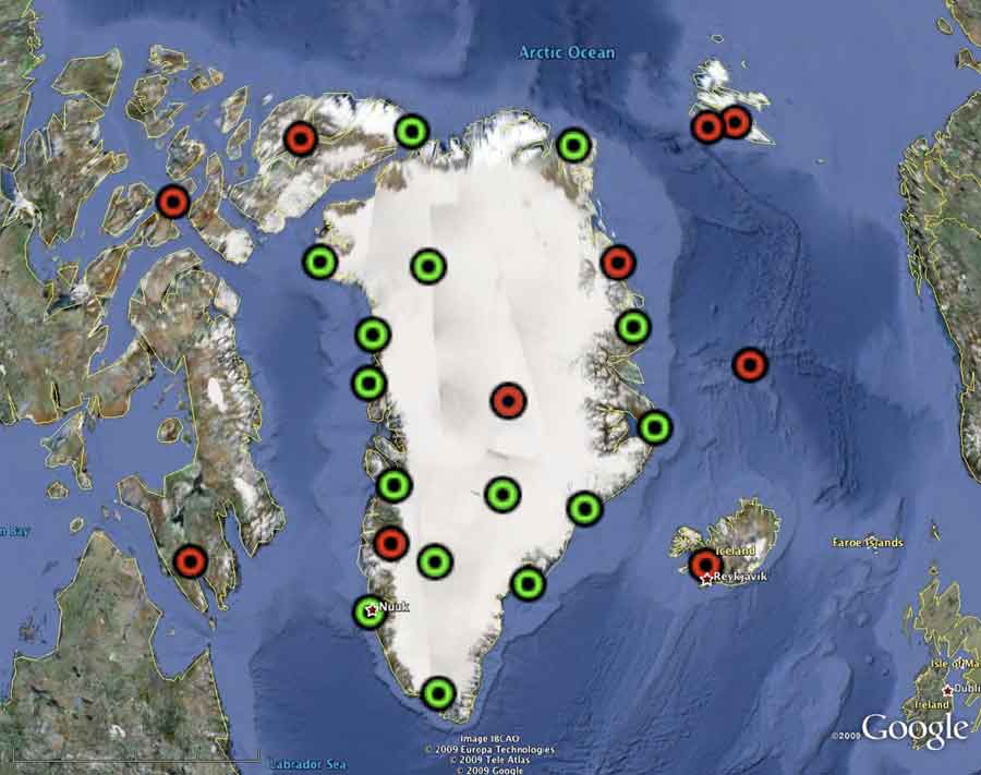 |
The map shows the location of existing real-time broadband seismic stations (red) joining GLISN with open data sharing and sites (green) where equipment, telemetry, and infrastructure is being installed and upgraded in concert with GLISN partners. |
